Weather warnings are in force as Storm Floris begins to batter the UK and Ireland, with high winds hitting coastal areas and travel disruption expected.
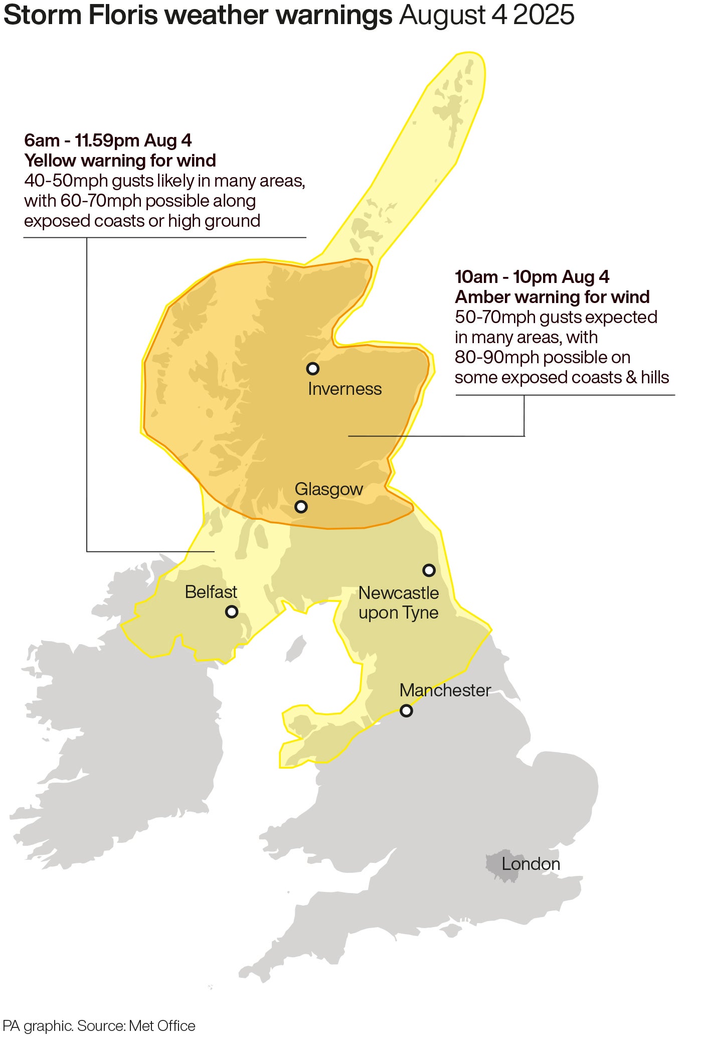
A yellow warning for wind for northern parts of the UK became active at 6am on Monday, lasting until 6am on Tuesday.
Central and northern Scotland are covered by a more serious amber warning from 10am to 10pm on Monday.
Train operator LNER has told passengers not to travel north of Newcastle while Avanti West Coast has advised passengers not to travel north of Preston, warning it will be “heavily impacted” by the weather.
In Scotland, a number of train services will halt from midday and ferry sailings have been cancelled.
The storm could also disrupt road traffic and bridges.
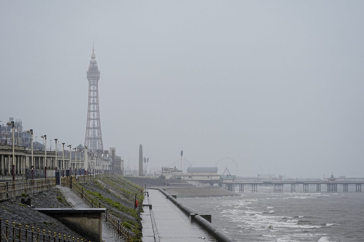
The west of Scotland saw heavy rain early on Monday morning, with winds expected to pick up later in the day.
Gusts could reach as high as 85mph, the Met Office said.
Western coastal areas are expected to bear the brunt of the storm although strong winds and rain will likely lead to disruption at Edinburgh’s festivals.
A Scottish Government minister says it is “imperative” that people follow advice as Storm Floris hits the country.
Justice Secretary Angela Constance told the BBC’s Good Morning Scotland news programme: “Storm Floris is well and truly with us today and it’s imperative that people follow advice because there will be significant disruption on our travel network.”
She said anyone who has to travel is likely to face disruption and should plan ahead, adding: “Consider this a winter journey as opposed to a summer journey.
“Please make sure you’ve got warm clothes, food, water, plenty of fuel and that your mobile phone is charged up.”
Network Rail said several lines will be closed from 12pm on Monday, with all other routes experiencing a reduced timetable and longer journey times.
ℹ We're asking anyone with garden equipment, such as tents, trampolines or furniture, to secure items so that they don't blow onto the tracks and interfere with lineside equipment. #StormFloris pic.twitter.com/EkJjhXUTKc
— ScotRail (@ScotRail) August 4, 2025
Edinburgh – Fife/Perth/Dundee, Perth – Dundee/Aberdeen/Inverness and the West Highland Line are among the routes that will close at noon.
Ferry operator CalMac has also issued a series of cancellations ahead of the storm.
Met Office chief meteorologist Matthew Lehnert said: “Across the warning area, many inland areas are likely to see gusts of 40-50mph, with 60-70mph more likely at higher elevations and around exposed coasts in Scotland.
“There is a small chance that some locations here could even record gusts of 85mph.”
#StormFloris arrives during Monday morning, bringing unseasonably strong winds to the north of the UK ⚠️
— Met Office (@metoffice) August 3, 2025
Heavy rain will also sweep eastwards across the country ☔ pic.twitter.com/t6j0Hl4tb8
The strongest winds will most likely affect Scotland on Monday afternoon and night but “there remains some uncertainty in the depth and track of Floris”, a spokesperson added.
“Winds will first ease in the west during later Monday but remaining very strong overnight until early Tuesday in the east.
“Heavy rain may also contribute to the disruption in places.”
The warning zone covers Scotland, parts of Northern Ireland, north Wales and the north of England.
Storm Floris is the sixth named storm of the 2024-25 naming season, which runs from early September to late August.
January’s Storm Eowyn was the most recent.
Train services axed because of dry soil
Hotel protests must not be used to ‘have a pop at the police’ – minister
Storm Floris map: Met Office reveals where amber warning weather will hit UK
Weather warnings come into force with severe travel disruption expected
No 10 declines to say if Palestine to be recognised with Hamas in power