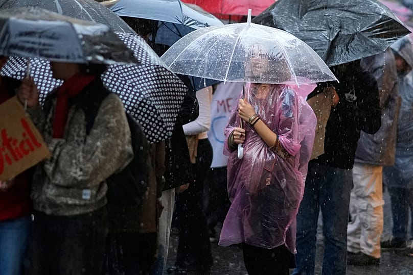
Floods, falling trees and widespread destruction - these were some of the main consequences of Storm Cláudia. By Sunday, it had caused 4,017 incidents and claimed three lives, according to Portugal's Civil Protection service.
The authority reported that the Setúbal, Porto, and Algarve regions were hardest hit by the severe weather, which brought heavy rainfall and extreme winds.
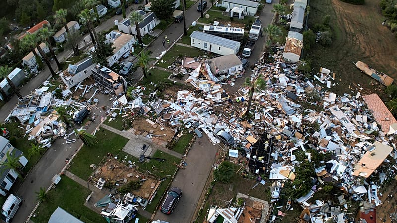
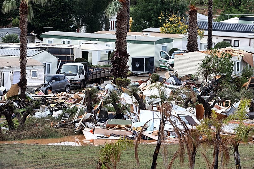
In the Algarve town of Albufeira, there was a tornado on Saturday morning, which killed an 85-year-old British woman and caused significant damage to a hotel and a campsite. Images of the destruction spread across Europe.
But the impacts of Cláudia were not only felt in Portugal. The effects of the storm were also visible in Spain, Ireland, England and Wales.
It comes as the consequences of extreme meteorological phenomena have been increasingly reported in recent years.
The DANA (Depression Isolated at High Levels) that hit Spain, and in particular the Valencia region, in October last year, resulted in more than 200 deaths. A year later, the Spanish island of Ibiza also experienced severe flooding, while France felt the impact of Storm Benjamin.
Are these phenomena really becoming more frequent? Can tornadoes be predicted? And are we prepared to deal with similar situations in the future?
What happened on Saturday in Albufeira?
Speaking to Euronews, Paulo Pinto, a meteorologist at the IPMA (Portuguese Institute for the Sea and Atmosphere), explains that "a tornado originating from a supercell" or, in other words, "a mesocyclone", was identified in the Algarve town on Saturday.
In other words, the basis of this phenomenon was, in simplified terms, a "thunderstorm cloud which, due to certain circumstances, acquired organised circulations [of air] within it".
For it to form, says Paulo Pinto, it is necessary for the "horizontal wind" in the lower atmosphere (the first two or three thousand metres) and that which is much higher up, at the level of six thousand metres, to have different characteristics in terms of direction and speed - also known as wind shear.
It is these differences that ultimately result in the formation of a tornado, commonly identified as a "vortex that shows the air rotating along an approximately vertical axis and rising from the ground to the base of the parent cloud".
Climatologist at the University of Lisbon's Dom Luiz Institute (IDL), Carlos da Camara, added that the extreme weather phenomena which have occurred in Portugal over the last few days were the result of a "cold depression".
This is different from "frontal depressions" which are characterised by the contrasting interaction "between two air masses, one cold and dry, the other hot and humid", which give rise to "instabilities that lead to rain, wind, etc".
These frontal depressions stand out for their "mobility", normally moving "from west to east" and taking "a few hours to pass over the territory".
On the other hand, in cold depressions, such as the latest one that hit Portugal, "the winds almost make a counter-clockwise circle and so we have a kind of core of low pressure in the centre and then they increase towards the periphery", according to da Camara.
Are these phenomena becoming more common?
This phenomenon is not "unheard of" in Portuguese territory, according to da Camara.
"Cold depressions occur frequently in Portugal and are often responsible for floods (and other weather)," he explains.
In fact, "a 'cousin' of these depressions, not the same but very close, was what happened in Valencia last year, da Camara explains.
In statistical terms, he adds, more greenhouse gases being released, first and foremost, leads to "more energy being stored in the atmosphere". This means there is "more energy available to convert into movement" or, in other words, "to power strong winds", and these occurrences become more likely.
On the other hand, da Camara says, climate change is leading to a "lower contrast between the cold north, the polar north, and the warm equatorial south".
Thus, "if we have the polar regions warming up faster than the equatorial regions, the difference between the warm south and the cold north decreases."
Consequently, the professor explains, if this contrast is reduced, there is a "greater possibility of there being ripples to the north and south in the atmosphere [...] that cause these cold depressions".
In view of this data, he concludes, "it is to be expected" that this type of phenomenon will start to happen more frequently.
In the specific case of tornadoes and if there are more of them today than there were 40 years ago, da Camara believes that this is a "difficult" question to answer. Now, he says, "a tornado is always recorded by someone with a mobile phone", and it's hard for it to go unnoticed like it might have done in the past.
Can we forecast tornadoes?
According to the IPMA expert contacted by Euronews, despite all the radars, satellite observation, surface stations and numerical models that currently exist, and "as a result of the practical and technological conditions" available to weather forecasting authorities, there is still "insufficient observation" at the level of a layer in the lower troposphere (0-1 kilometres above Earth's surface).
Though it is possible to indicate several days in advance if a storm or depression is going to hit the country, the same isn't possible for tornadoes for this reason.
Not least because "with meteorological radar", experts can't "observe tornadoes", Pinto explains.
"What the weather radar observes is the convective structure and the mesocyclone."
This then allows forecasters to assess whether it has greater or lesser potential to generate a tornado. Even so, Pinto says, "this assessment is not usually conclusive because we don't know exactly all the physics inherent in the generation of the phenomenon."
It means it's not possible to precisely indicate the place and time when an event of this nature might occur. It is also up to the competent authorities, namely Civil Protection, to act in accordance with the meteorological warnings issued by the IPMA. But Pinto points out, "the truth is that there are no tornado warnings."
"On days - and there are quite a few, more than people realise - when there is a likelihood of extreme phenomena occurring [...], our interaction with Civil Protection is always to inform them as best we can."
However, he says it isn't easy to communicate the risks associated with a low-probability phenomenon that isn't predictable in the classic sense of the term.
Da Camara supports the thesis that "a tornado is impossible to predict" and that it is only possible to say that, on certain occasions, there may be "very favourable conditions for the occurrence of tornadoes".
"A simple rule that every meteorologist knows [...], and which is justifiable from the point of view of the laws of physics, is that the smaller the scale of the phenomenon, the less predictable it is," he explains.
A tornado is an "extremely local" phenomenon and therefore much more difficult to anticipate.
Adélia Nunes, president of the Portuguese Association of Geographers, also says that tornadoes "are very localised phenomena and difficult to monitor".
"Therefore, prevention is structural and not specifically aimed at this type of phenomenon," she emphasised in a statement to Euronews.
According to the geographer, these events that combine several meteorological elements simultaneously, such as very heavy rainfall and very strong winds, have to be seen on a "very micro, very small scale, because they are rare and have to have specific local conditions in order to form".
"Obviously, there may be meteorological warnings, but they are much more general than on a local scale. This doesn't mean tornadoes or even very strong gusts of wind," says Nunes.
Problems with people's 'civic sense'
Despite all this, da Camara says that not everything went smoothly, with one of the main problems having to do with citizens' "civic sense".
Faced with extreme "storm and swell warnings", he continues, there have been several cases of people disregarding recommendations from authorities.
"They immediately go to the cliffs to take photos and don't realise the danger they're in," he explains.
Something similar happens in the summer. In the professor's opinion, the Portuguese should take care to "look at the meteorological charts or the [existing] warnings to find out if it's wise to go camping", depending on whether or not there is a risk of rural fire.
"It's not just in the event of an earthquake" that people should take extra care, the climatologist adds.
Given this reality, da Camara believes that there is a serious problem of "lack of information" and "unpreparedness on the part of citizens". To prevent this, intervention is needed from an early age, especially in schools and the education sector, but also through campaigns to raise awareness of these risks.
Nunes even speaks of a [climate] literacy problem, identifying that there is a "lack of risk culture".
"I think we have a very short memory of what risks are; in other words, we forget previous manifestations of risk very quickly. And so, in political terms, there has to be a need to focus on risk prevention, and this is very much about risk literacy," the geographer argues.
She says this applies to any type of risk, whether it's flooding or fire, for example. Therefore, "it's transversal: people don't know how to react in situations of risk because, in fact, in our society there is no real culture of risk, in which everyone is the first agent of personal protection," she adds.
Building without regard for the risk of flooding
Carlos da Camara also points out that there is "another aspect" that cannot be overlooked, and where "much more progress needs to be made" in terms of "infrastructure and prevention".
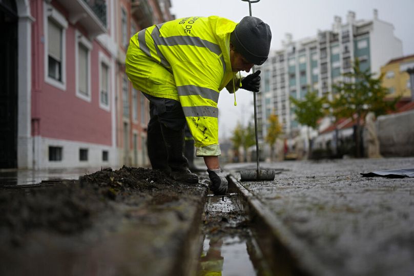
Citing the episodes of flooding that have been increasingly recurrent in Portugal, the University of Lisbon professor notes that floods continue to occur "due to deficiencies in cleaning", but also due to the lack of "better sewers", among other shortcomings. Therefore, in his view, a greater commitment to prevention is needed.
Portugal has 63 areas at potentially significant risk of flooding, which could affect more than 100,000 inhabitants on mainland Portugal, according to the Portuguese Environment Agency (APA).
But Nunes believes that the potential to increase the number of areas at risk is great, given that extreme phenomena are becoming more recurrent, but also less predictable.
"Allied to these more recurrent phenomena, we also have increasingly dispersed construction in areas at high risk of flooding. Urban growth, with construction in floodbeds, creates these situations, and possibly the number of areas that are susceptible to this type of flood risk will tend to grow in the future, in the face of increasingly extreme meteorological events," she says.
The University of Coimbra professor also points to the fact that buildings are built without taking risk maps into account.
"Risk mapping is fundamental for delimiting the areas where urban areas should or shouldn't grow, and in reality, political power and local authorities are often not concerned with this issue; they are concerned with increasing their urban fabric, the area of housing or other infrastructures, without taking these risk areas into account," she explains.
For the professor, it is the central government that needs to define which institutions produce this mapping and the legal instruments that allow it to be operationalised in territorial terms.
"We have to prepare our territory for these increasingly extreme events. And this can only be achieved through effective policies in terms of land use planning and management, which, in fact, have not been in line with the changes that are occurring in these phenomena," she argues.
Nunes stresses that all urban areas that don't have direct drainage to a watercourse run the risk of being flooded because the soil is waterproofed.
This is because "the internal drainage system in cities is undersized, i.e. it is not capable of draining all the water that circulates on the surface, because the soil is waterproofed and practically all the water from precipitation runs off onto the surface," she explains.
Most of the municipalities at risk are located in the Tagus and Oeste regions, but also around the Vouga, Mondego and Lis rivers.
"If we have buildings and people exposed, it's only natural that in an extreme situation the material and human damage will increase," the geographer laments.
She stresses that "cities, above all, will have to pay extra attention in this context of increasingly extreme phenomena, increasingly intense and concentrated rainfall and the increasing waterproofing of the soil, which means that the water doesn't infiltrate and circulate on the surface."