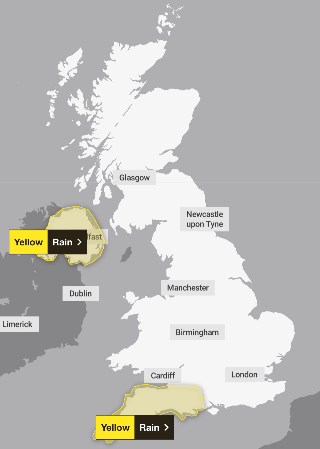
Storm Chandra has brought weather chaos this week with strong winds, heavy rain and snow battering much of the UK, with the Met Office issuing further yellow warnings till Saturday.
The Met Office have issued a yellow weather warning for rain in south west England from 9am on Friday, which is set to expire at 6am on Saturday morning. Another weather warning was issued in regions of Northern Ireland from 12am on Friday till 6pm on Friday evening.
Dozens of flood warnings remain in place across the UK, with a major incident also declared in Somerset as a result of the disruption caused by the downfalls earlier in the week.
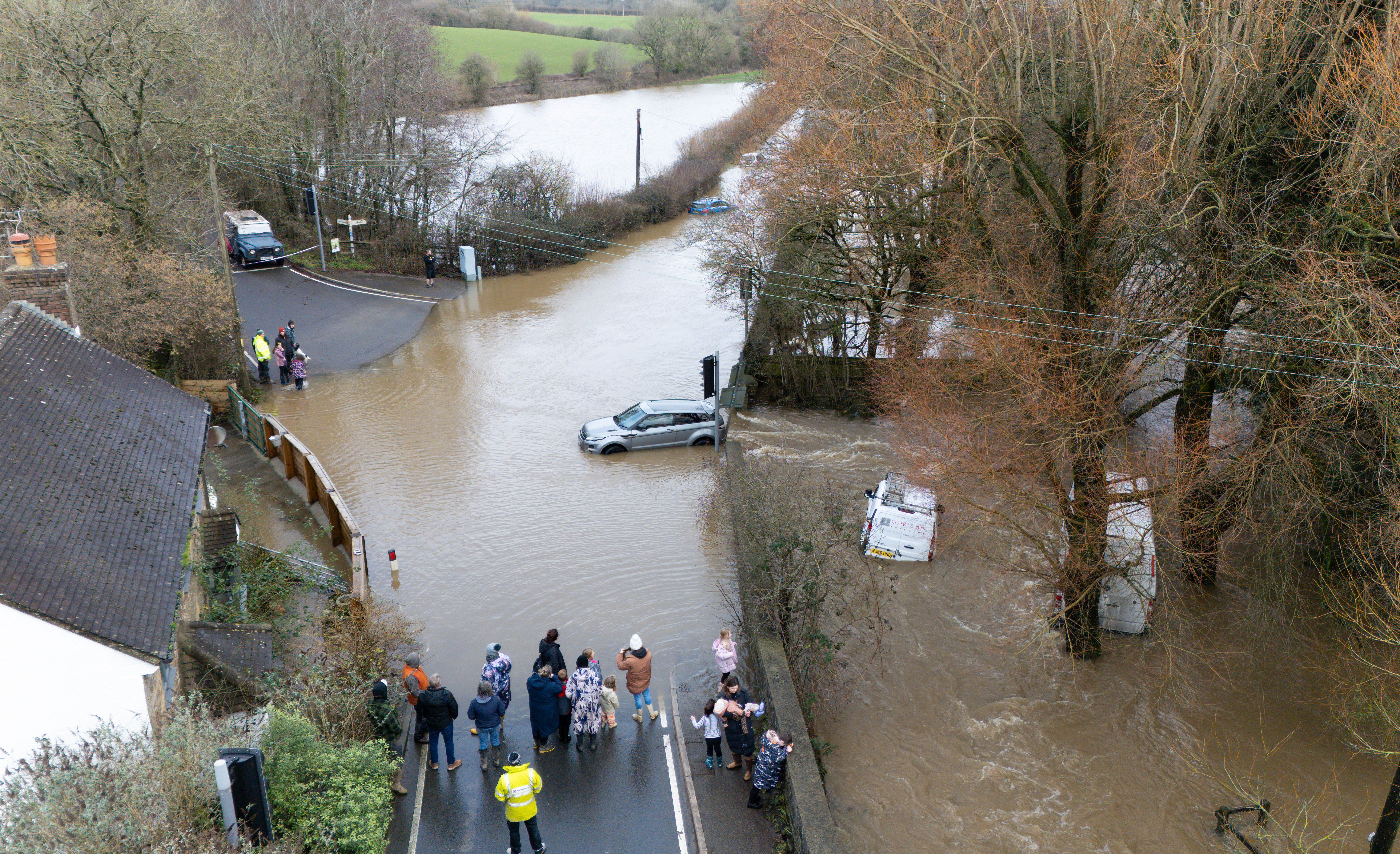
Storm Chandra has already broken several new January daily rainfall records. Earlier this week a lorry driver died in the New Forest after crashing into a river on Tuesday in the aftermath of Storm Chandra.
Longer journey times and cancellations are expected to impact road, rail, air and ferry services, as well causing some roads and bridges to close during the weather warnings.
The Met Office stated: “Spells of heavy rain will move over Northern Ireland during Thursday night and Friday. While the wettest conditions are likely over Antrim and Down, there is potential for many areas to see 10-25 mm build up, with 40-60 mm over some hills. Rain will be accompanied by strong southeasterly winds, especially Thursday night and early Friday.”
The forecasting service added: “Outbreaks of rain, heavy at times, are expected to arrive across Cornwall on Friday morning and move northeastwards across other parts of southwest England by afternoon, followed by showers during Friday evening and overnight into Saturday morning. 10 to 20 mm rainfall is likely widely, with up to 30 mm possible over the moors and perhaps west Cornwall. Falling on saturated ground, this may lead to some flooding and disruption. Strong winds are also likely in places.”
There is a small chance that homes and businesses in Northern Ireland could be flooded and that some communities will become cut off by flooded roads. The Met Office has also warned that there is a slight chance of power cuts and loss of other services.
The Royal National Lifeboat Institution (RNLI) is warning people to be vigilant near the coast in Devon and Cornwall due to because of the potential of 15ft waves surging up exposed beaches and topping over sea fronts and harbour walls.
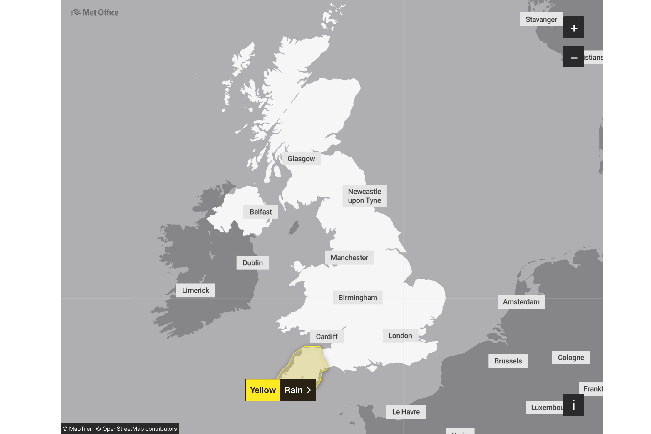
The weather warning on Saturday will cover the following regions in South West England: Cornwall, Devon, Plymouth, Somerset and Torbay.
Here’s the Met Office’s four-day forecast for the UK:
This evening and Tonight:
Rather cloudy with some rain and hill snow in the north. Initially cloudy and mostly dry elsewhere, but further wet and breezy weather towards the southwest moves northeastwards overnight. Turning clearer and showery in the southwest later. Mostly frost free.
Friday:
Friday looks rather cloudy and breezy with rain moving northwards, giving snow over some northern hills. Briefly brighter in the south, though heavier rain and strong winds developing here.
Outlook for Saturday to Monday:
Remaining unsettled over the weekend and to start next week. Showers or longer spells of rain affecting most areas, coupled with brisk winds at times. Further snow on northern hills.
Hypothermia risks increase in Mississippi and Tennessee with next wave of frigid temperatures
Warm Home Discount to be extended for rest of decade
Darts world champion Deta Hedman ‘absolutely over the moon’ after receiving OBE
Trump blasts Starmer China trip as PM arrives in Shanghai for next leg of visit
Why train passengers are missing out on £80 million a year in compensation
Trump says ‘very dangerous’ for UK to do business with China amid Starmer visit