
Dozens of flights at Dublin Airport have been cancelled and delayed as Ireland braces itself for widespread disruption from Storm Bram.
The Irish forecasting agency, Met Eireann, has issued rolling orange wind warnings as the storm tracks across the country, due to very strong winds and high coastal water levels.
Following a week of persistent rainfall, soils are already highly saturated and many rivers are nearing bank-full capacity, significantly increasing the risk of surface and river flooding from any additional precipitation.
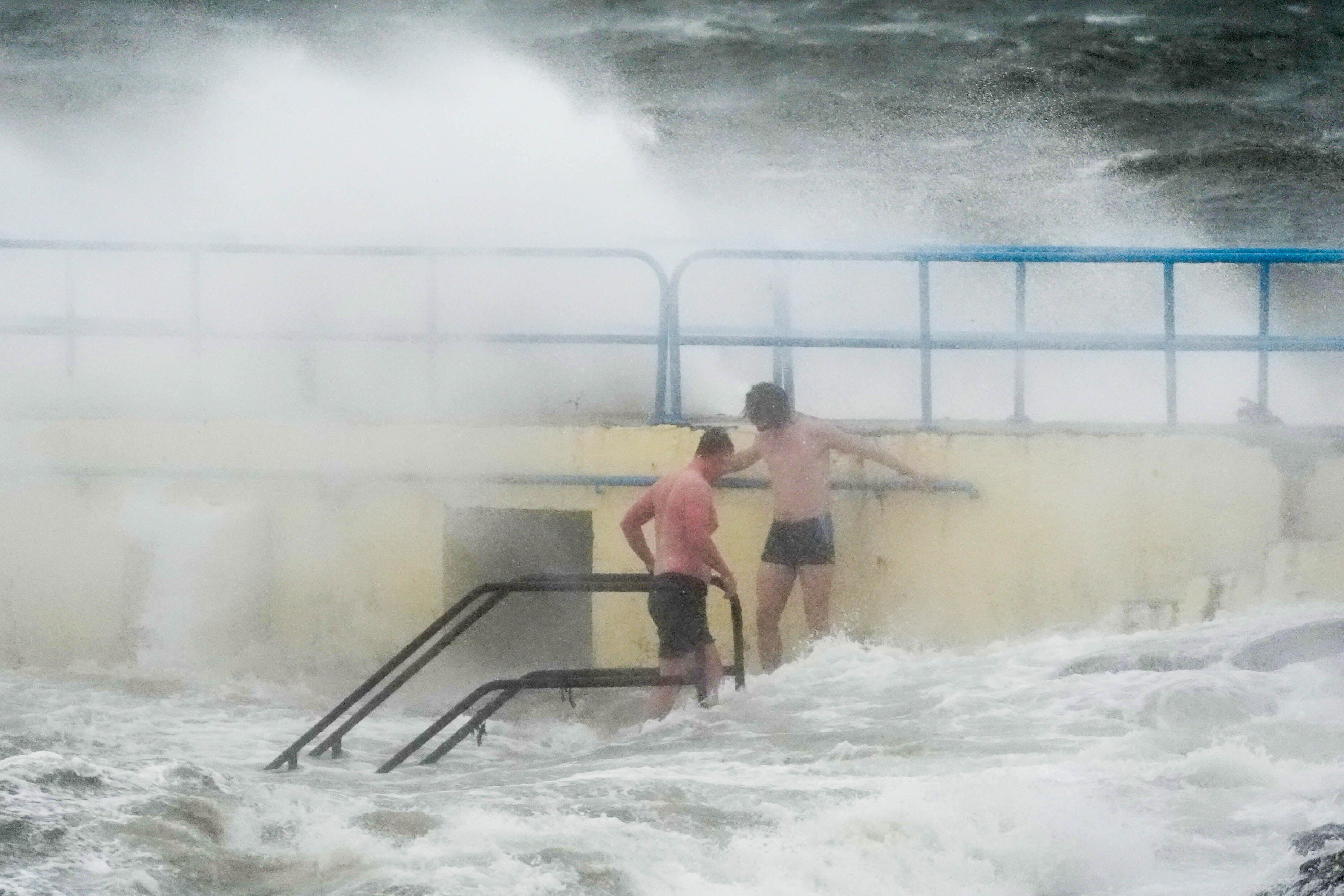
Forecasters have warned of potential flooding in low-lying coastal areas, particularly during high tide, alongside wave overtopping, challenging travel conditions, flying debris, and the likelihood of power outages.
Keith Leonard, national director for Fire and Emergency Management, told RTE radio he anticipates a "significant impact" on power supplies, especially across south-western coastal regions.
The storm has already begun to cause travel chaos, with 42 flights cancelled at Dublin Airport as the country prepares for the severe weather.
The airport warned that further cancellations are possible later today as wind speeds are expected to increase.
In a post on social media, the airport said: “Strong winds are forecast for Dublin Airport over the course of the day, which has already resulted in airlines cancelling a number of flights.
“As of 7.45am, a total of 42 flights had been cancelled, including 21 inbound and 21 outbound. Further cancellations are possible later today as wind speeds are expected to increase.
“As always, passengers due to fly today should contact their airline directly for updates regarding the status of their flight.”
An orange warning for Carlow, Kilkenny, Wexford, Wicklow, Cork, Kerry, Limerick, Tipperary, and Waterford is in place until 3pm.
A separate orange warning for all of Connacht, as well as Cavan, Monaghan, Clare, Dublin, Kildare, Laois, Longford, Louth, Meath, and Offaly was announced for 11am to 9pm.
And a third orange warning for Donegal was announced for between 2pm and 9pm.
Met Eireann forecaster Gerry Kelly said it was a day to be “very, very careful”.
He told RTE’s Morning Ireland: “It is going to be a very windy day everywhere, and there is certainly a possibility for all areas to reach those levels for a time.”
Passenger Update - 07.45
— Dublin Airport (@DublinAirport) December 9, 2025
Strong winds are forecast for Dublin Airport over the course of the day, which has already resulted in airlines cancelling a number of flights.
As of 07.45, a total of 42 flights had been cancelled, including 21 inbound and 21 outbound. Further… pic.twitter.com/2LnP3OjQur
He particularly highlighted a risk of coastal flooding in the south of the country during high tide on Tuesday morning.
Meanwhile, warnings in Irish waters have also been upgraded with a status orange storm warning for all coasts and on the Irish sea applying until midnight.
In addition, two red marine warnings are in place between 8am and 3pm, combined with a similar advisory between midday and 8pm from Loop Head to Erris Head to Malin Head.
Forecasters are advising that south to southwest winds will occasionally reach violent storm force 11.
In Northern Ireland, the UK Met Office has issued a yellow wind warning for the entire region between 9am and 10pm.
A more severe amber warning for wind is in place for the western part of Northern Ireland, applying to counties Antrim, Fermanagh, Londonderry and Tyrone between 2pm and 7pm.
Yellow warning of wind affecting Northern Ireland https://t.co/1IGX6nZvxd pic.twitter.com/72Lk73Cvk2
— Met Office - Northern Ireland (@metofficeNI) December 8, 2025
The poor weather has resulted in the closure of the Belfast Christmas Market on Tuesday.
Organisers said: “We recognise this may be disappointing, however, the safety of our visitors and traders is of the utmost importance.
“At the moment, the plan is to reopen on Wednesday December 10, however, this is weather dependent.”
The Met Office advised the public to expect delays to transport services and further warned that cancellations are possible.
It added that there was a chance of injuries and danger to life from flying debris, as well as damage to buildings and power outages.
Forecasters said gusts of around 60-70 mph are possible in the amber region, and potentially in excess of 80mph over coasts and hills.