The first early effects of Storm Barra have been felt across the UK and Ireland, with gusty winds battering communities already enduring days-long power outages.
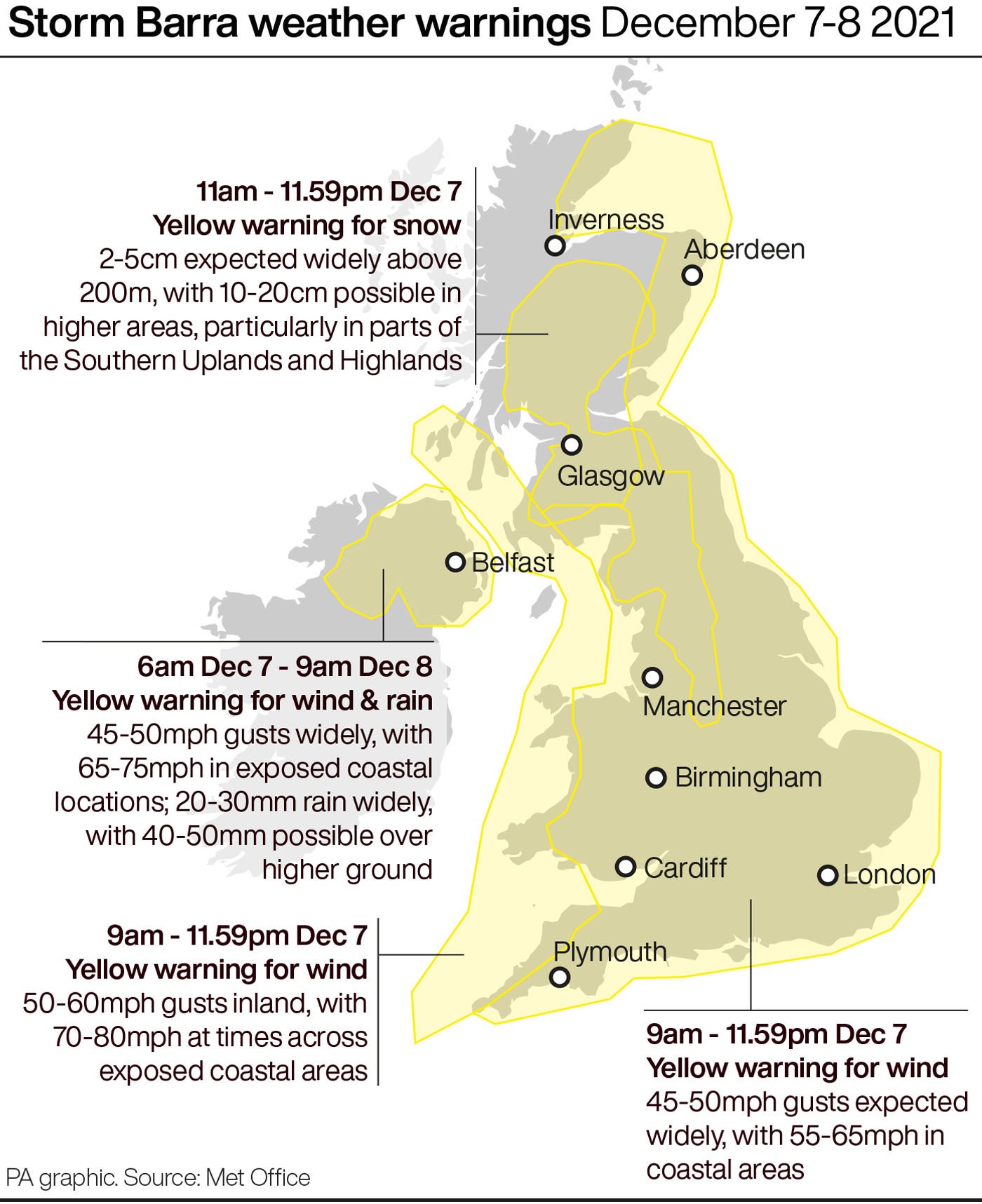
The Met Office said it is likely that Barra will not be as bad as Arwen, its predecessor, but that disruption to the travel network is likely, with snow and heavy rain in some areas until Wednesday.
Elsewhere, some short-term loss of power is possible due to the wind.
There is also “a small chance” that larger-than-usual waves in coastal areas could present a risk of injury or potentially a threat to life if wild winds whip street furniture and beach material into the air.
Gusts of 70mph have already been recorded at Berry Head in south Devon, and on Sherkin Island, south-west of Co Cork in Ireland.
There were further gusts of 69mph at Aberdaron, on the western tip of the Llyn Peninsula in Wales.
Met Office spokeswoman Nicky Maxey said: “We are not expecting the impacts of Barra to be as bad as we saw with Arwen.
“Storm Barra will bring strong winds and heavy rainfall to many parts of the UK today.
“We may see some snow on the higher ground, too.
“It is unlikely to be as impactful as Storm Arwen last week but there will be blustery conditions so people should still be prepared.”
Meanwhile, misery continues for hundreds of households in the North East of England after Arwen left them without electricity.
They are in one of the areas covered by the latest Met Office yellow warnings.
Northern Powergrid said it is in “the final push” to reconnect 500 customers who remained without power on Tuesday morning.
Downing Street has said it is “unacceptable” that some homes remain without power following Storm Arwen.
The Prime Minister’s official spokesman said 686 homes have had their power restored since Monday to leave around 539 still without supply.
He added: “It’s obviously unacceptable that these homes, these families are without power, we’ve seen the situation improve but that will not be of help to those who are still facing this challenge.”
Heavy snow is expected across parts of Scotland and northern England from late on Tuesday morning, the Met Office said, although mostly between the Scottish Highlands and the Pennines.
The lowest temperature overnight was in Aboyne, on the edge of the Highlands near Aberdeen, which saw a low of minus 3.8C (25.2F).
The heaviest rain on Tuesday morning was near Launceston in north Cornwall, which saw 14mm (0.6in) fall in three hours from 7am.
Yellow wind warnings are in place across much of England, Wales and Northern Ireland although the west of Ireland will receive the worst of the storm on Tuesday.
There are further weather warnings in place across Northern Ireland and the South West of England into Wednesday.
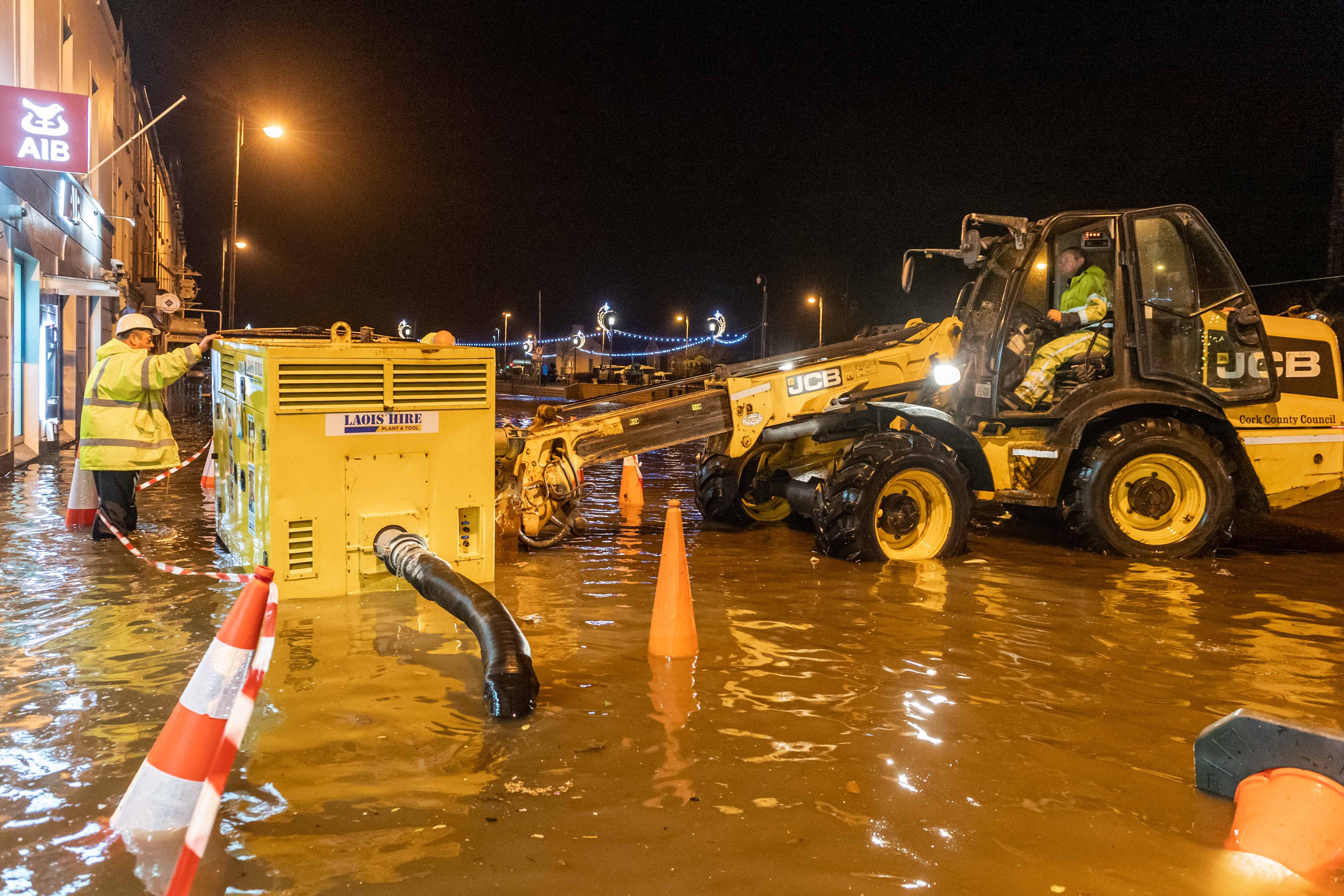
The Environment Agency had five flood warnings in place as of 11am on Tuesday, meaning flooding is expected.
They are along the south coast of England between Dorset and Hampshire, in Christchurch, Beaulieu, Fareham, and Langstone and Emsworth, and along the Essex coast at Coalhouse Fort.
There are nearly 40 flood alerts also in place, meaning flooding is possible.