Snowfall affected normal life in Himachal Pradesh and Jammu and Kashmir on January 31 and rainfall in parts of north India intensified the winter chill in the region, with the IMD predicting above-normal rainfall in February across the country.
According to the India Meteorological Department (IMD), after experiencing a drier-than-usual December and January, north India, consisting of seven meteorological subdivisions, is most likely to receive above-normal rainfall (more than 122 per cent of the long period average) in February.
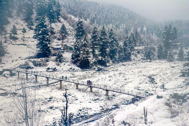
On Wednesday, normal life was disrupted in Himachal Pradesh as the tribal areas and other high reaches received the first heavy snowfall of the year, leading to closure of 134 roads, including four national highways.
Also read: Why Himachal Pradesh had its most rainless January since 1901 | Explained
About 15-cm deep snow has been recorded in the higher reaches of Shimla district since Tuesday night, MeT official Sandeep Sharma told PTI, adding that the day temperatures have dropped by four-five days in one day.
The local MeT office has issued an orange warning of heavy snow and rains at isolated places in five districts — Shimla, Kullu, Chamba, Kinnaur and Lahaul and Spiti on January 31 and February 1.
Delhi experienced a bone-chilling cold on Wednesday as parts of the city received light rainfall, bringing down the maximum temperature to 18.6 degrees Celsius, four notches below the season's average, and a low of 7.3 degrees Celsius, a notch below the normal, according to the IMD.
As a dense fog shrouded the national capital in the morning, the Delhi airport saw diversions of at least three flights and several diversions with several trains running late.
In Jammu and Kashmir, many areas in the higher reaches, including along the Zojila axis on the Srinagar-Leh highway, received fresh snowfall, while the plains were lashed by rains. The tourist resorts of Gulmarg, Sonamarg and Pahalgam received fresh light to moderate snowfall overnight, officials said.
The local MeT also issued an avalanche warning for six Jammu and Kashmir districts — Poonch, Baramulla, Bandipora, Kupwara, Doda and Ganderbal.
The 40-day harsh winter period in the region known as 'Chilla-i-Kalan' ended on Tuesday. While there was light to moderate snowfall in the higher reaches of the valley at the fag-end of the period, most of the Chilla-i-Kalan — when the chances of snowfall are maximum and most frequent — remained dry.
The valley witnessed a prolonged dry spell this winter, with no snowfall in the plains.
The Uttarakhand MeT department on Wednesday sounded a yellow alert for heavy rain, snowfall and thunderstorms at isolated places in the hilly areas of the state for the next 24 hours.
Parts of Punjab on Wednesday received rain, ending a prolonged dry spell as the minimum temperature in the state and neighbouring Haryana hovered close to the normal limits.
According to IMD's forecast for February, normal to above-normal rainfall is likely over northeast and central India. Below-normal rainfall is predicted over south peninsular India.
Most parts of the country are likely to witness above-normal minimum temperatures next month while northwest, west-central, northeast and parts of east-central India are likely to see above-normal maximum temperatures, according to the IMD.
Normal to below-normal maximum temperatures are likely in most parts of peninsular India and parts of east-central India, the Met office said.
"Below-normal cold wave days are expected over some parts of central India during February," it said.
The strong El Nino conditions — abnormal warming of surface waters in the central Pacific Ocean — are likely to weaken steadily and turn to ENSO-neutral conditions by the end of the spring season.
Most models indicate a transition to La Nina conditions, considered favourable for the Indian southwest monsoon, around July-September, IMD Director General Mrutyunjay Mohapatra said.