Milky haze has filled the sky over parts of Canada and the eastern United States in recent days, a phenomenon that can be traced back to unusually early wildfire activity in the Canadian Prairies.
Wildfire smoke is more commonly seen in the sky during late summer and early fall around the peak of the annual wildfire season, but the smoke has made an early appearance this year due to a surge in fire activity in Alberta over the past week.
The height of wildfire season across North America is still months in the future, but infernos are already ramping up in parts of Canada well ahead of historical averages.
“Western Canada’s wildfire season is off and running – in Alberta especially,” Plume Labs, an air quality company owned by AccuWeather, said in a blog post. The company added that there are over 100 active wildfires in the province, including 28 out-of-control blazes.
Over 3,100 hectares have burned in Alberta so far this year, more than twice the 10-year average through May 10 of 1,431 hectares, according to the Canadian Wildland Fire Information System.

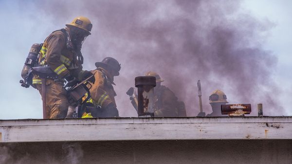
The worst of the fires are burning in the northern half of Alberta and have forced 29,000 people to evacuate their homes. Local officials declared a state of emergency in response to the intense wildfires, according to The Associated Press.
“People have called this season certainly unprecedented in recent memory because we have so many fires so spread out,” Christie Tucker with Alberta Wildfire said during a press briefing on Sunday. “It’s been an unusual year.”
Wildfires have also broken out in areas of British Columbia and Saskatchewan, but they have not been as intense as those in Alberta.
Massive clouds of smoke billowing from the wildfires in Alberta have traveled thousands of miles across parts of northern Canada toward the Arctic Circle, and in recent days, have spread southward into Ontario and parts of the United States.
Hazy conditions filled the sky over parts of New England on Tuesday and spread over the mid-Atlantic by Wednesday morning, including over New York City and Washington, D.C.

The smoke was easily spotted from space by NOAA’s GOES-EAST weather satellite.
“Look at all that smoke from the wildfires in Canada across the Great Lakes and Northeast!” AccuWeather Prime Host Adam Del Rosso said on Twitter after looking at satellite images.

The smoke was too high in the atmosphere to have a substantial impact on air quality conditions near the ground, but there were pockets of fair to poor air quality over the Northeast, according to Plume Labs experts.
Smoke can also contribute to vivid sunrises and sunsets, although the smoke was too thick to have the colorful effects in the sky at daybreak on Wednesday.
The most extreme air quality conditions are present in Alberta near the site of the raging wildfires.
The Air Quality Index (AQI) was fair to poor in Calgary on Wednesday morning and was even worse north and west of the city along the foothills of the Canadian Rocky Mountains. Air quality ranged from “very unhealthy” to “dangerous” in this zone, with any exposure to the air posing the risk of serious health effects.
People near the ongoing fires or in areas where it is smokey are urged to check the air quality forecast for their area before spending time outdoors.

AccuWeather released its annual U.S. wildfire forecast on April 12 and will have more details about the wildfire season in Canada on May 24 with the release of its annual Canada summer forecast.
Produced in association with AccuWeather