A sunny start to the day has not ruled out any chance of snow in the capital on Wednesday, the Bureau of Meteorology has advised.
The same weather system that sparked a storm warning for the ACT on Tuesday evening could bring snow down to 600 metres in the late morning.
Bureau of Meteorologist Helen Reid said a rain band moved through the territory and the morning sunshine was not showing what was happening to the west.
"We have some very cold cloudy air mass to the west and that is where we are expecting the snowy, hailey situation," Ms Reid said.
"Hopefully snow would be on the Brindabellas later today as that cold air moves through."
Ms Reid said it was likely to be white on the Brindabellas at low levels into Thursday morning as well.
"We don't usually see snow in the actual city, I'm sorry to say, but I am expecting anyone who looks west to the ranges to see snow on them," she said.
"There might just be one or two flurries that creep into the very western parts of Canberra itself. It's not going to be very warm in the ACT at all."
SNOW
— Tim the Yowie Man (@TimYowie) June 8, 2021
...and so it begins
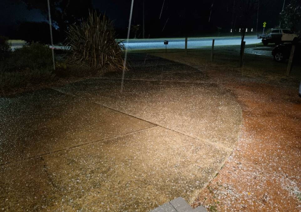
3cm so far in downtown Nimmitabel.
Photo via the good folk at The Royal Arms in Nimmy. pic.twitter.com/JJKtvvIxbx
The Bureau of Meteorology issued a storm warning at 4.31pm on Tuesday, saying a line of thunderstorms was tracking east and "likely to produce damaging winds in the warning area over the next several hours". It was cancelled about 6pm after a brief storm was replaced by steady rain.
Meteorologist Melody Sturm said the snow was due to a cold front moving through the state and wa connected to a low pressure system through the south.
"It will move through west to east from the cold front and pass over Canberra," Ms Sturm said.
Earlier, the Bureau tipped snowfall for elevated areas of the ACT such as Mount Ginini and the Brindabellas.
Wednesday was expected to be particularly cold, with the Bureau tipping a top of just seven degrees. It says we will have a near 100 per cent chance of rain, with up to 8 millimeters expected to fall. There's also the chance of another thunderstorm.
It says there is the chance of snow falling above 600 metres on Wednesday and Thursday, suggesting some of Canberra's mountains could get a dusting. Mount Ainslie is 842 metres and Black Mountain is 812 metres.
Pic 1: This is headin right for ya right now Melbs. Duck!
— Anthony Sharwood ❄️ (@antsharwood) June 8, 2021
Pic 2: snow above 600m forecast for Canberra tomorrow. Parly House is 604m, Mt Ainslie 843m, Black Mtn 812, Brindabellas as high as 1913m (!) which is why snow v common there.
My gut: biggest Canberra snow in years tomoz pic.twitter.com/BHq8xtzKtQ
The start of the snow season and the chilly conditions in Canberra have prompted ACT Policing to warns drivers to be aware of dangerous conditions on the road.
Acting Superintendent Donna Hofmeier said: "If you are considering going up [to the mountains] we would ask that you go up there with someone who is experienced.

"Use a four-wheel-drive [vehicle], use your headlights, look out for the ice on the roads and just listen to the radio and ACT government website [about] road closures."
Corin Forest officials have been welcoming visitors for weeks and the fresh fall will add a new blanket to the snowfields.
"We do get snow settling a couple of times a season here. This is looking like it's going to be a pretty big one if it goes according to the weather reports. We are hoping in the next few days the whole place will be blanketed in white," marketing boss Ashleigh Harrow said.