Satellites are tracking Tropical Storm Erin from space as it steadily gathers strength over the Atlantic Ocean. Currently, Tropical Storm Erin is expected to intensify and could become the first hurricane of the 2025 Atlantic season.
The storm, which formed from a tropical wave that drifted off Africa on Aug. 11, has shown increasingly organized cloud bands and intensifying thunderstorm activity in recent imagery from satellites operated by the National Oceanic and Atmospheric Administration (NOAA). Tropical waves are low pressure areas that typically move from east to west across the tropics and absorb warm ocean air, forming clouds and thunderstorms as they do, according to NOAA.
Erin developed in the eastern Atlantic, moving westward from the Cabo Verde Islands at about 20 mph (32 km/h). Infrared sensors on NOAA's GOES-19 satellite reveal colder cloud tops and deep convection near the center — signs of a strengthening system feeding on warm ocean waters.

Forecasts indicate Tropical Storm Erin may reach hurricane strength by late Thursday or early Friday. Maximum sustained winds are currently near 45 mph (75 km/h), according to a statement from NOAA.
Satellite animation sequences taken over the course of its development show a more symmetric structure and tightening circulation — early indicators of potential eye formation and evolution into a hurricane. Forecast models track Erin moving west-northwest before curving away from the United States, suggesting a very low chance of landfall.
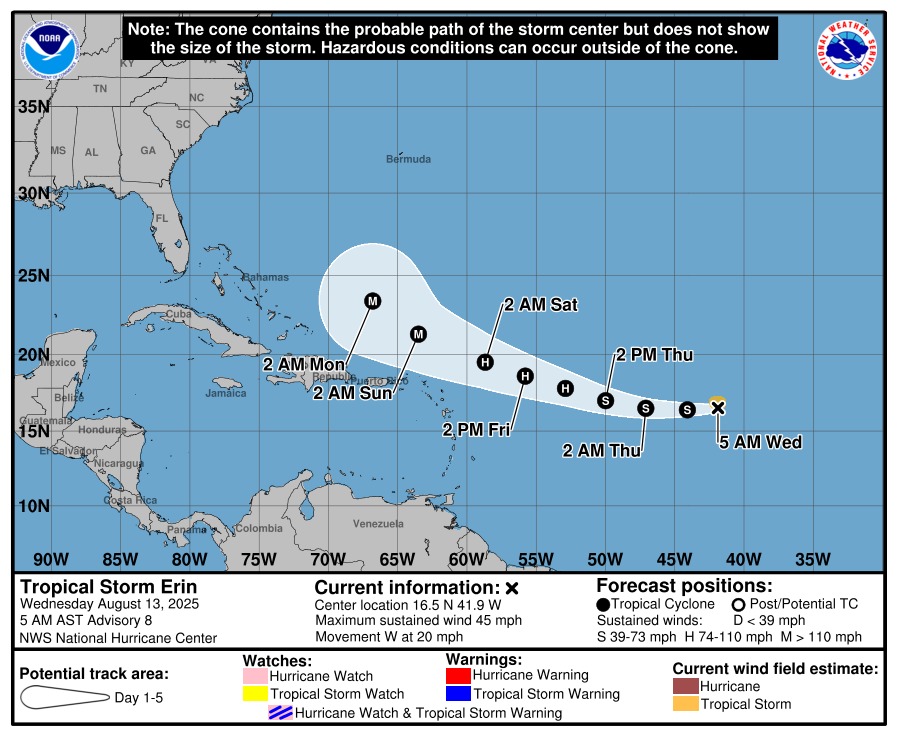
Still, even if it doesn't make landfall, the storm could bring heavy rain and strong winds to parts of the U.S. East Coast as it travels northward, and forecasters warn that swells generated by Erin could produce dangerous surf and rip currents along coastal areas.
The storm's development aligns with NOAA's forecast for an above-normal 2025 Atlantic hurricane season. As of early August, forecasters continue to project 13–18 named storms, with 5–9 hurricanes and 2–5 major hurricanes, consistent with pre-season models.
Satellites will keep delivering detailed, real-time views of Erin as it develops, supplying essential data to improve tracking and intensity forecasts — not just for this storm, but for others anticipated in what may be a highly active 2025 hurricane season.