Satellite images reveal the scope of destruction in the south of France caused by the worst wildfire to hit the country in over seven decades.
The fire was first detected on Tuesday (Aug. 5), near the town of Ribaute in the Aude region in the southeast of France. Within less than four days, it turned some 42,000 acres (17,000 hectares) of forests and agricultural land into ashes — an area larger than France's capital Paris.
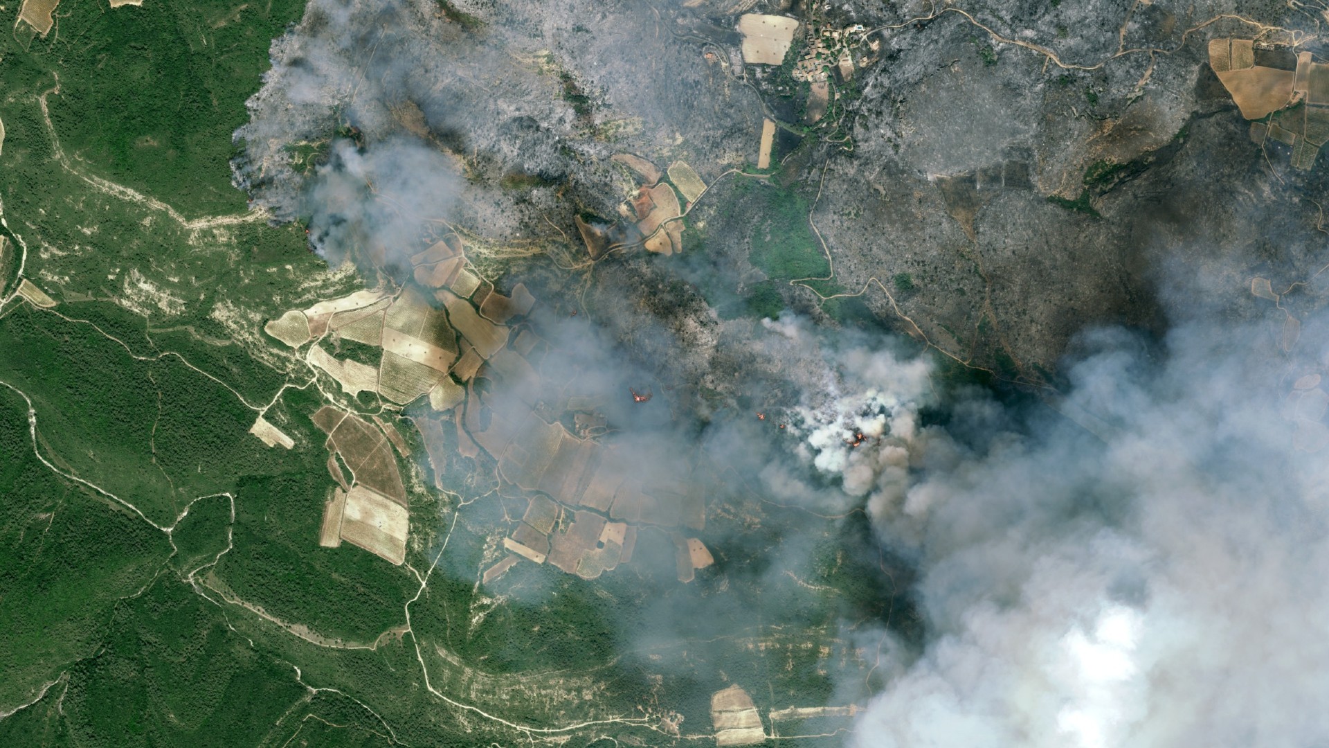
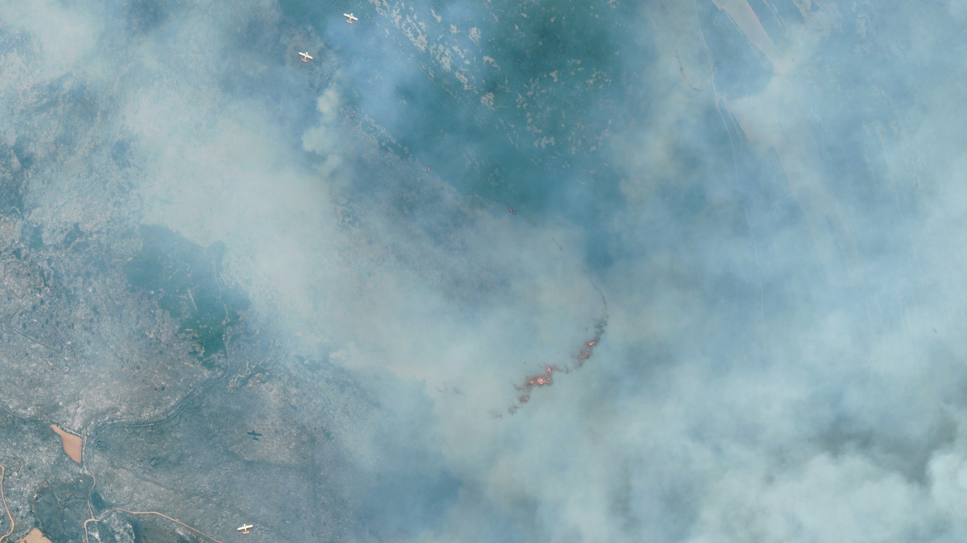
The scope of the fire was captured in dramatic images taken by the high-resolution Pleiades Neo satellites operated by the European aerospace giant Airbus.
At its peak strength, the blaze was devouring about 2,470 acres (1,000 hectares) of land per hour, fanned by strong winds blowing from the Mediterranean Sea. Within two days of its ignition, the fire devoured 40,000 acres (16,000 hectares). At least one person died, and 13 others were injured as the fire engulfed several villages in the wine-making region, according to the BBC.
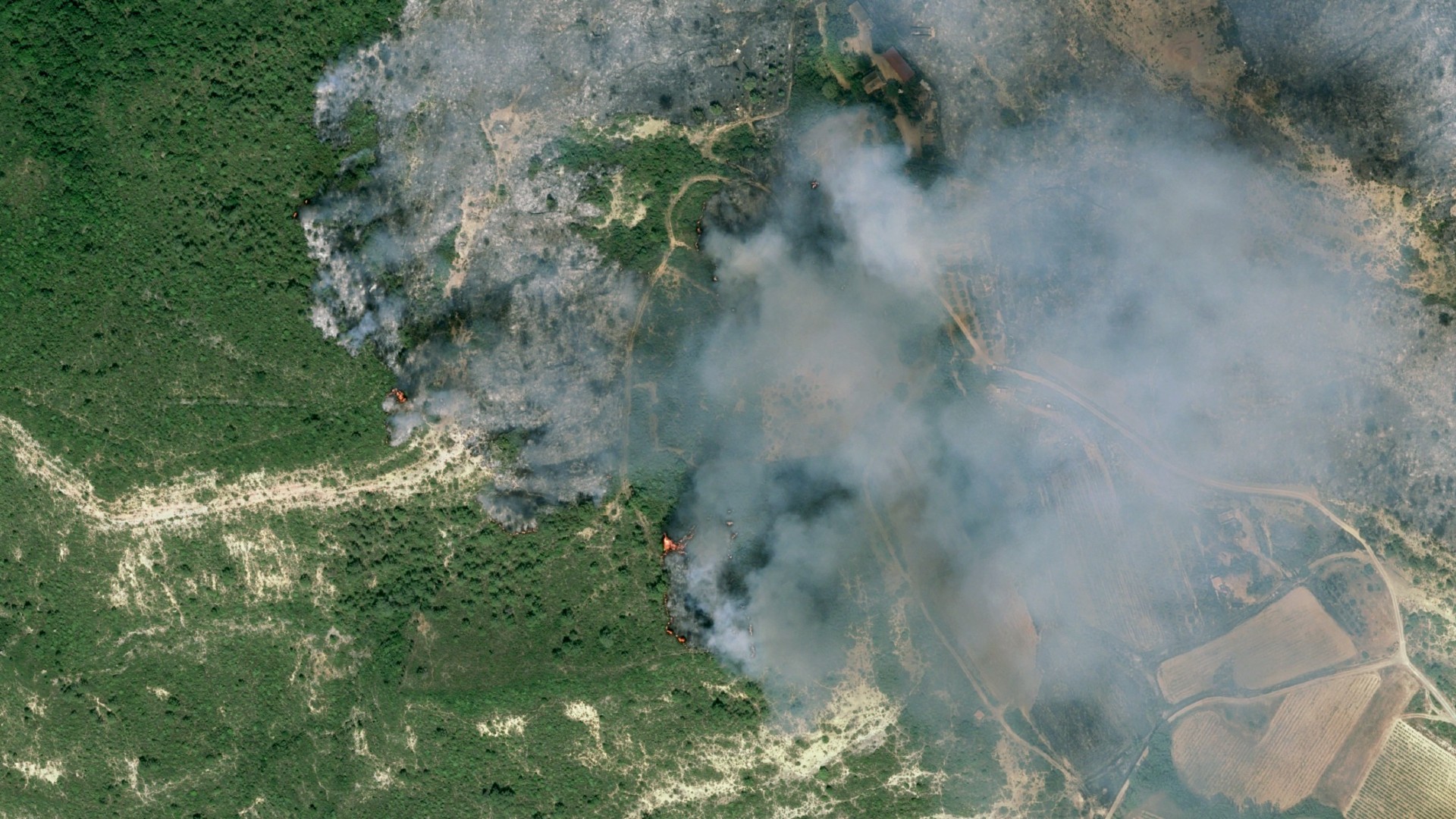
The Pleiades Neo images, taken the day after the fire started, reveal swaths of scorched land as well as burning hotspots and thick plumes of smoke covering the land. In some images, firefighting planes flying over the affected region can be seen.
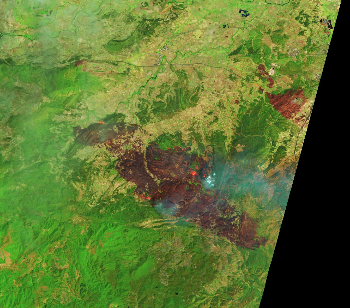
NASA's Terra and Landsat 9 satellites also spotted the fire, revealing its fast-paced progress. The Terra image, obtained with the Moderate Resolution Images Spectroradiometer (MODIS), shows the situation in natural colors at 11:20 a.m. local time on Aug. 6.
The false-color images from Landsat 9, obtained one hour later, are a combination of shortwave infrared, near infrared and optical wavelengths, which together allow it to reveal the freshly burned ground that would otherwise be obscured by a thick layer of smoke.
Firefighters mostly contained the wildfire by Thursday evening, Aug. 7, according to Al Jazeera, but local authorities said it would take days to completely extinguish the remaining burning spots.
France's officials attributed the fire, the worst to have hit the country since 1949, to worsening climate change. France's popular Mediterranean coast has been hit particularly hard this year, registering over 9,000 wildfire breakouts since the beginning of the summer season, according to Al Jazeera.
The summer of 2025 is shaping up as one of the hottest on record in western Europe, with temperature records having been broken in the month of June, according to the E.U. environmental service Copernicus.