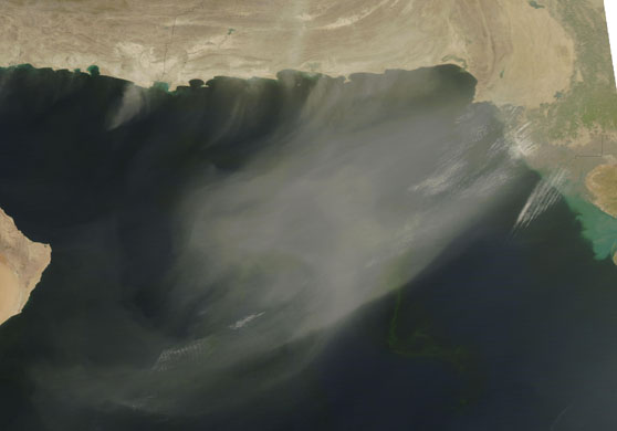
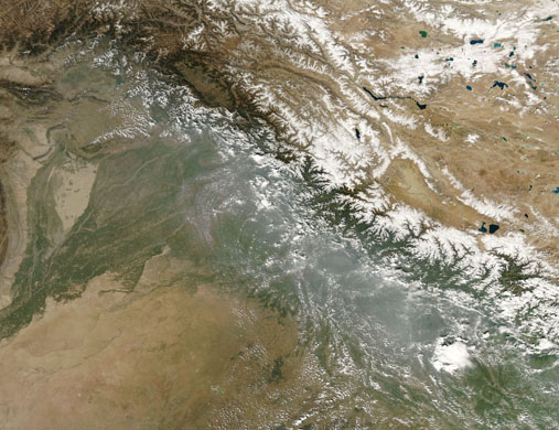
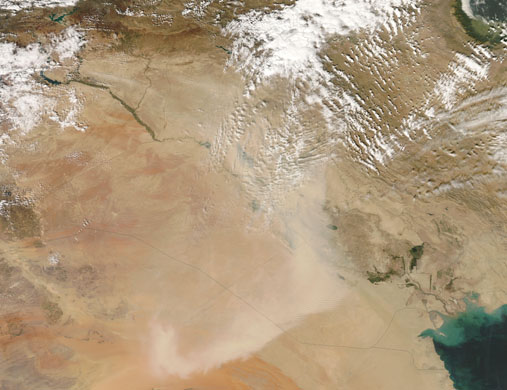
Dust over the Arabian Sea The thin plume of dust that hung over the Arabian Sea on October 15, 2008, intensified as the day wore on. In this image, the dust is lighter in colour and more opaque than the earlier plume. Larger puffs of dust blow southward off the coasts of Iran and Pakistan. All the plumes follow the same general direction, toward the southwestPhotograph: NASAHaze along the Himalaya Haze hugged the Himalaya in early October. Northeast of the snowcapped peaks, the skies are largely clear in Tibet. Southwest of the mountains, however, haze partially obscures the landscape, from Pakistan to Nepal. Agricultural fires and industrial pollutants are probably responsiblePhotograph: NASADust over Iraq A plume of dust swept over Syria, Iraq, and Saudi Arabia on October 16, 2008. In this photo-like image, the dust appears as an arc of pale beige over a slightly darker landscape. Although the origins of this storm are not immediately obvious in this image, some plumes appear to originate in SyriaPhotograph: NASA
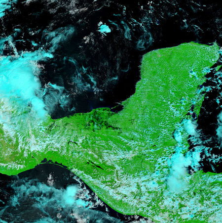
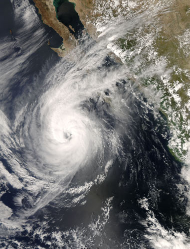
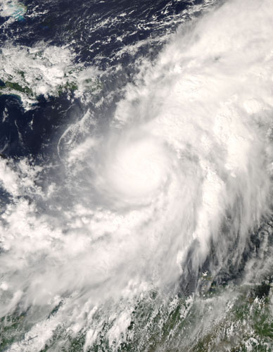
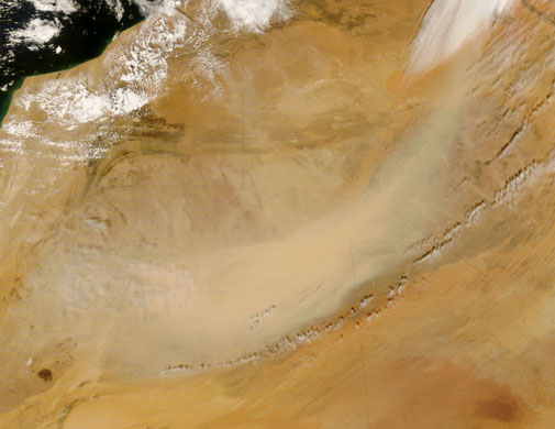
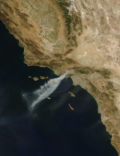
Floods on the Mexican Gulf coast Rivers along Mexico’s Gulf coast burst their banks after two weeks of heavy rain in late September and early October 2008. The flood waters - seen here on the land in black - forced 7,500 people from their homes and shut down oil wells in the state of VeracruzPhotograph: NASAHurricane Norbert On October 10, Hurricane Norbert retained a Category 2 hurricane status as it headed toward Baja California. The storm had maximum sustained winds speeds near 165kph (105mph), with higher gusts, threatening property and lives along Baja California’s west coastPhotograph: NASAIn mid-October, Hurricane Omar was poised to strike Puerto Rico, but weakened and headed for the Atlantic. In this image, the storm more than covers the expanse of ocean between the northern coasts of Colombia, Venezuela and Puerto Rico. The clouds extend toward the northeast, well past the string of Caribbean islands east of Puerto RicoPhotograph: NASADust over the western Sahara Desert A massive dust storm swept through the western half of the Sahara Desert on October 10, 2008. In this image, the dust plume appears as a tan veil that blows over the slightly darker desert floor in a clockwise direction. The source of the dust is not obvious in this image but likely arose from the sand seas in Algeria, and perhaps kicked up more dust as it blew over the sand seas of MauritaniaPhotograph: NASAFires near Los Angeles, California Driven by powerful Santa Ana winds, wildfires raged near Los Angeles, California, in mid-October 2008. Not only did the winds fan the fires’ flames, they also sent the smoke far out to seaPhotograph: NASA
Sign up to read this article
Read news from 100’s of titles, curated specifically for you.