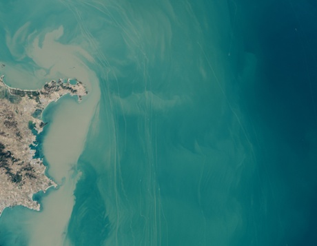
The shipping lanes off the coast of China’s Shandong Peninsula are so crowded that the traffic can be seen from space. The lanes form one of the main routes from the Yellow Sea into the Bohai Sea and the Chinese ports of Dalian and Tianjin, two of the busiest in the world. The ships appear as small gray and white specks.
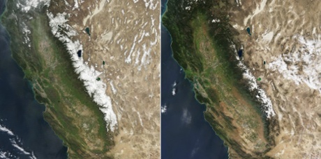
These two images compare snow cover in the Sierra Nevada in California – the left image is from March 2010, the last year with average winter snowfall in the region. The right image shows this year’s much depleted snow cover (most of the white is cloud cover). In normal years, snowfall supplies about 70% of California’s annual precipitation, melting to replenish reservoirs to meet water demands in the summer and fall. As California heads into a fourth year of drought, the snowpack levels are at their lowest on record for the time of year.
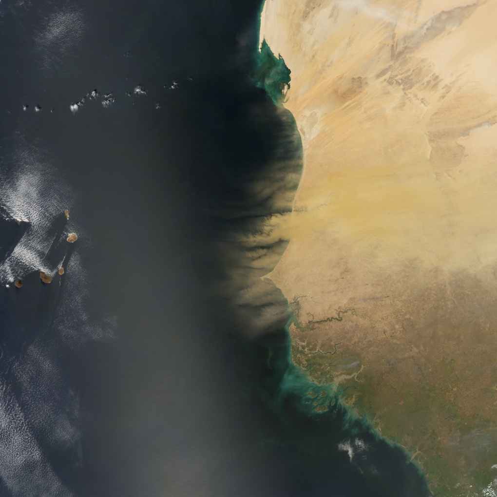
Hundreds of millions of tons of sand and dust particles rise up from Senegal, Mauritania, and Gambia to start a transatlantic journey. So much dust is kicked up that the microscopic particles amass into sweeping tan plumes that are visible to satellites.
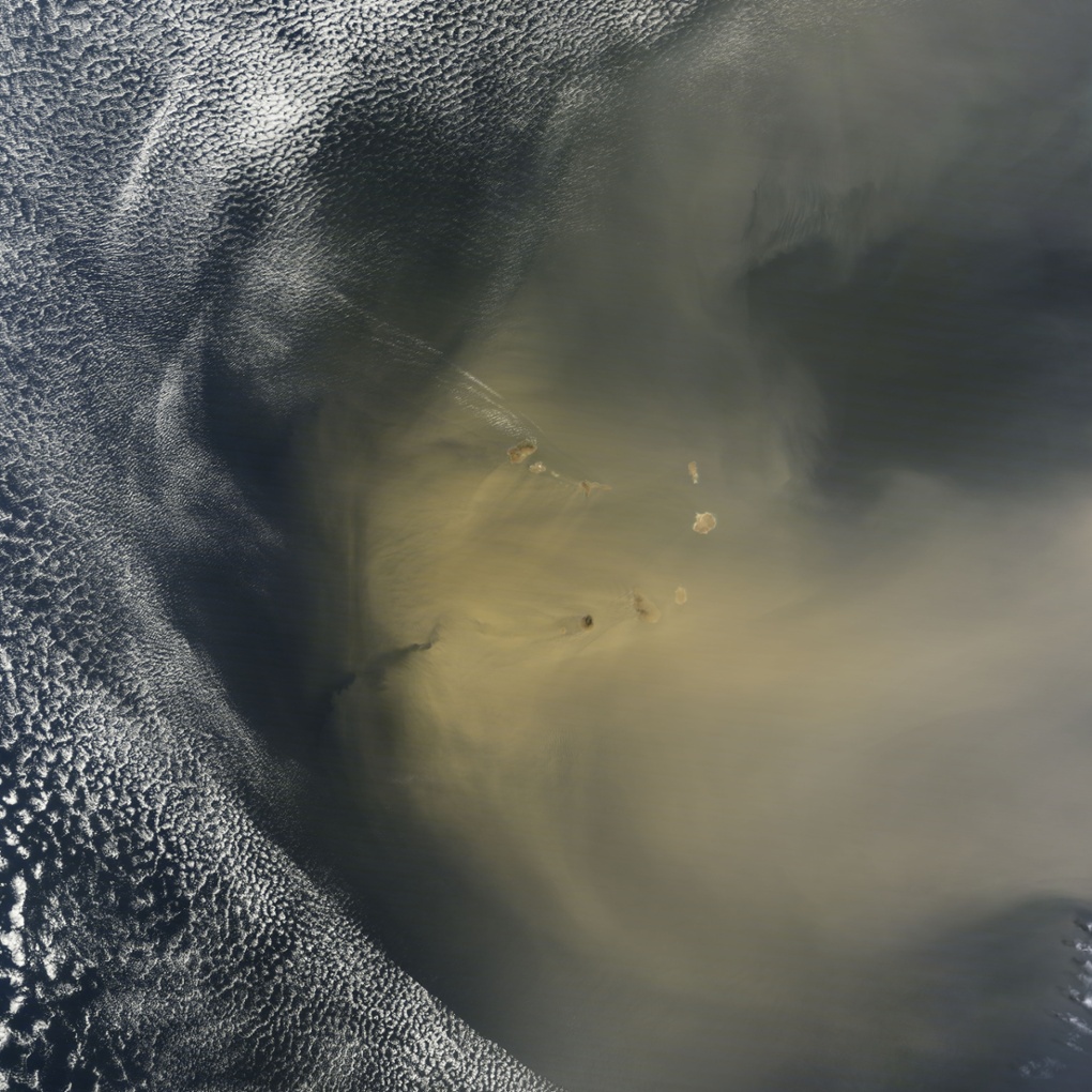
By the next day, the dust passed over Cape Verde. In a new paper published in February, 2015, scientists using a Nasa satellite quantified how much dust makes the trans-Atlantic journey from the Sahara Desert to South America and importantly how much phosphorus — remnant in Saharan sands from the desert’s ancient past as a lake bed — gets carried from one of the planet’s most desolate places to one of its most fertile. The Amazon rainforest depends on this phosphorus - an essential nutrient for plant proteins and growth - to flourish because nutrients are in short supply in Amazonian soils.
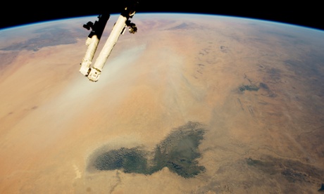
The arid landscapes of the Sahara and the darker vegetation of the wetter, semi-arid woodland known as the Sahel. The dark green marshes of Lake Chad stand out in the foreground. Even though it is more than 200 km (120 miles) long, modern Lake Chad is just a small remnant of a vast lake that once occupied this landscape. The lake basin stretches almost 1,000km (600 miles) from the foreground of the image to the foot of the Tibesti Mountains.
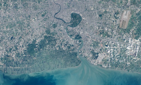
In the heart of Thailand’s most populous city, an oasis stands out from the urban landscape like a great “green lung”. That’s the nickname given to Bang Kachao – a lush protected area that has escaped the dense development seen elsewhere in Bangkok.
Last month’s solar eclipse casts a shadow over the clouds in the Arctic Ocean.
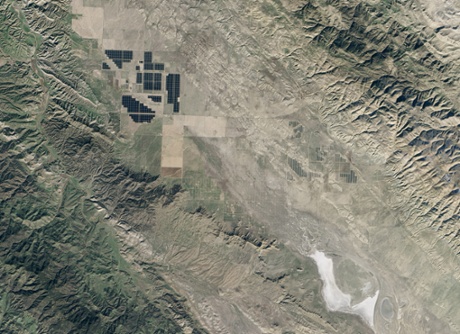
Nine million cadmium telluride solar modules now cover part of Carrizo Plain in southern California. The modules are part of Topaz Solar Farm, one of the largest photovoltaic power plants in the world. At 9.5 sq miles (25.6 sq km), the facility is about one-third the size of Manhattan island. When operating at full capacity, the 550-megawatt plant produces enough electricity to power about 180,000 homes.
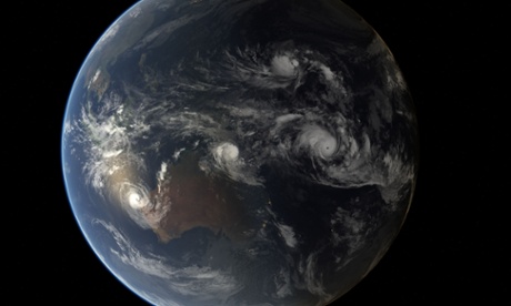
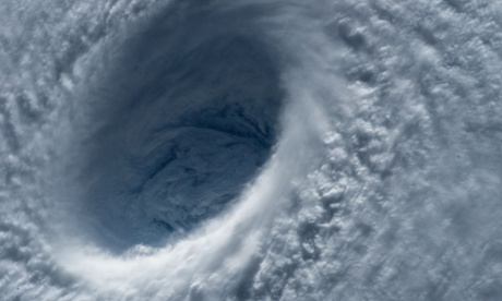
A composite image of four tropical cyclones, Olwyn, Nathan, Bavi and Pam, on 2 March.
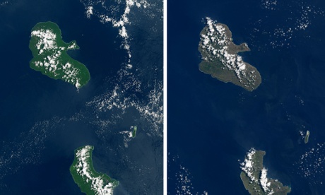
These two images show the aftermath of category 5 cyclone Pam that swept over the island nation of Vanuatu last month, hitting the islands of Tanna and Erromango. Before Pam (right), Erromango appeared dark green due to the lush tropical vegetation that thrives on it. The cyclone’s fierce winds downed many trees, stripped vegetation, and coated leaves in damaging salt spray, leaving the islands with a browner hue in the aftermath.
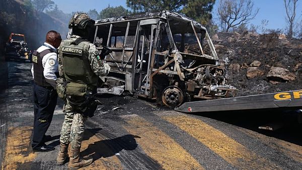
The storm killed six people and seriously injured many more, according to media reports. On Tanna the homes of 80% of the residents were either damaged or destroyed.

Stunning show of lightning near Bangkok.
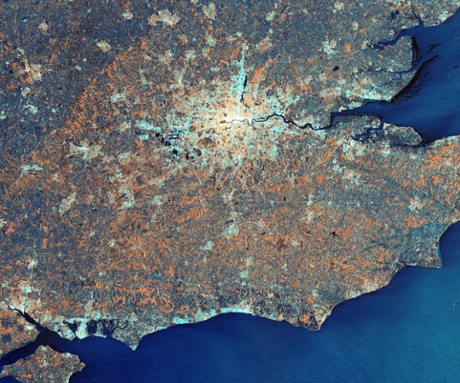
London appears as a cluster of bright radar reflections along the River Thames in this radar image from Sentinel-1A. This image was released to mark the signing, in Paris, of an agreement between ESA and the UK Space Agency that establishes access to data from the Sentinel satellites in the UK.
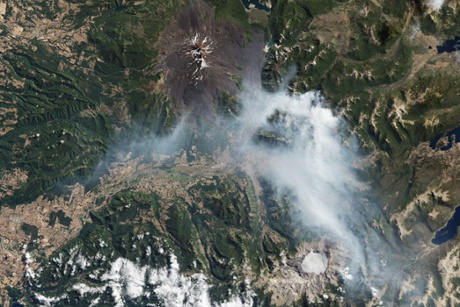
High winds and unusually warm weather fuelled damaging wildfires in southern Chile. This image shows smoke produced by a fire southeast of Llaima volcano on 17 March.
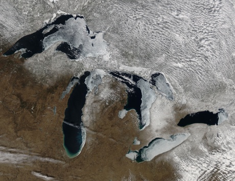
Ice cover on North America’s Great Lakes, March 2015. Ice covered 55% of the lakes compared to 75% the previous year.
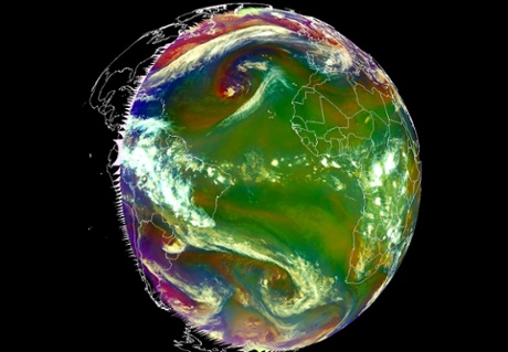
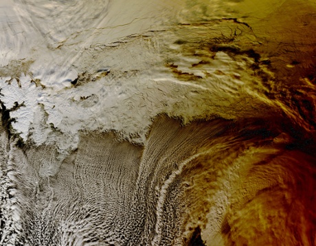
Around the equinox the Sun heats both Hemispheres equally causing symmetrical low pressure systems north and south of the equator.
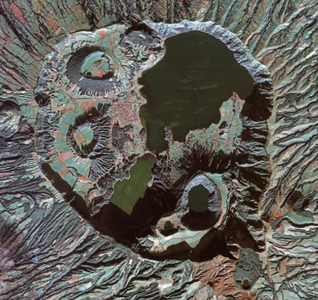
This image from over the Azores island of São Miguel shows the volcanic Sete Cidades Massif complex. The circular crater or caldera dominates the image and measures about 5 km across. The interior has lakes, volcanic cones, lava domes and maars – or shallow, flooded craters.
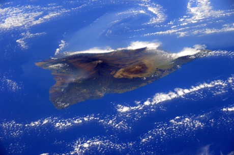
The island of Hawaii with its volcanoes, taken from the International Space Station.