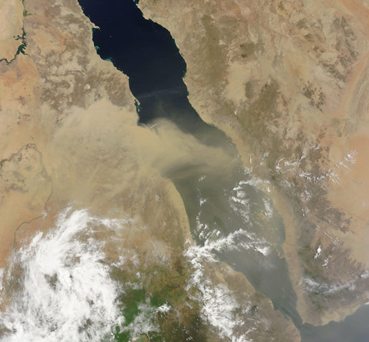
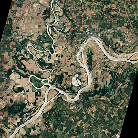
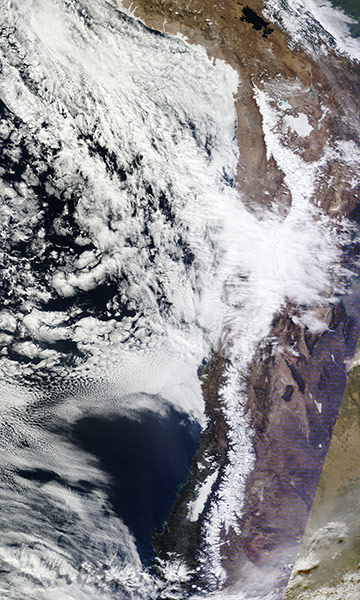
Though less dramatic than the initial eruption in June, Chile's Puyehue-Cord volcano complex continued releasing ash and steam in early July. Shifting winds moved the plume in different directions, sometimes over the Pacific and sometimes over South America, where ash interfered with air trafficPhotograph: Jeff Schmaltz/NasaDust plumes blew off the coast of Africa and over the Red Sea. The dust blowing off the coast of Sudan is thick enough to completely hide the land and water surface below, but the thickest dust stops short of reaching Saudi Arabia. Farther south, between Eritrea and Yemen, a thin dusty haze hangs over the Red SeaPhotograph: Jeff Schmaltz/NasaThe spring floods in the Mississippi river basin extended to the confluence of the Ohio and Wabash rivers in the south-western corner of Indiana, pushing the rivers over their banks in May 2011. By early June, flooding had largely receded, and by late June 2011, little flooding remainedPhotograph: Robert Simmon/NASA Earth Observatory
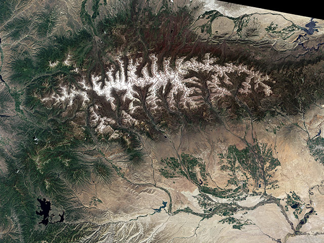
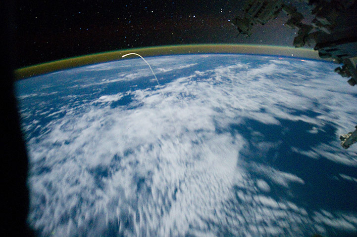
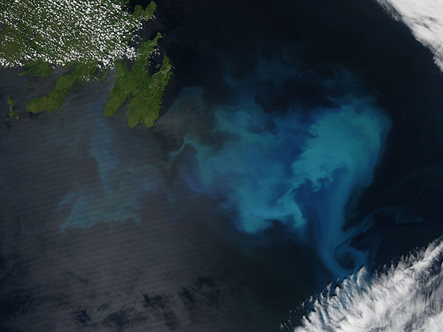
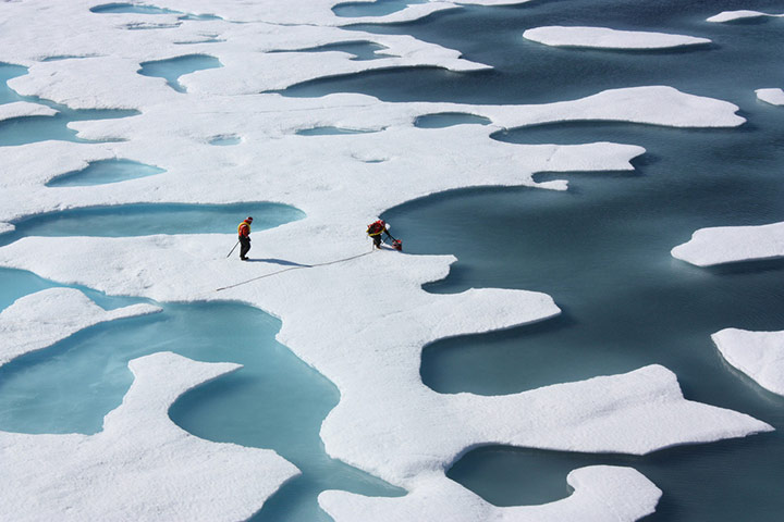
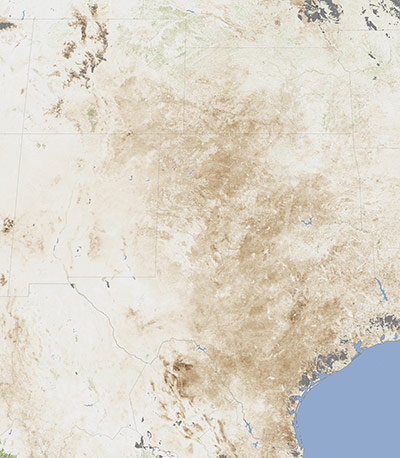
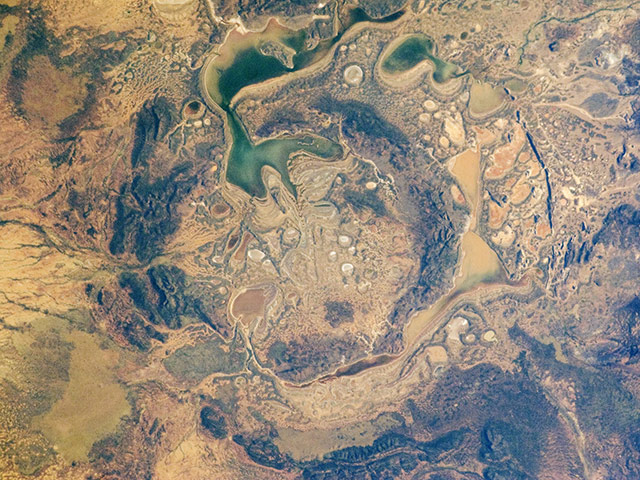
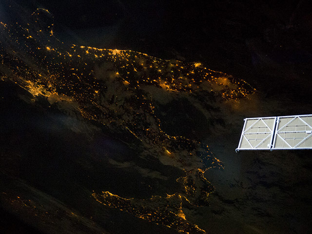
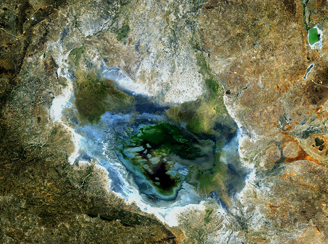
July Snow in the Uinta Mountains, Utah. By July in a typical year, the snow that covers the slopes of the Rocky Mountains has given way to grasses and wildflowers, leaving only the peaks capped in white. But 2011 has not been a typical year. As this image of the Uinta Mountains in northeast Utah shows, winter's snow is lingering into summerPhotograph: Robert Simmon/NASA Earth ObservatoryThis astronaut photograph, taken from the vantage of the International Space Station (ISS), shows the the space shuttle Atlantis streaking across the atmospherePhotograph: NasaThe waters off of the Newfoundland coast were colored with swirls of teal, turquoise and navy as millions of tiny, light-reflecting organisms bloomed in the cold waters in late July 2011. The organisms are called phytoplankton, and are photosynthesizing microscopic organisms that grow in sunlit ocean surface watersPhotograph: Jeff Schmaltz/NASAThe sea ice atop the Arctic Ocean can, as shown in this photograph from 12 July, 2011 look like a bright coastal wetland. As ice melts, the liquid water collects in depressions on the surface and deepens them, forming melt ponds. These fresh water ponds are separated from the salty sea below and around it, until breaks in the ice merge the twoPhotograph: Kathryn Hansen/NasaBy July 2011, Texas and New Mexico had completed the driest six-month period on record. Average rain between January and June was more than eight inches (20cm) below average in Texas and 3.5 inches below average in New Mexico. Record warm temperatures also persisted in Texas between April and JunePhotograph: Jesse Allen/NASA Earth ObservatoryThe Shoemaker (formerly Teague) Impact Structure located in Western Australia is approximately 19 miles in diameter and clearly defined by concentric ring structures formed in sedimentary rocks (brown to dark brown, image centre). The rocks were deformed by the impact event approximately 1.63bn years ago Photograph: NasaAt night, the Earth's surface is covered with a delicate tracery of lights, particularly in regions that have a long history of urban development (such as Europe). Large urban areas are recognisable from orbit owing to extensive electric lighting and distinct street patterns. With smaller urban areas spread across the land surface and coastlines, the outlines of continental land masses are easily discernable at nightPhotograph: NasaThis satellite image shows Lake Sulunga and surrounding areas in central Tanzania. A major road running east to west can be seen north of the lake with a railway running nearby. Agriculture is evident in the surrounding areasPhotograph: ESAOrdinarily, the flashes of white in South America's Atacama desert rise from salt pans. But on 7 July 2011 the white came from a far rarer commodity: snow. Starting on 3 July and lasting several days, a cold front dumped up to 80cm on the driest desert in the world, reported BBC NewsPhotograph: courtesy the MODIS Rapid Response Team/NasaIn August 2010, the Petermann Glacier along the northwestern coast of Greenland calved an ice island roughly four times the size of Manhattan. Nearly a year later, on 20 July 2011, a piece of that ice island named Petermann Ice Island-A (PII-A) and about the same size as Manhattan was still visible to Nasa's Terra satellite. On July 21, 2011, MSNBC reported that PII-A was slowly drifting toward NewfoundlandPhotograph: Jeff Schmaltz/Nasa
Sign up to read this article
Read news from 100’s of titles, curated specifically for you.