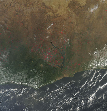
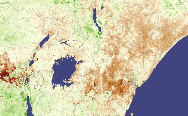
Agricultural fires (shown here with red dots) are common in west Africa's dry season. In this image, showing Ghana, Ivory Coast to the west and Togo to the east, fires dominate the drier parts of the country to the west of Lake Volta and north of the city of Kumasi. Although such fires are not necessarily hazardous, they can have a large impact on air quality and human health, climate, and natural resourcesPhotograph: NASASea ice around the north magnetic pole. Just as the Earth has two geographic poles, the North Pole and the South Pole, it also has a north and south magnetic pole. Although the geographic and magnetic poles are near each other, they are not located in the same places. Currently, the north magnetic pole is located in the Canadian Arctic at approximately 82.7 degrees north and 114.24 degrees westPhotograph: ESATen million people could face hunger in Kenya after a poor harvest, Kenya’s government warned on 9 January 2009. As developing drought settled over eastern Kenya, slowing plant growth, areas in which plants were growing less vigorously than average are seen as brown in this image, while areas in which plants were growing well are greenPhotograph: NASA
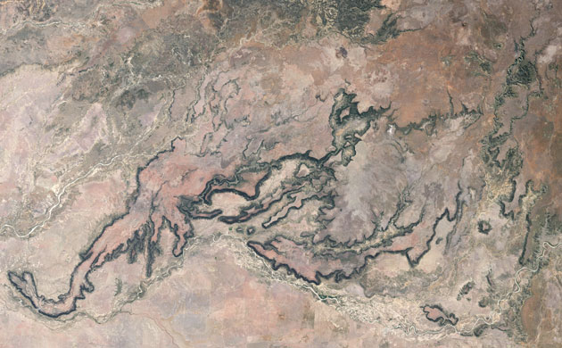
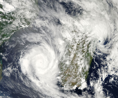
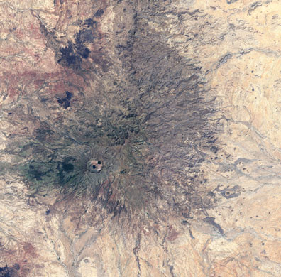
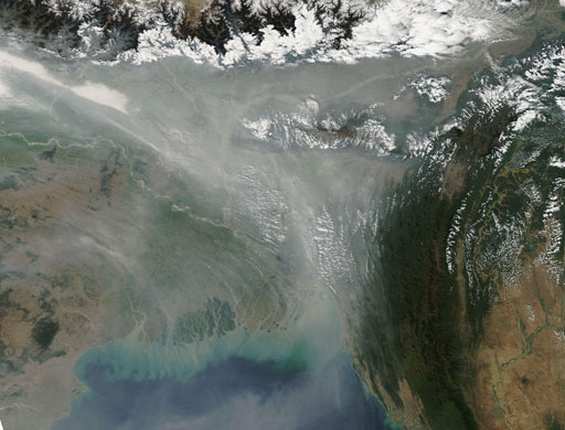
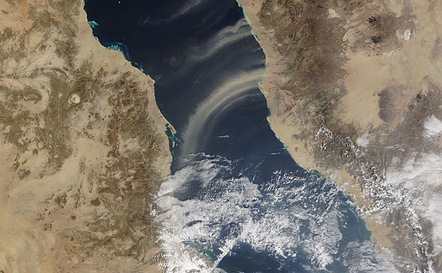
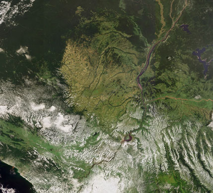
Porcupine Gorge, Queensland, Australia. Hard, basalt rock caps a large sandstone plateau in the savanna of central Queensland. The erosion-resistant rock (a type of hardened lava) weathers the elements with persistence. In some places, however, water has gained the upper hand, carving the plateau and exposing the pale sandstone that underlies the basaltPhotograph: NASAMadagascar, an island nation off the eastern coast of Africa, was hit by two tropical cyclones within days of each other. This image shows what both storms looked like on 19 January 2009. Fanele is the larger storm on the left, in the Mozambique channel. Eric, a much smaller and weaker storm, is further north than Fanele and on the opposite coast of the islandPhotograph: NASAMount Marra, Sudan.The African nation of Sudan extends from the Sahara desert in the north to fertile equatorial regions in the south. Halfway in between, in western Sudan, lies a network of volcanic mountains and fertile valleys known as Jebel Marra, where just enough rain falls to sustain agriculturePhotograph: NASAPale grey haze over Bangladesh on 20 January 2009 forms a triangle just south of the Himalaya, stretching southward toward the Bay of Bengal. The haze likely comes from urban and industrial pollution in the regionPhotograph: NSADust plumes blew off the coast of Saudi Arabia and over the Red Sea in mid-January. In this image, captured on 15 January, the largest plume blows off the Saudi Arabian coast north of Jeddah, forming an arc that extends to the Sudanese coast. Along the northwestern margin of this plume, tendrils of dust form lines roughly perpendicular to the plume’s arc. These tendrils may arise from different air currents at different altitudesPhotograph: NASAChile's Chaiten volcano had been dormant for more than 9,000 years when it erupted in May 2008. In the months that followed, the volcano remained active, releasing plumes of steam and volcanic ash, coating local vegetation, clogging waterways, and inundating the nearby town. On 19 January 2009, an explosive dome collapse occurred at the volcano, resulting in this white plume which can be seen from spacePhotograph: NSAThis image shows the rainforests of the Congo River basin, the second largest in the world after the Amazon. The basin covers an area of more than 4m km sq, spreading across the Democratic Republic of Congo (east of the Congo River), most of Congo-Brazzaville (west of the Congo River), Gabon (visible in dark green along the left side), Equatorial Guinea (above Gabon), and southern parts of Cameroon and the Central African RepublicPhotograph: ESA
Sign up to read this article
Read news from 100’s of titles, curated specifically for you.