LOS ANGELES _ New oil, gas and mineral exploration and development will be barred in the San Gabriel Mountains National Monument under a long-awaited management plan, released Thursday, governing the largest wilderness in Los Angeles County.
The U.S. Forest Service plan prioritizes environmental protection over economic development and, in some cases, recreational access _ limiting overnight camping along certain popular rivers and streams because of its ecological toll.
The plan comes four years after President Barack Obama established the monument and amid a push by the Trump administration to increase industrial use of public lands and waters nationwide.
Released two months behind schedule, the document is scant on specifics for the 346,000 acres of alpine peaks, lush canyon lands and rivers that lure 4 million annual visitors to what it describes as "America's most urban national forest in the nation's most populous county."
It deems exploration and development of oil, gas and mineral resources and use of motorized vehicles for commercial purposes "unsuitable" in the monument. (Companies and individuals with existing mining claims will be unaffected by the plan.)
And it bans camping along the East and North forks of the San Gabriel River and Aliso Creek Canyon _ tourist hot spots that have been designated as "critical biological land use zones" for rare and endangered species including mountain yellow-legged frogs, red-legged frogs and the Santa Ana sucker.
The plan focuses attention on one of the oldest and most rancorous arguments in the San Gabriels: the damage caused by gold mining in its streams.
Monument lands and waterways are not open to prospecting or any other mining operation including panning for gold. Until now, however, enforcement has been deliberately lax because the rule is based on a 1928 policy that does not include penalties.
The new document recommends that the monument collaborate with local, state and federal agencies, as well as volunteer groups, in an enforcement campaign to document and eliminate unauthorized mining activities.
Agencies, nonprofits, conservationists and communities that lobbied for the creation of the monument support the moves by the Forest Service.
"This plan is an excellent sign that the Forest Service is making management of the monument a high priority," John Monsen, co-chair of the Sierra Club Angeles Chapter's forest committee, said. "It's strong and ambitious, and should make it easier to persuade Congress to provide the cash-strapped Forest Service with the resources needed to apply it."
The management plan, hammered out over three years in often contentious meetings between Forest Service officials and stakeholders, recommends easing traffic congestion by considering temporary one-way traffic flows and closures during peak periods at popular destinations, and enforcing parking capacity limits to reduce the number of cars left haphazardly along hairpin turns _ and the flood of vehicles heading back down the mountain because there was no parking to be found.
It urges the use of multilingual information in signage and outreach programs, and more collaboration with volunteers and communities in the interests of "shared stewardship" of the land, a tactic that could help earn a greater return on the agency's investments with its shrinking appropriated funds.
Deeming the lands a monument was a strategy intended to increase interest and attendance _ and with them, donations. So far, fundraising efforts have been relatively modest, and because fire seasons are growing longer, wildfire suppression has eaten into a greater portion of the Forest Service's budget each year.
Over the last four years, the National Forest Foundation has raised about $6.5 million for projects on the monument and throughout the Angeles National Forest including educational programs, trail maintenance, removal of invasive plants and habitat restoration, Edward Belden, a spokesman for the nonprofit, said.
Compounding problems, budget cuts have forced the Forest Service to cut back on recreation and maintenance programs, officials said. The Forest Service's budget has been reduced by more than $1.5 billion over the last two years alone, according to federal documents.
The monument still lacks a budget or administrative unit of its own. It comprises half of the Angeles National Forest _ and the existing authority of the Forest Service remains in place.
Jeffrey Vail, supervisor of the monument and the Angeles National Forest, was not immediately available for comment.
Monument advocates say partnerships are necessary to balance conservation and public interests without circumventing environmental regulations at the most popular picnic areas, hiking trails and campgrounds.
"The new plan counters what you see going on right now in the rest of the nation's forest communities," Mark Stanley, executive officer of the San Gabriel and Lower Los Angeles Rivers and Mountains Conservancy, said. "It's also in line with the direction we want to go _ and that's a good thing."
On almost any given weekend, a two-mile stretch of the East Fork of the San Gabriel River, about 15 miles north of Azusa, and the Switzer picnic area, only seven miles from La Canada Flintridge, are as crowded as Southern California beaches.
Most of the people who come to the monument each year get into it one way _ by car on California 39, the winding mountain highway that provides the only access to Crystal Lake and other recreational areas north of the East Fork.
Awaiting them are panoramic views of steep canyon lands that are home to rare and endangered species including the California condor, Nelson's bighorn sheep and a new species of scorpion recently discovered in Eaton Canyon, a highly visited area above Pasadena.
Scenic hiking trails bring visitors to Sturtevant Falls or atop Mount Wilson, where one of the world's largest telescopes sits.
The San Gabriel River takes shape in three forks that drain a lacework of streams, and it ranks among the steepest rivers in the United States, plunging from its 9,000-foot-high headwaters to the ocean in about 70 miles.
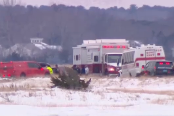
Hiking, biking, horseback riding, off-highway vehicle use, fishing, hang-gliding, hunting and picnicking are just a few of the recreational activities jockeying for elbow room in one of the most heavily used national forests in the U.S. The area is also susceptible to crowds who bring vandalism, trash, illegal campfires and emergency rescues.
Not all are in favor of the changes in the new land management plan.
Matthew McAuliffe, a spokesman for the American Mining Rights Association who said he has prospected for gold in the San Gabriels for nearly a decade, warned of "a lot of backlash coming down" in the event of a crackdown.
"I fear for the guy who comes up on a weekend to pan for gold with his kids only to be made an example of by militarized forest rangers," McAuliffe said. "If that happens, there will be litigation. We may lose, but at least we'll give the Forest Service a run for its money."