More than 40 planned hazard reduction burns in the Lower Hunter have been unable to go ahead this season due to wet weather.
Lower Hunter Rural Fire Service Inspector Dave Milsteed said mother nature had been "very kind" by bringing wet weather, but conditions meant hazard reduction burns would be ineffective.
"It's pointless trying to undertake them when burn parameters are too wet," he said. "We're having it reported back to us that it is very wet - even in places along the peninsula in Port Stephens we've still got puddles of water lying around."
Inspector Milsteed said crews were able to forge ahead with some burns at the end of summer and early autumn, but the March flood event and subsequent rain had put the kibosh on more.
Meanwhile, the wet weather has allowed for local areas affected by the Black Summer fires to recover.
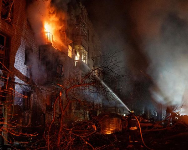
Fire tore through more than 400ha of bush near Wangi Wangi on New Year's Eve 2019. Firefighting crews took four days to get it under control and it resulted in blackened landscape that was stripped of vegetation and seemingly devoid of life.
But a recent photographic survey has captured the native flora and fauna's recovery in the past 18 months.

Lake Macquarie City Council Senior natural assets officer Dominic Edmonds said Gymea lillies, grass trees and banksias were among the plant species thriving again.
"As these plant species regenerate, birds and other animals return to the area and the ecosystem is slowly restored," he said. "It can take months or even years to fully recover, but monitoring specific sites over time helps us keep tabs on progress."
Council is also spearheading a pilot project aiming to change the way bushfire risk is assessed in the community. Using aerial infra-red, thermal and high-resolution imagery of bushland, an online platform is under development where residents can check their property's bushfire risk.
Council's manager environmental systems Karen Partington said until now, bushfire risk assessments required council officers to visit a site and talk to residents.
"This online tool will allow people to search a map and see the bushfire risk by themselves before they ring us and request an inspection," she said.
"We will still be visiting sites to determine bushfire risk, but a tool like this has the potential to greatly improve the community's knowledge of bushfire risk and increase the ability of residents to plan accordingly."
The pilot project, funded through the NSW Government's Bushfire Community Recovery and Resilience Fund, will cover a study area between Belmont and Glendale and is expected to go live later this year.
"The plan is for the program to be expanded across the whole LGA during 2022," Ms Partington said.
Meanwhile, Inspector Milsteed said residents should now be preparing their properties and assessing their bushfire survival plans ahead of the warmer weather.
"For us going forward the best defence is a prepared community," he said.