SES crews have prepared for minor flooding in Queanbeyan with 25 to 40mm of rainfall forecast for the Canberra region Wednesday.
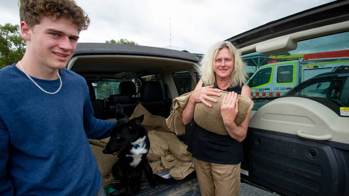
SES volunteers distributed sandbags on Tuesday, while Queanbeyan SES deputy unit commander of operations Brent Hunter said that rivers were already swollen, heavy ground saturated and Googong Dam was at capacity.
Emergency services are ready and waiting for rain that has stalled off the coast and expected to arrive late Wednesday afternoon.
"It should be just more a flood of inconvenience than one of great danger in this region," Mr Hunter said.
He urged people to take flood safety seriously in light of events in Queensland and northern NSW, "over the last 12 months [in the ACT] every time we've had a significant rain or flood event, we've been pulling people out of water".
"This might be the event where people actually listen and keep themselves safe."
Houses are not expected to be inundated but roads and crossings have been impacted.
Bureau duty forecaster Rob Taggart said there was a risk of minor flooding with wet weather expected to hit on Wednesday afternoon and Thursday. Further rainfall is forecast for the ACT over the weekend and Monday. "We're basically expecting intermediate to moderate rainfall across the ACT, and if it's persistent enough, that could lead to minor flooding of the Queanbeyan and Molonglo Rivers," he said.
Current road closures include: Bombay causeway, Wyanbene Road crossing, Farringdon Road crossing, Stewarts Crossing Road, Briars Sharrow Road at Molonglo River crossing with a possible closure at Morisset Street crossing. All other low level causeways are at watch and act.
Braidwood Unit Commander Matthew Talbot said that while the bureau's rain gauge had failed, local readings had shown the area received 60mm so far this week and 12mm to around midday on Wednesday.
"We're surviving well, but this is only the early stages of the weather event. It is due to hit later on [Wednesday] afternoon," he said.
"We'll be watching it intently and we have crews ready to roll out when necessary.
"The locals are keeping as well and truly informed of what's going on."
A slow moving coastal trough has already delivered hundreds of millimetres of torrential rain that has flooded southeast Queensland and northern NSW in recent days.
The trough has hit the South Coast with the Bureau of Meteorology issuing a severe weather warning that some areas could receive up to 200mm of rain in six hours.
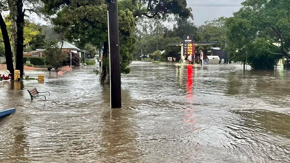
The South Coast town of Mogo is reportedly all but deserted after business owners stacked their goods up high and surrounded buildings with sandbags before leaving the area for the next few days.
This comes after the small town was flooded in mid-December 2021 after a number of areas on the coast recorded more than 200 millimetres of rain in 24 hours.
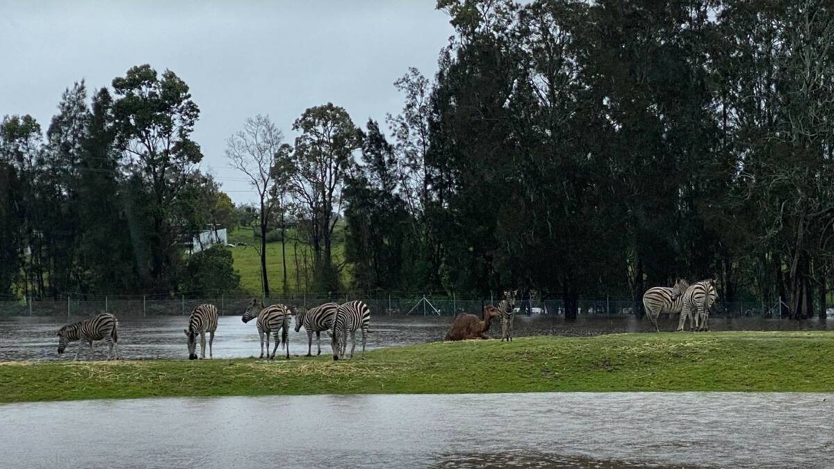
Mogo Wildlife Park zookeeper Chad Staples said the zoo, located on the banks of the Shoalhaven River, had experienced minor flooding but no animals had been impacted. With the danger of high tide passed, residents were waiting for the next peak at about 9.40pm on Wednesday.
"It's really hard because ... it's a weather system that could change at any moment. So how prepared can you be?" he said.
"People were certainly worried because we'd never seen the water come up like [it did in December] before in the town, that's for sure."
"Thankfully, the wildlife park itself, we do know that flooding happens and so the animals will always be safe. We just have to make sure that we do everything we can once the water stops to get it away as quick as possible."
Intense rainfall and thunderstorms could also have also caused flash flooding, in parts of the Hunter and Metropolitan, Illawarra, South Coast and parts of Central Tablelands and Southern Tablelands, while wind gusts could exceed 90km/h in some areas.
Meanwhile, a moderate to major flood watch issued on Tuesday for the Queanbeyan and Molonglo Rivers has been downgraded to minor.
READ ALSO:
-
More damage to come from storms: Morrison
-
NSW flood death fears as rain heads south
- Warnings still active for flooded SE Qld
A flood watch means that people living or working along rivers and streams must monitor the latest weather forecasts and warnings and be ready to move to higher ground should flooding develop.
Flood warnings will be issued if a minor flood level is expected to be exceeded at key sites along the main rivers.