East coast of NSW suffers through day five of floods | July 6, 2022 | ACM
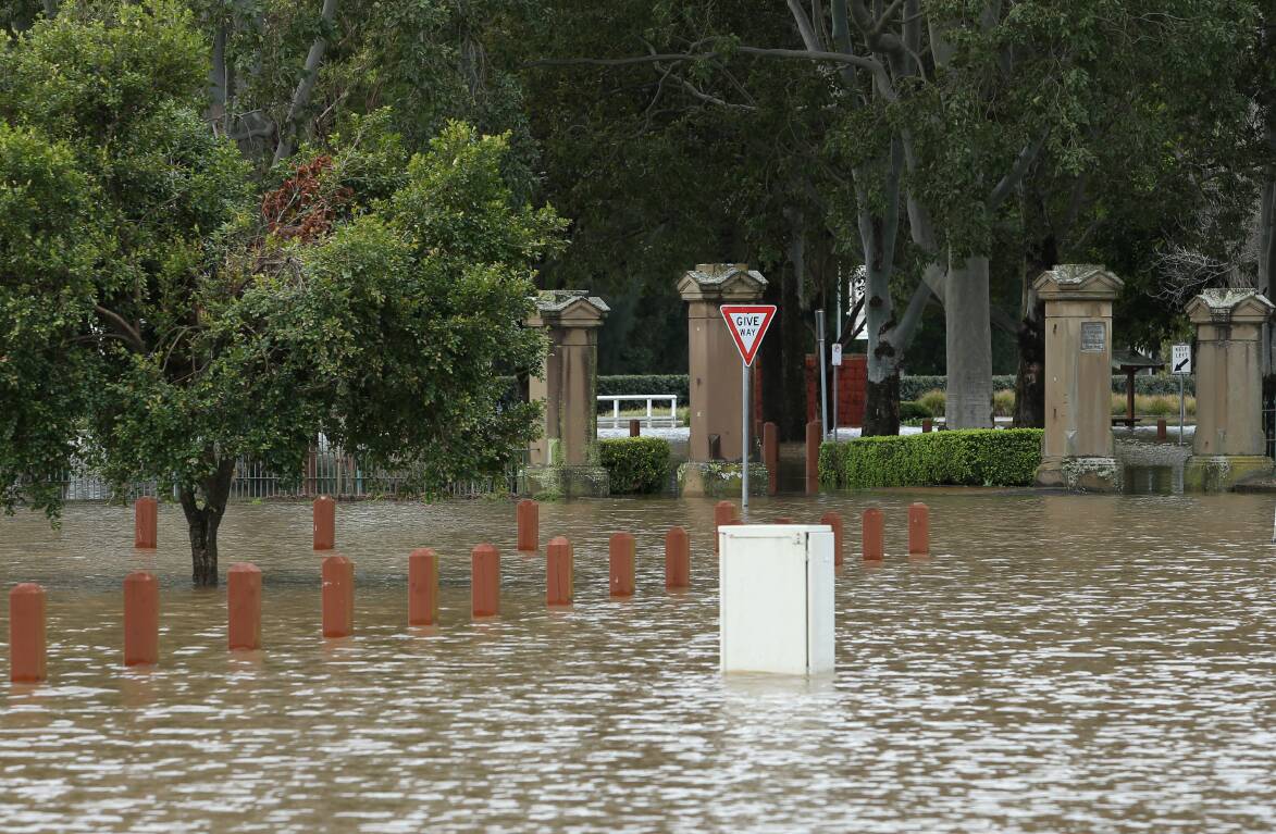
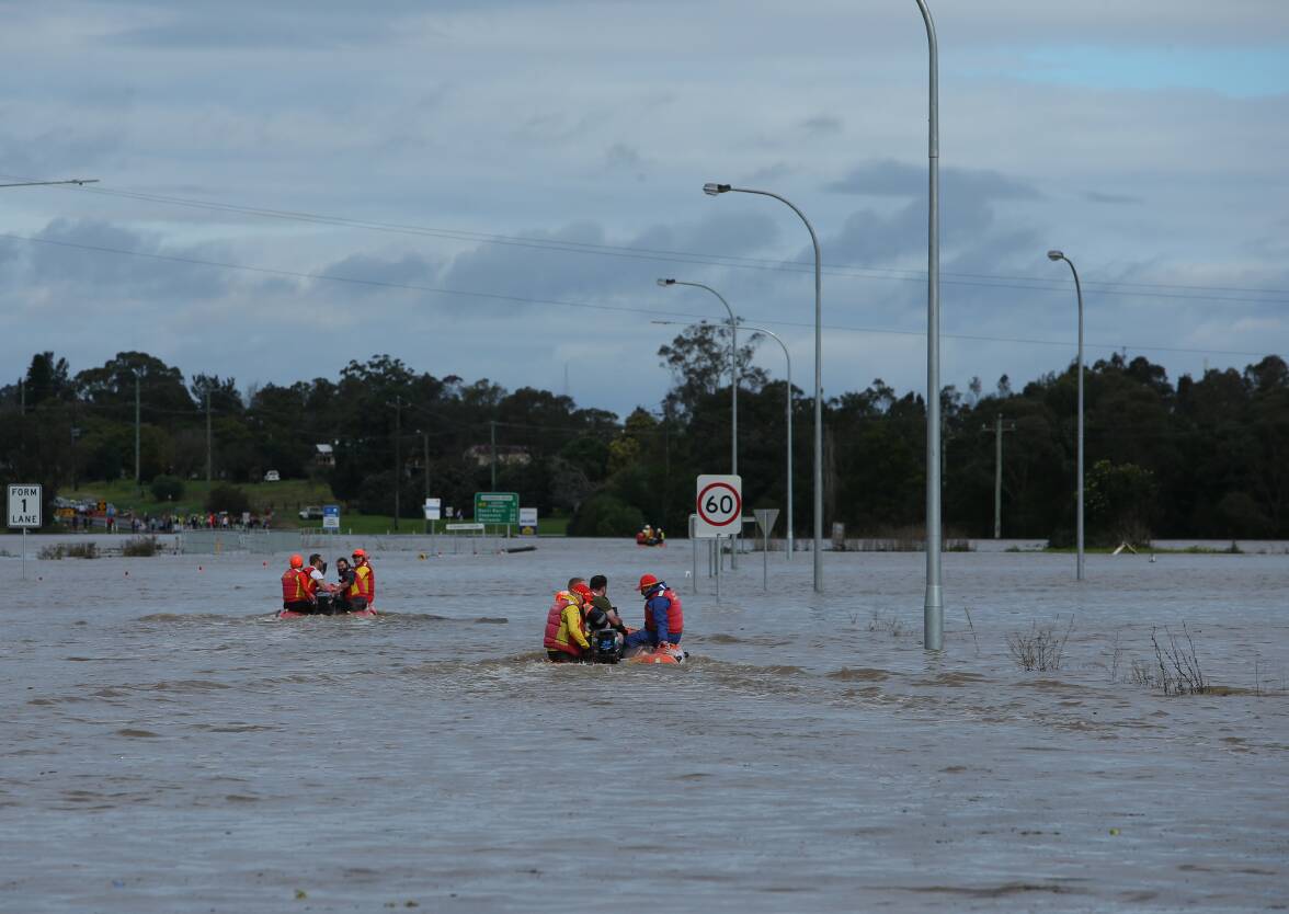
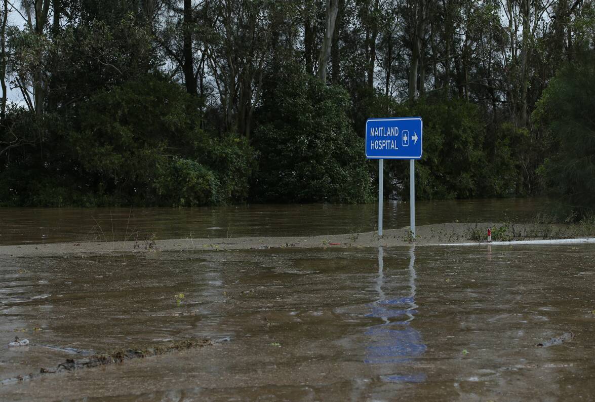
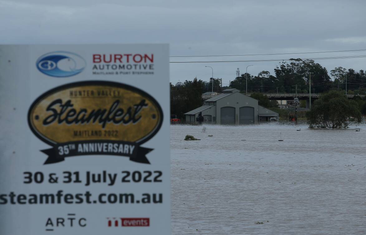
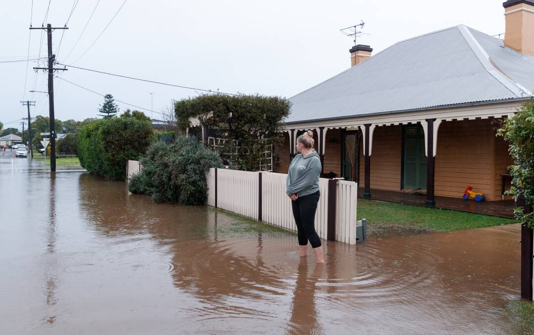
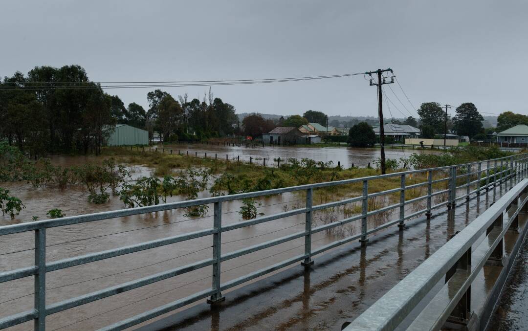
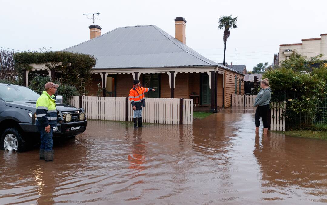
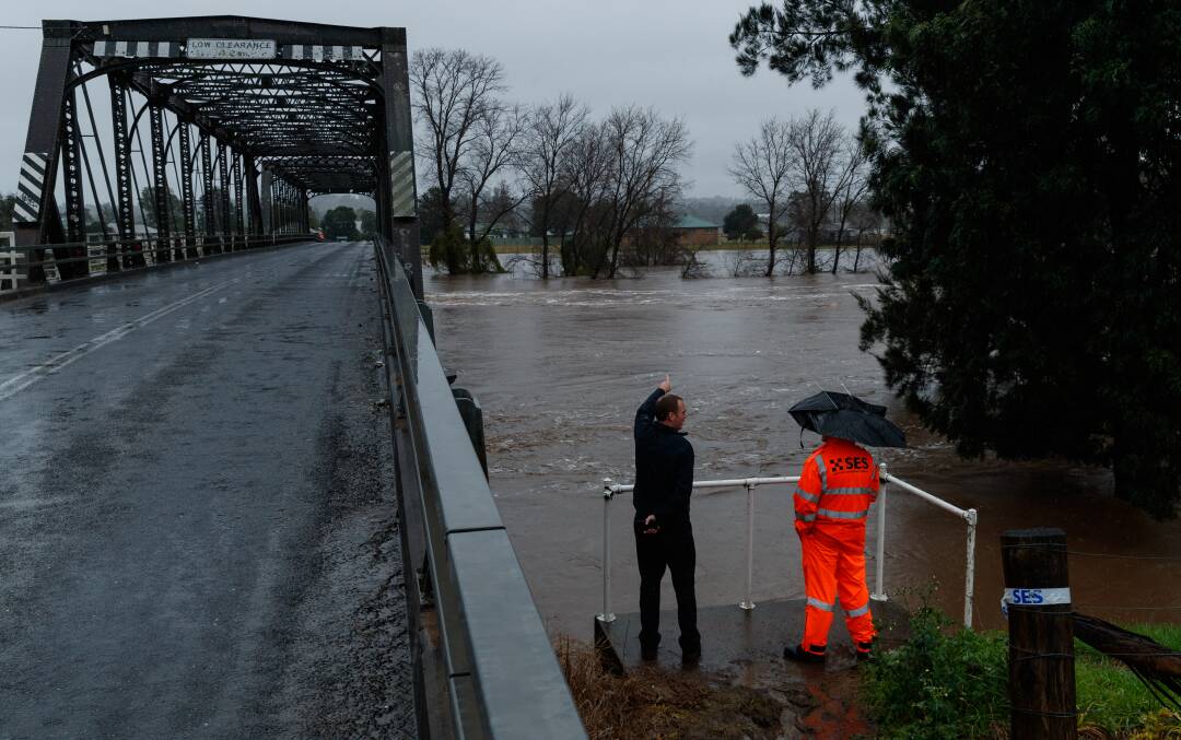
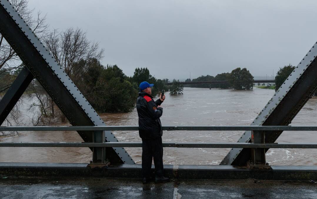
Emergency services and the community were continuing to brace for possible major flooding of the Maitland area on Friday, with the water expected to peak around the major level of 10.5m at the Belmore Bridge during the morning.
The flood level had reached 10.39m early on Friday as moderate flooding of low-lying areas continued.
It came amid news that Premier Dominic Perrottet and Minister for Emergency Services and Resilience and Minister for Flood Recovery Steph Cooke will tour flood-affected parts of the region throughout the day.
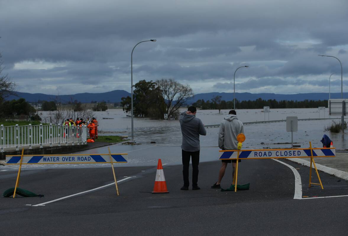
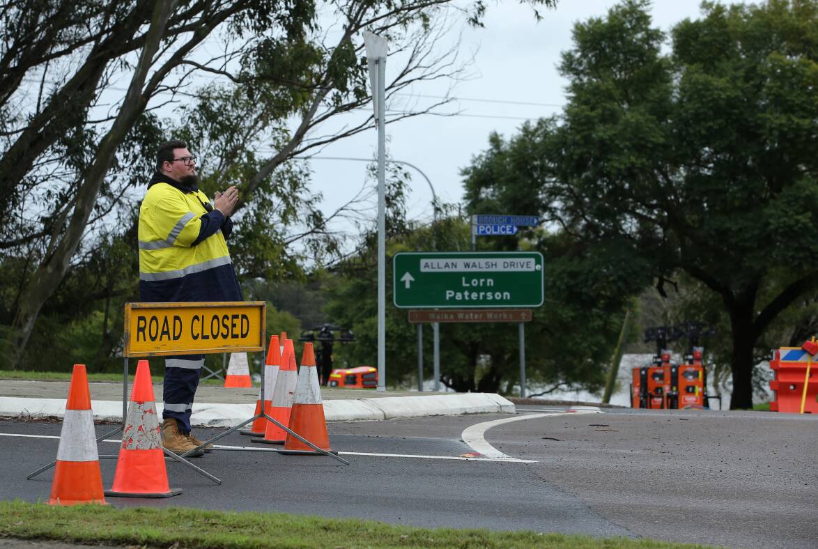
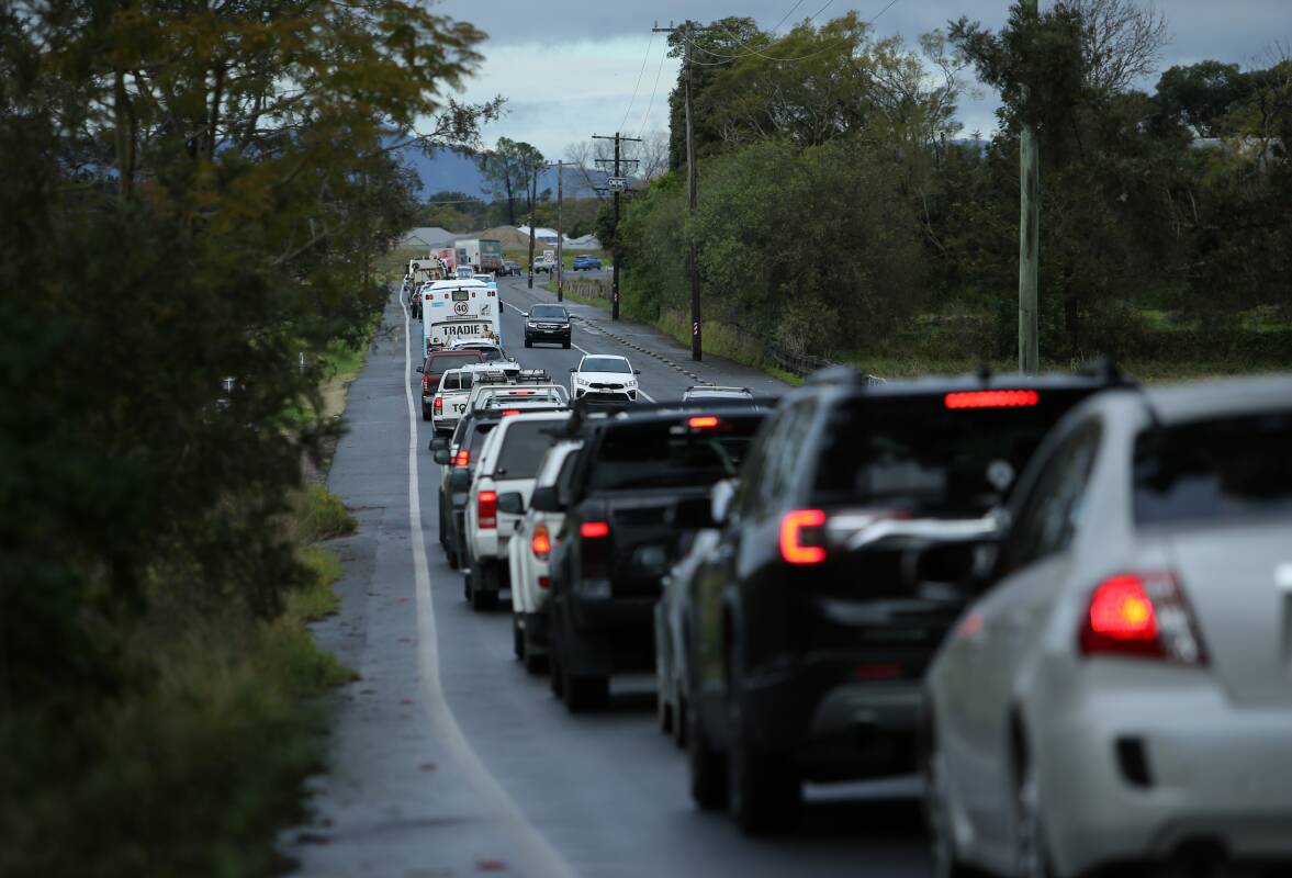
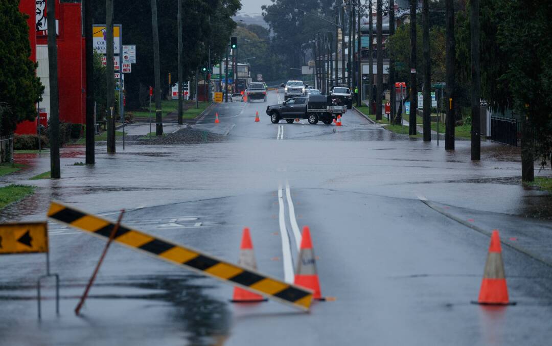
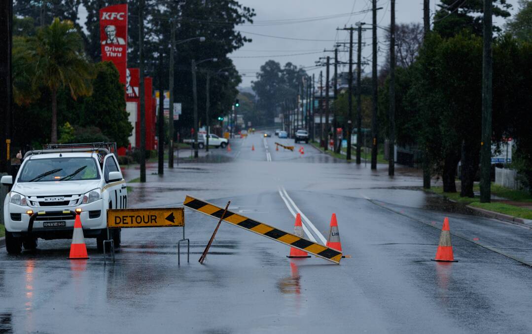
The New England Highway is cut between the Golden Highway and Thomas Mitchell Drive (from just south of Muswellbrook to near Belford), and is also closed between Melbourne Street and Bungaree Street in East Maitland.
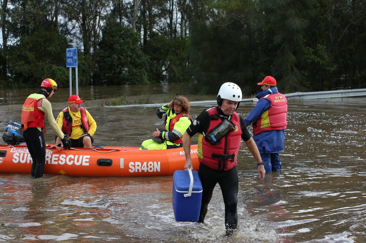
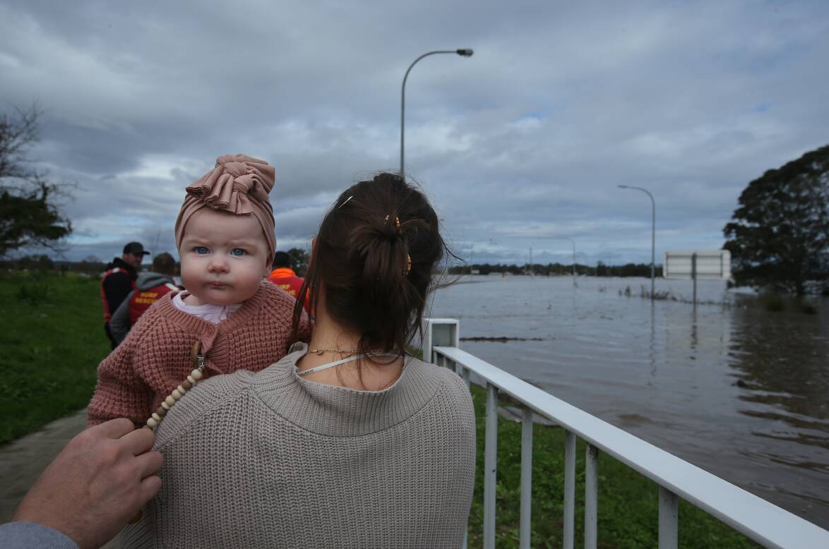
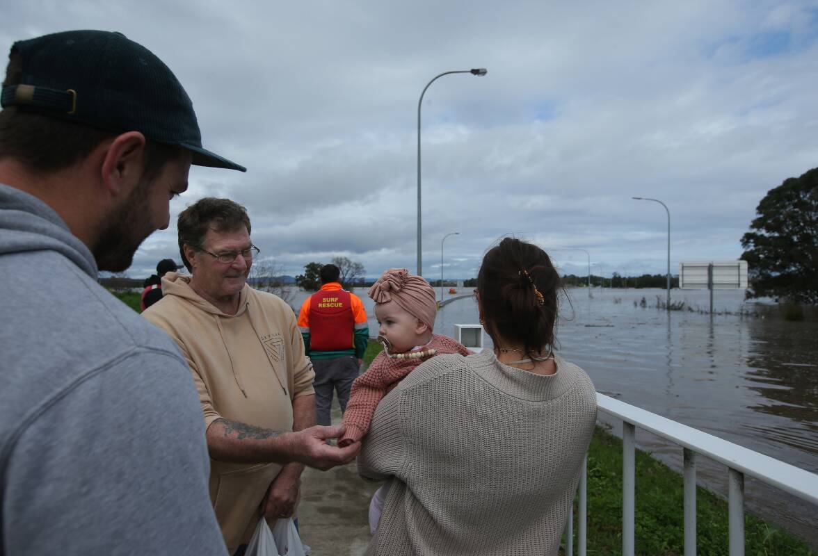
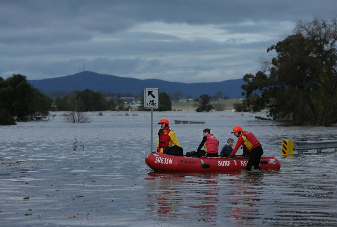
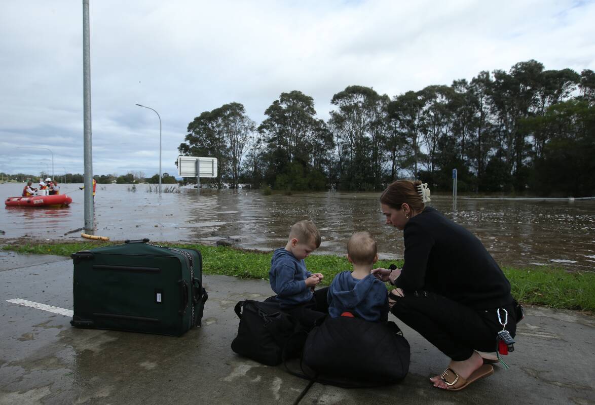
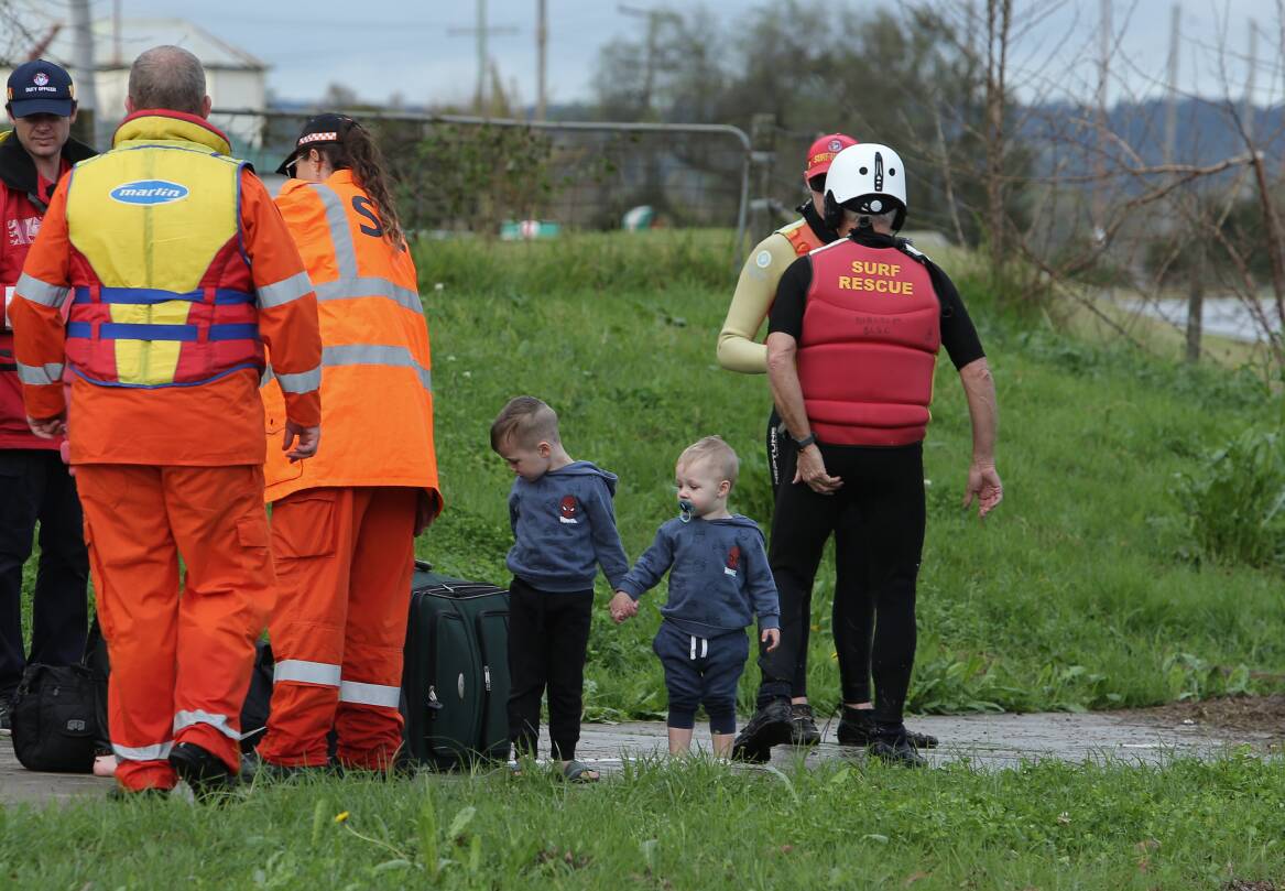
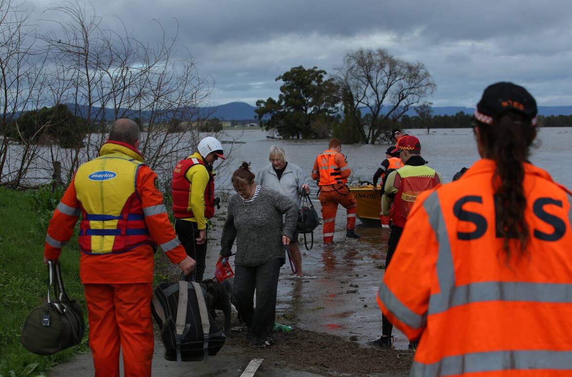
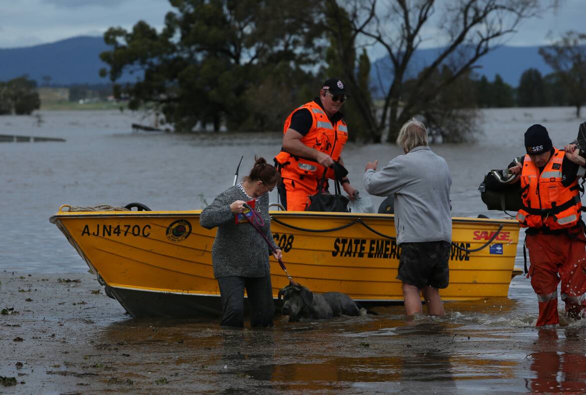
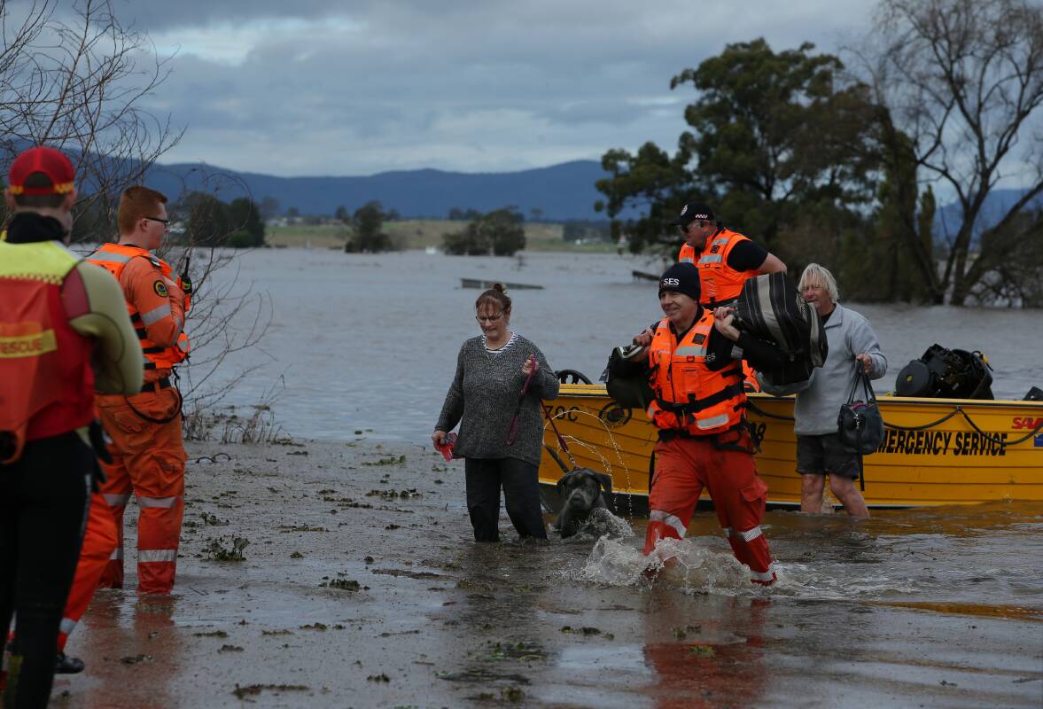
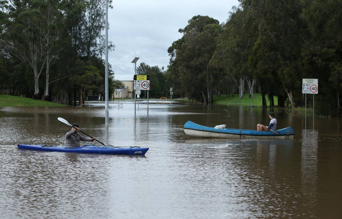
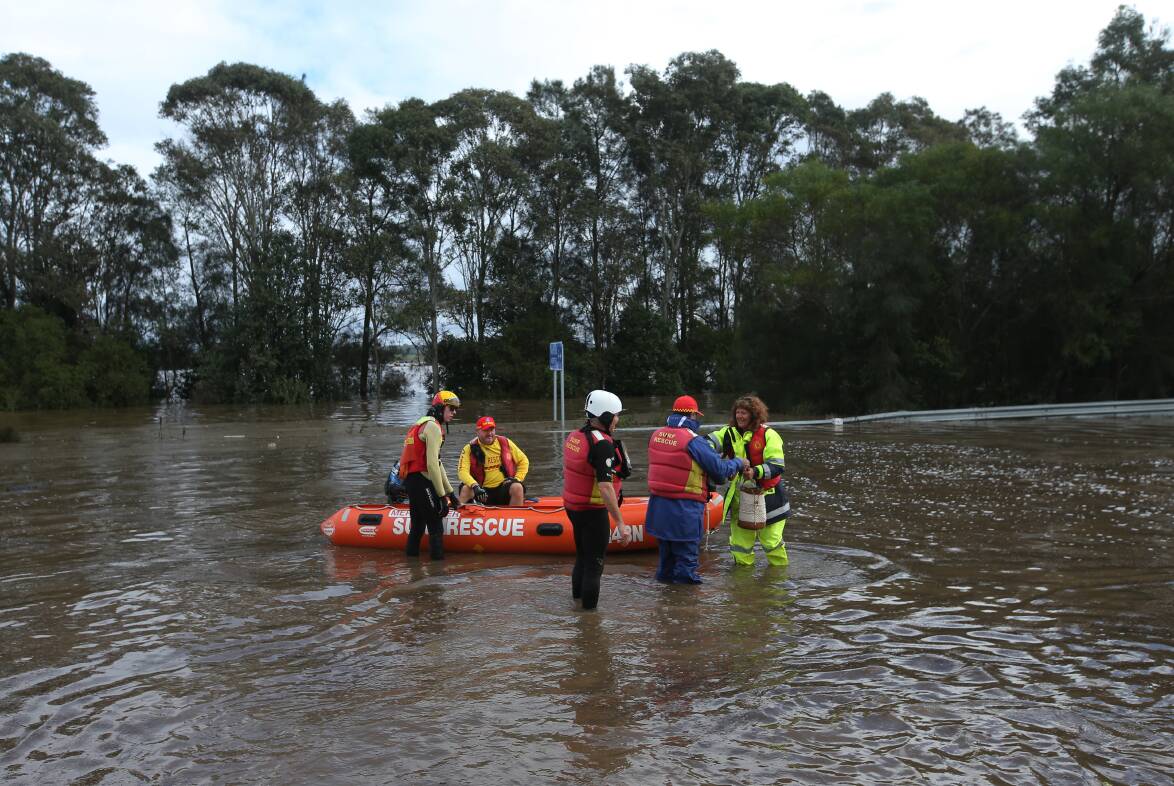
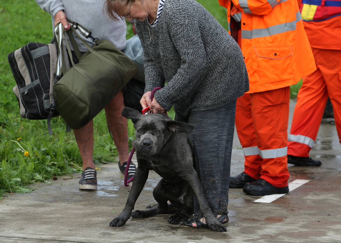
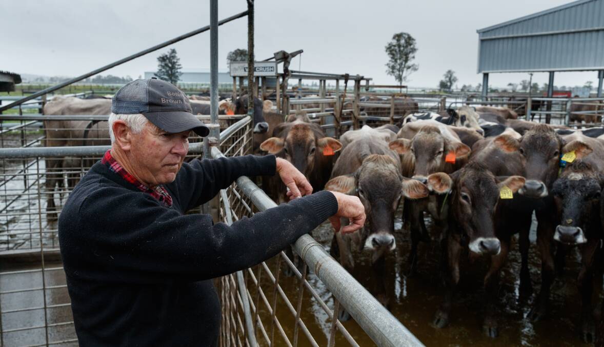
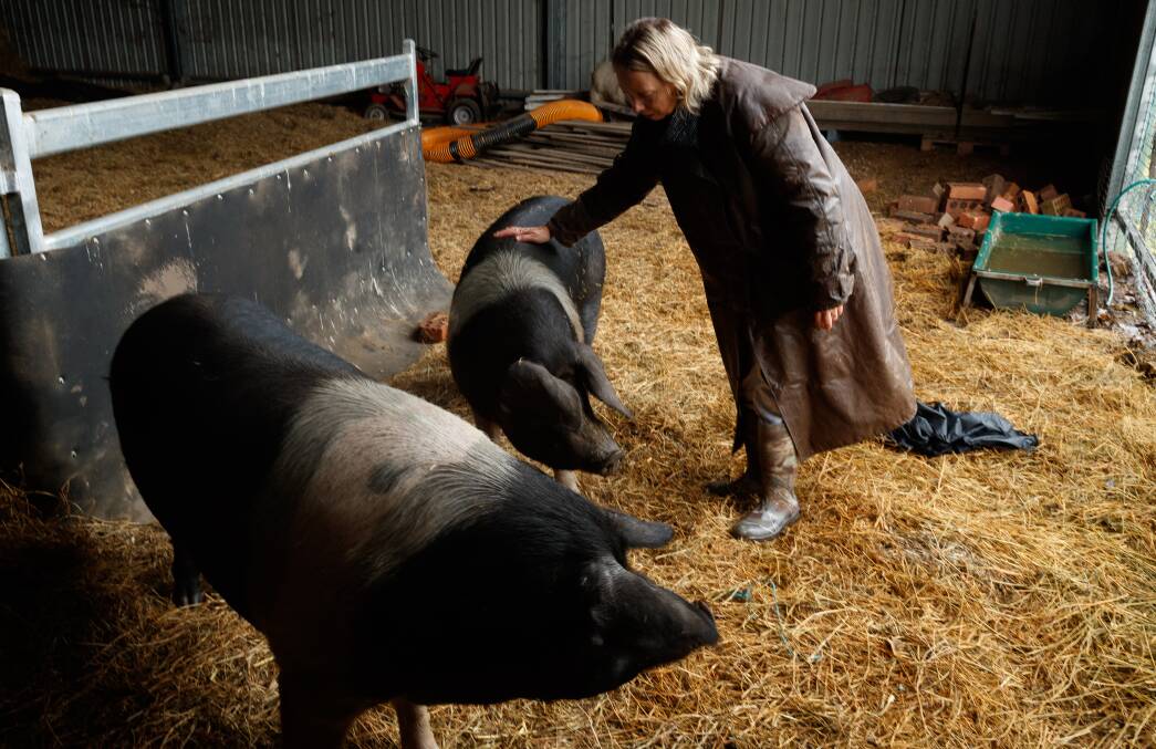
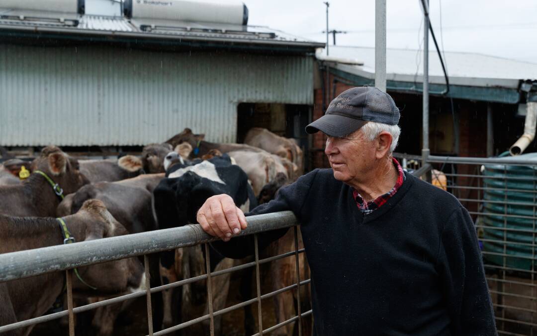
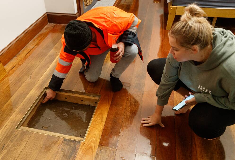
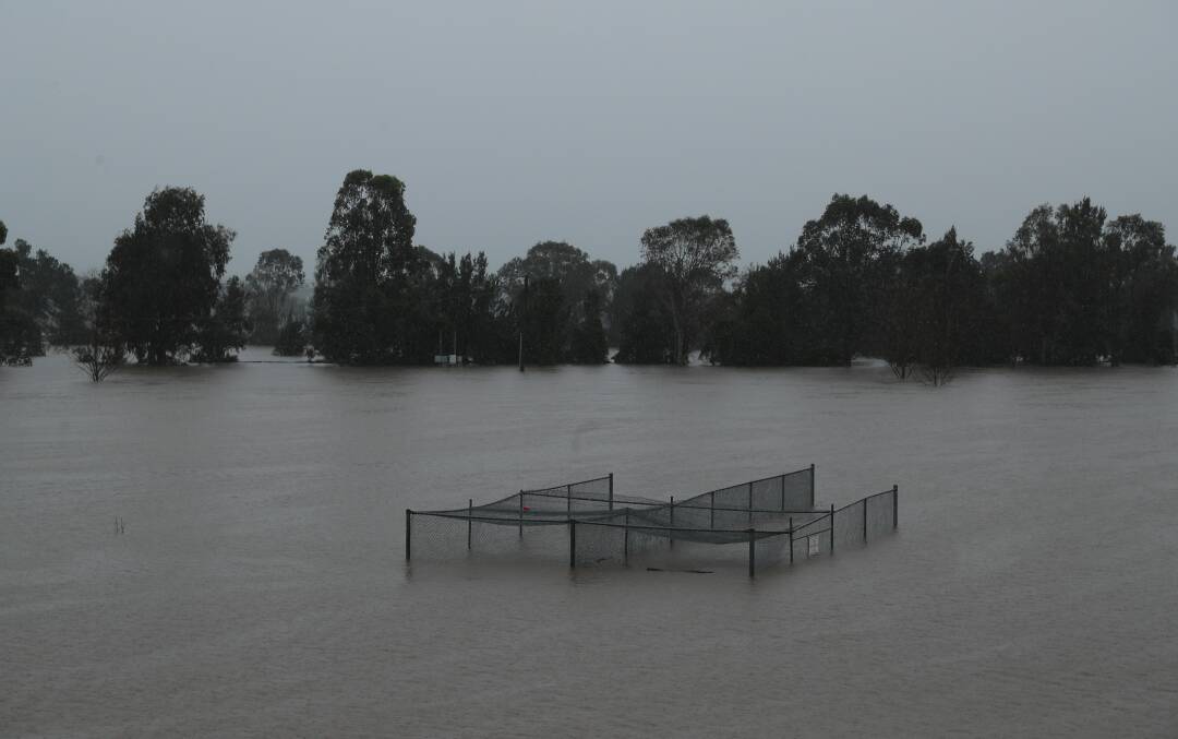
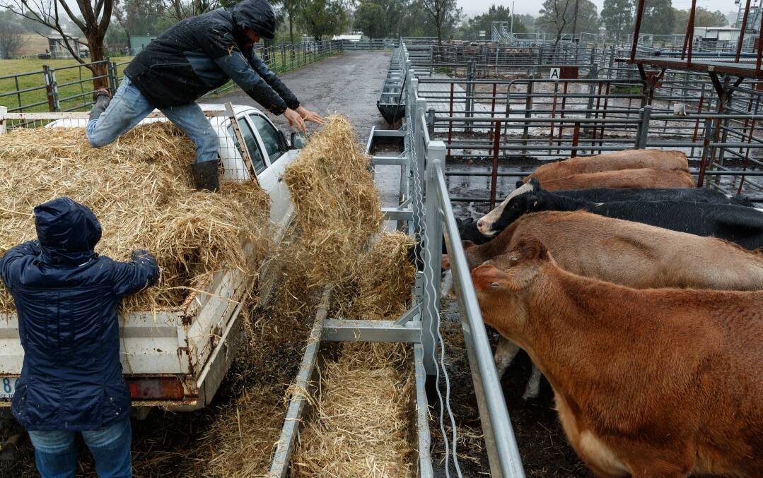
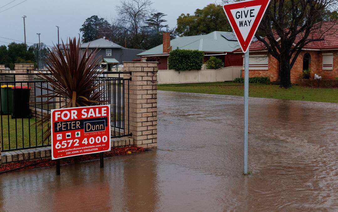
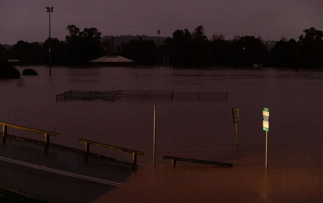
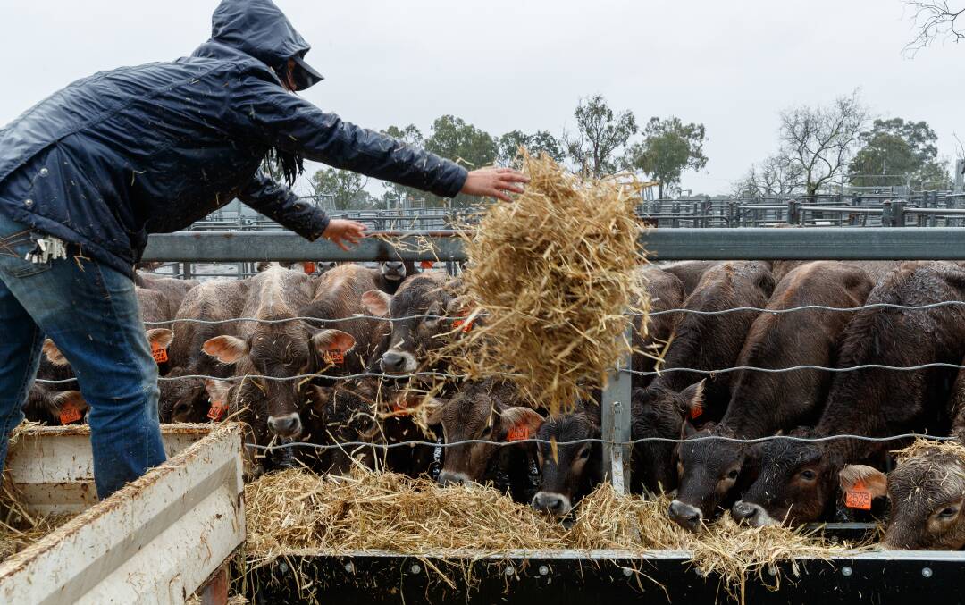
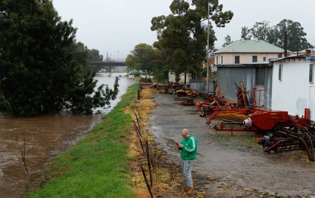
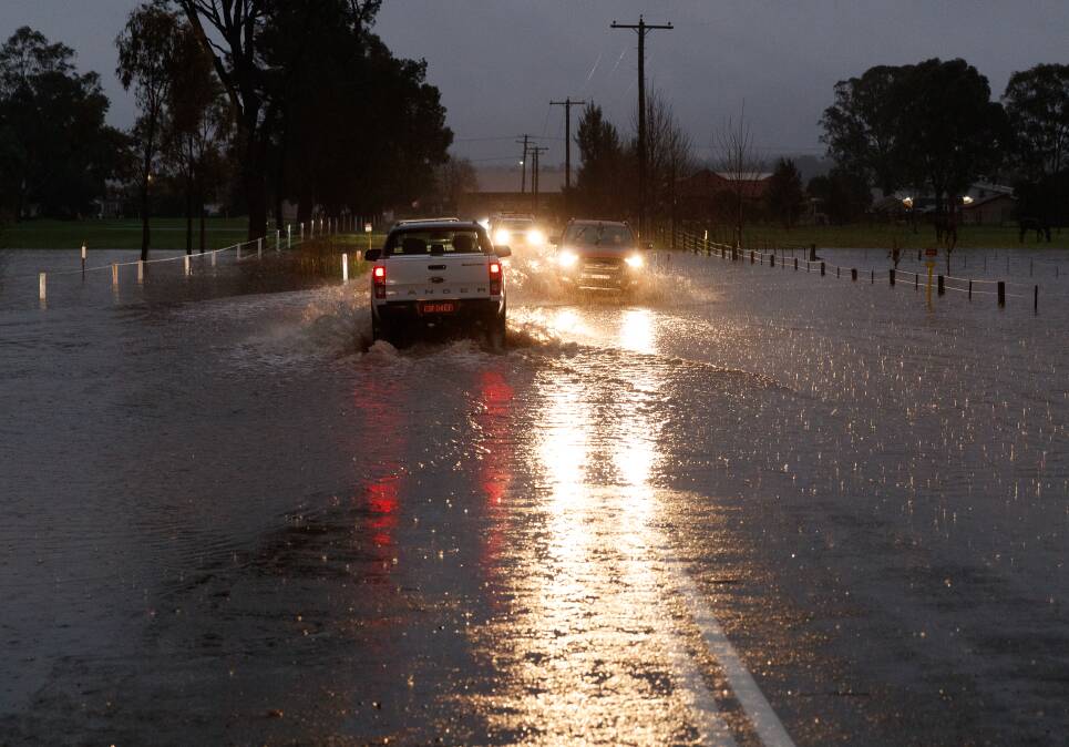
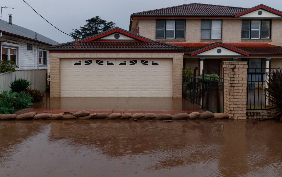
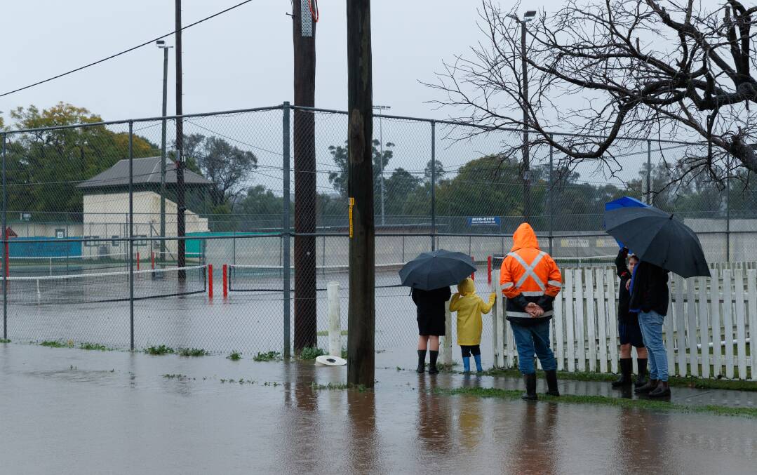
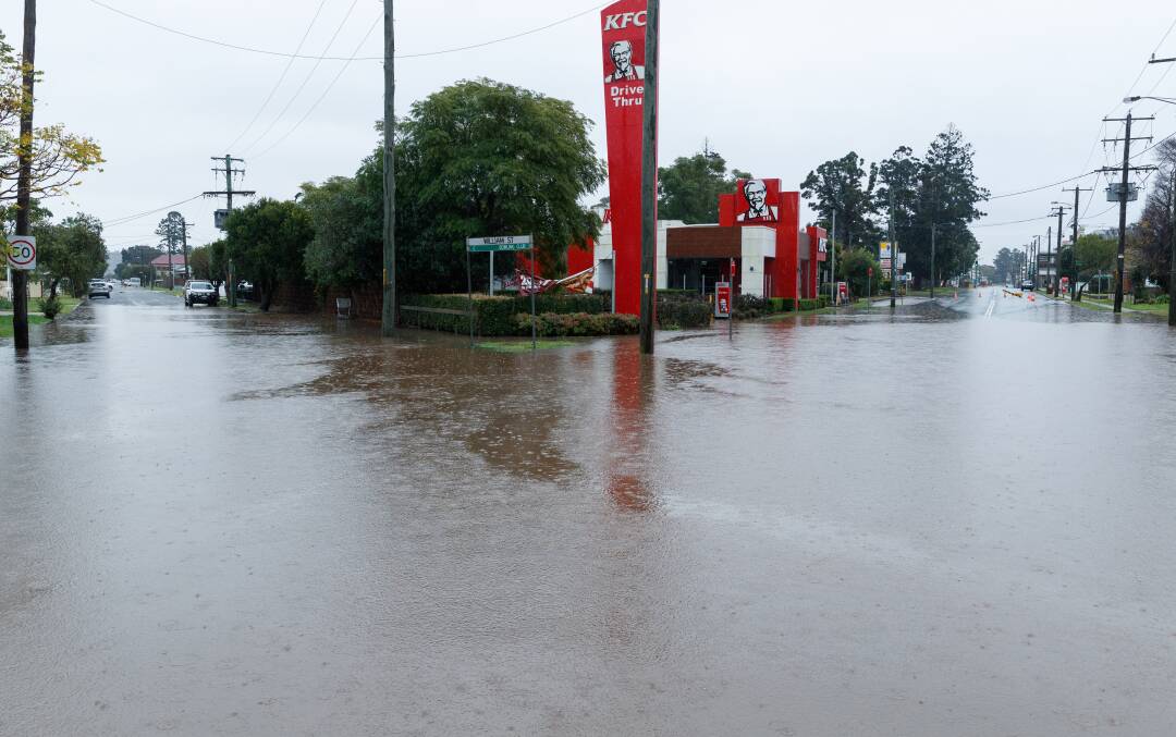
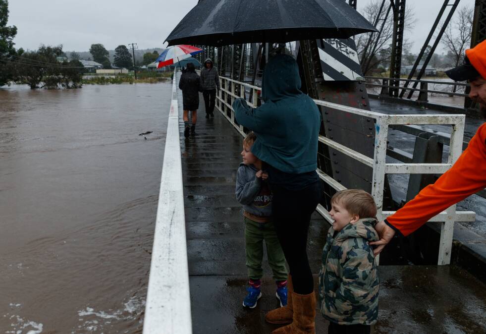
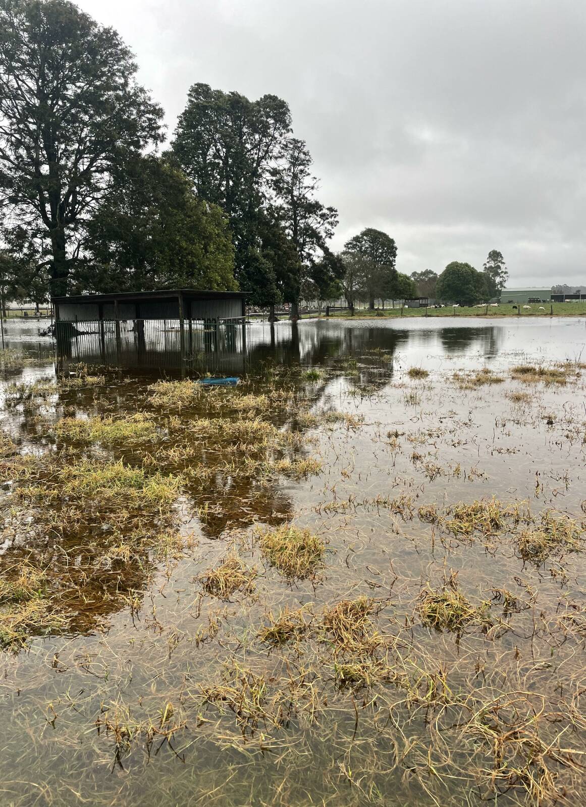
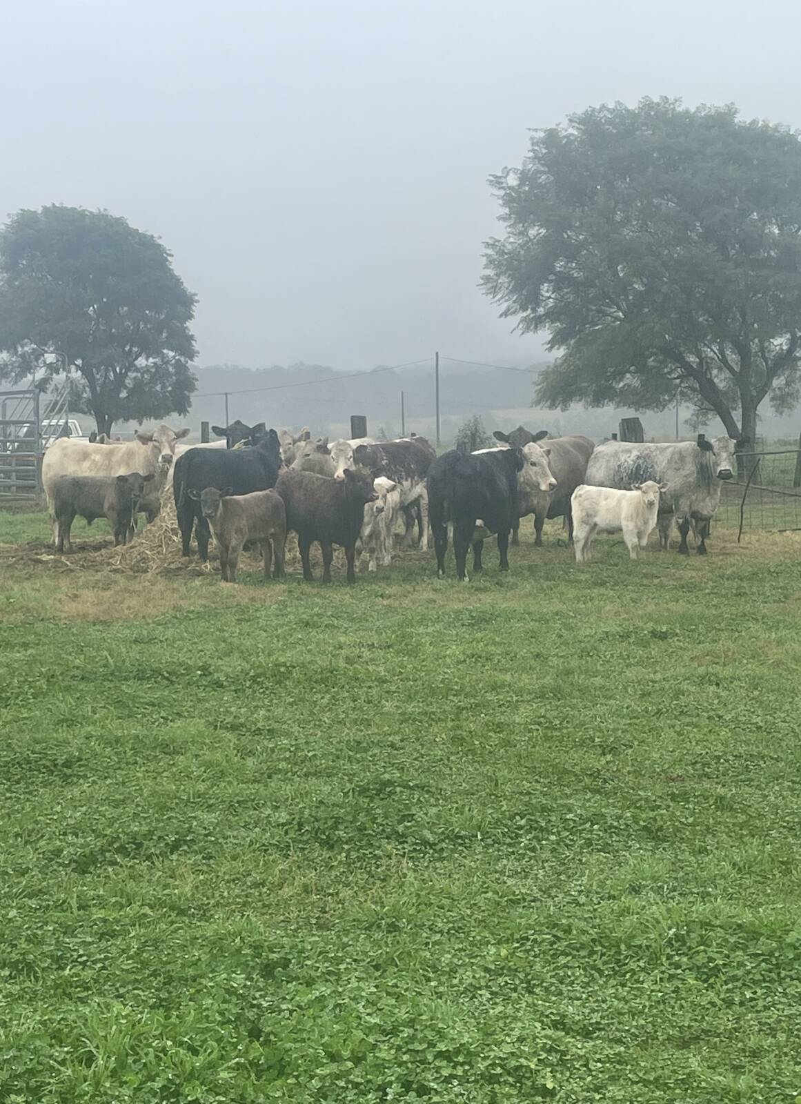
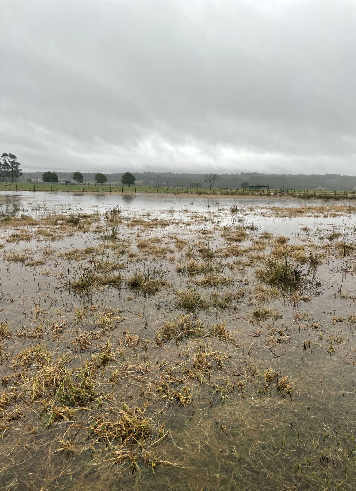
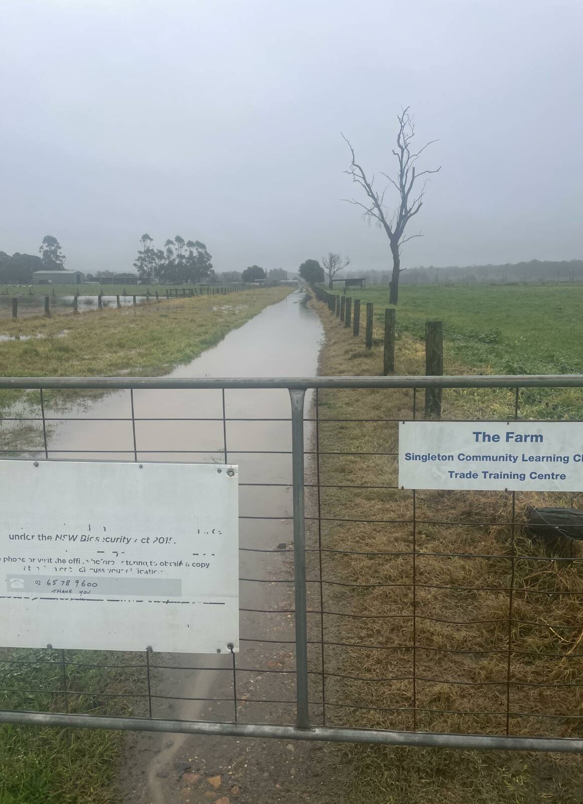
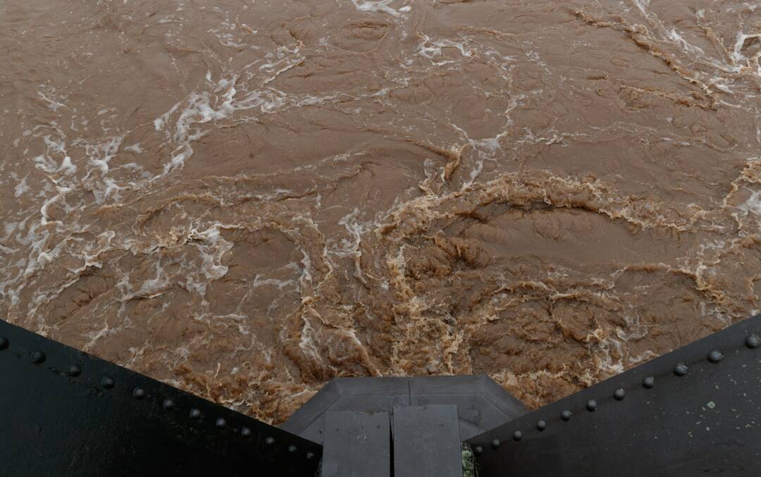
Addison says farewell to her pop Steve McCann, with her mum Elysha holding her looking towards Gillieston Heights. Picture: Simone De PeakCessnock Road between Maitland CBD and Gillieston Heights on Thursday. Picture: Simone De PeakAnthony Lloyd and his son Tom paddling near their home on the flooded Athel Dombrain Drive on Thursday. Picture: Simone De PeakLooking towards Gillieston Heights from Maitland on Thursday. Picture: Simone De PeakMaitland on Thursday. Picture: Simone De PeakJulie Moy arrives from the isolated area with her dog Lil. Picture: Simone De PeakFLOODS: Kyra Ward checking the water Level outside her cousin's house on Bishopgate Street where she's staying. Picture: Max Mason-HubersBEDLAM: Dairy farmer of 47 years Max Wake checking on his cows at the milking shed. Picture: Max Mason-HubersHIGHER GROUND: St Catherine's Catholic College agriculture teacher Joanna Towers with pigs she moved to a shed on higher ground. Picture: Max Mason-HubersBEDLAM: Dairy farmer of 47 years Max Wake checking on his cows at the milking shed. Picture: Max Mason-HubersFLOODS: Ben Hynes and Kyra Ward checking the level of water under the floor of Ben's house on Bishopgate Street Singleton. Picture: Max Mason-HubersFLOODS: Mark Webster checking the water level in the underfloor cellar at Ben and Katie Hynes' house. Picture: Max Mason-HubersFLOODS: The cricket nets at Cook Park inundated by water. Picture: Max Mason-HubersFLOODS: Lara Pepperall and Josh Maytom feeding cattle which had been evacuated to the safety of the HRLAX saleyards outside town. Picture: Max Mason-HubersFLOODS: Singleton streets were inundated with water. Picture: Max Mason-HubersFLOODS: Singleton streets were inundated with water. Picture: Max Mason-HubersFLOODS: Singleton streets were inundated with water. Picture: Max Mason-HubersFLOODS: Singleton streets were inundated with water. Picture: Max Mason-HubersFLOODS: Singleton streets were inundated with water. Picture: Max Mason-HubersFLOODS: Lara Pepperall feeding young cattle which had been evacuated to the safety of the HRLAX saleyards outside town. Picture: Max Mason-HubersFLOODS: Singleton streets were inundated with water. Picture: Max Mason-HubersFLOODS: Singleton streets were inundated with water. Picture: Max Mason-HubersFLOODS: Singleton streets were inundated with water. Picture: Max Mason-HubersFLOODS: Singleton streets were inundated with water. Picture: Max Mason-HubersFLOODS: Singleton streets were inundated with water. Picture: Max Mason-HubersFLOODS: Bec Harris and her kids Theo and Arlo checking out the water level in the Hunter River. Picture: Max Mason-HubersFLOODS: Singleton streets were inundated with water. Picture: Max Mason-HubersFLOODS: Singleton streets were inundated with water. Picture: Max Mason-HubersFLOODS: Singleton streets were inundated with water. Picture: Max Mason-HubersFLOODS: Singleton streets were inundated with water. Picture: Max Mason-HubersFLOODS: Singleton streets were inundated with water. Picture: Max Mason-HubersFLOODS: Singleton streets were inundated with water. Picture: Max Mason-HubersFLOODS: Singleton streets were inundated with water. Picture: Max Mason-HubersFLOODS: Singleton streets were inundated with water. Picture: Max Mason-HubersFLOODS: Bec Harris and her kids Theo and Arlo checking out the water level in the Hunter River. Picture: Max Mason-HubersRISING WATERS: Cattle had to be moved from St Catherine's Catholic College at Singleton this morning. Picture: Joanna TowersRISING WATERS: Cattle had to be moved from St Catherine's Catholic College at Singleton this morning. Picture: Joanna TowersRISING WATERS: Cattle had to be moved from St Catherine's Catholic College at Singleton this morning. Picture: Joanna TowersRISING WATERS: Cattle had to be moved from St Catherine's Catholic College at Singleton this morning. Picture: Joanna TowersFLOODS: Swirling floodwaters under a bridge at Singleton. Picture: Max Mason-Hubers
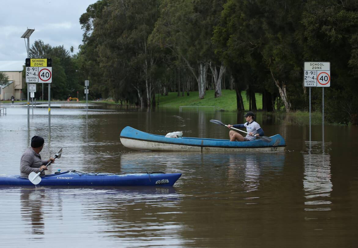
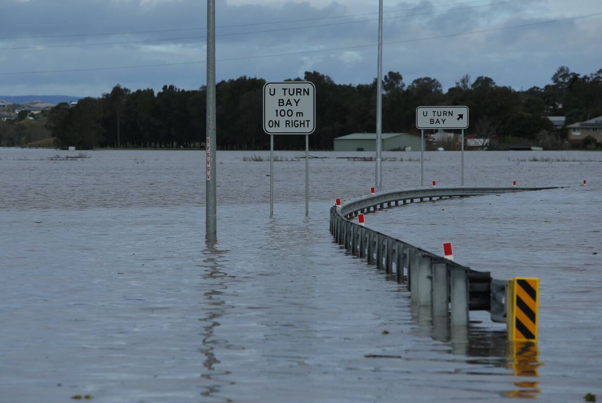
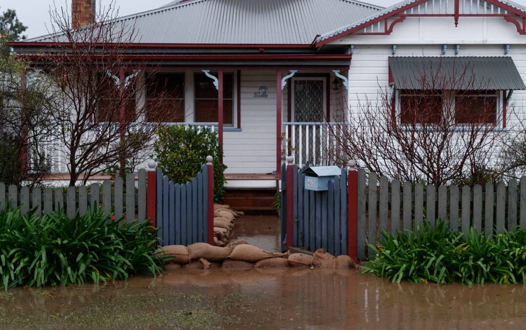
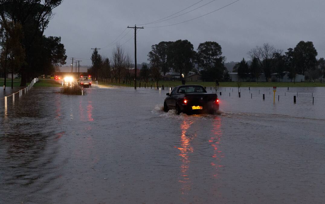
Gillieston Heights remains isolated, with Cessnock Road under water between Cliftleigh and the roundabout near the entrance to Maitland CBD, at the intersection with the highway.
Raymond Terrace Road is closed between Government Road and Woodberry Road at Chisholm and Tomago Road is shut between Graham Drive and Masonite Road.
Putty Road between Milbrodale Road and Broke remains inaccessible.
Meanwhile the level has peaked at Singleton and is falling, with an evacuation order for Singleton township cancelled.
The Hunter River at Raymond Terrace was at 2.88m and peaking on Friday morning causing minor flooding.
The river was expected to remain above the minor flood level of 2.50m until Friday night.
The SES has published a list of locations possibly affected by moderate to major flooding in the Maitland area:
Morpheth, Millers Forrest, Duckenfield, low-lying areas in Woodberry, Berry Park
Melville Ford Bridge at Aberglasslyn may be closed
Oakhampton Heights may remain isolated due to build-up of localised water
Windermere Road at Windermere may be cut just past Windermere House
Maitland Vale road at Lambs Valley may still be closed - 400m east of Luskintyre Road - alternate route via Maitland Vale Road to Bolwarra
Maitland Vale Road may still be closed at Rosebrook near the RFS station
Anambah Road at Anambah may still be cut 2.5km from the New England Highway
Brush Farm Road and Pitnacree Road, Pitnacree (East Maitland) may be closed with low lying farmland likely to become inundated.
Oakhampton No 1 and No 2 Spillways are likely to spill with low lying rural properties around Lorn, Bolwarra and Oakhampton areas inundated.
Belmore Road/Paterson Road is likely to be closed due to floodwater.
Possible isolation of homes in Pitnacree Road, Fosters Lane, Duncan Lane, and Elizabeth Street at East Maitland
Inundation starts over the Louth Park farmlands outside the levee and joins water from backwater flooding of Wallis Creek
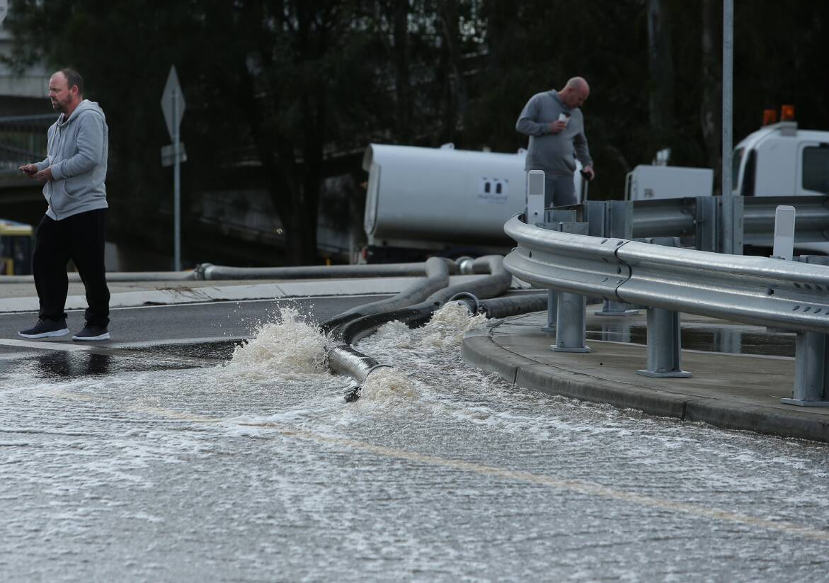
The low part of Cessnock Road near the Maitland station roundabout may close
Start of overtopping of Oakhampton Spillway No 2, this may lead to the closure of the New England Highway in the low part between the Trzecinski Bridge and the Maitland railway station roundabout
Sign up to read this article
Read news from 100's of titles, curated specifically for you.