LOS ANGELES _ A storm over Southern California dumped rain and snow on the area Monday, heightening the threat of mud and debris flows in areas scarred by recent wildfires, and closing a stretch of Pacific Coast Highway in Malibu and the Grapevine section of the 5 Freeway.
The National Weather Service issued a flood advisory for western Los Angeles County and Ventura County, warning that roads, streams and highways could pool with rain as showers are expected through the week.
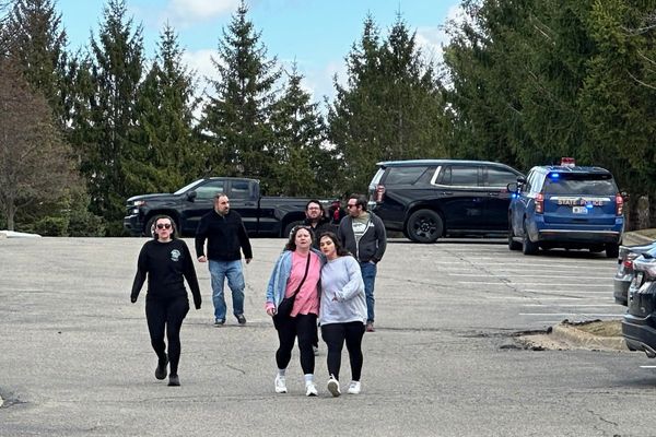
As rain pelted the state Monday, officials began to close roads that were too dangerous for traffic.
Snow on the 5 Freeway shut down all lanes of the road in both directions for five miles near the Grapevine, the California Department of Transportation said. Weather service officials warned that heavy winds and snow could make the freeway "treacherous at times with blowing snow and icy conditions" through Tuesday morning. Caltrans said several vehicles were stuck on the freeway and tow trucks were being brought in.
A 12-mile stretch of Highway 1 also was closed in Big Sur between Mud Creek Road and Paul's Slide, according to Caltrans.
One lane of westbound PCH was closed around 7:30 a.m. just south of Leo Carrillo State Beach because of a mudslide, the agency reported. Officials said crews were working to clear the right lane and were unsure how long the road would be blocked.
Three and a half hours later, a river of mud closed all lanes of the coastal highway from Trancas Canyon Road and Broad Beach Road in Malibu to Las Posas Road in Ventura County.
Earlier this month, a shallow mudslide covered a stretch of PCH in Malibu and trapped some cars.
The hillsides along PCH were charred by the Woolsey fire earlier this year. L.A. County officials urged residents to be ready to flee if they lived in areas burned by the blaze, which destroyed more than 1,500 structures from Oak Park to Malibu in November.
"We strongly encourage residents who live in or near Woolsey fire burn areas to be ready to evacuate at a moment's notice," Los Angeles County sheriff's Capt. Darren Harris said in a statement. "If you feel unsafe or think that hazardous conditions near your home may develop, do not hesitate to leave."
Though Kanan Road between Agoura Hills at the 101 Freeway and PCH in Malibu remained open, the torrential rain sent rocks the size of cantaloupes down the burned hillsides, forcing drivers to dodge the small boulders.
At Decker Canyon Road, a California Highway Patrol officer blocked the road to anyone but residents. Officials are concerned about the potential for debris flows along the route, which winds through hills blackened by the Woolsey fire.
Near Leo Carrillo State Beach, a fleet of dump trucks and bulldozers did cleanup work and utility workers dotted the landscape, repairing electrical lines and poles.
In Riverside County, authorities ordered residents to evacuate communities near the Holy fire burn area in Riverside County, citing the potential for dangerous debris flows.
"People in these zones SHOULD GO NOW because it is the safest time to leave," an alert from the California Department of Forestry and Fire Protection and the Riverside County Fire Department said Sunday.
The Riverside County Emergency Management Department ordered residents in the Glen Ivy and Horsethief Canyon areas to get out of the area.
Philip Gonsalves, a meteorologist with the National Weather Service in San Diego, said that as storms emerged over the next few days, officials would be monitoring the Holy fire burn scar, which straddles the border between Orange and Riverside counties.
"That is of the most concern to us because it's the most vulnerable one," he said.
Gonsalves said the risk of mudslides increased with heavier downpours but also as showers continued for many days and eroded the land.
In San Diego County, a large sinkhole on an Interstate 805 off-ramp near Serra Mesa prompted the closure of the exit.
Heavy runoff and a failing drainage pipe likely combined to create the gaping sinkhole, Caltrans spokeswoman Cathryne Bruce-Johnson said. Officials expected it would take crews all night to complete repairs on the hole, which covered the right lane of the exit ramp and was estimated to be 20 feet long, 10 feet wide and 20 feet deep.
Despite all the chaos the storm was bringing to Southern California, some were happy about the moody weather.
A film crew of about 25 people that had set up next to Mugu Rock off PCH weathered the rain as waves crashed on the jagged rocks below. It was the crew's first day of a two-day shoot for a short film called "Our Father," based on a true story that happened on the East Coast.
Unlike many residents anxious about what the weather would bring, the film crew was happy: A rainy, dreary day helped set the scene perfectly.
"It helps us," Jamie Duneier, the film's writer and director, said. "We are actually happy" about the rain, "as long as we can get everything we need."
In Northern California, where the Camp fire razed the town of Paradise 90 miles north of Sacramento, rain was also heightening the risk of mudslides this week.
Showers are expected to begin in that area Monday night, with the heaviest rainfall predicted for Wednesday, said Karleisa Rogacheski, a meteorologist with the National Weather Service in Sacramento.
"We'll be watching all our burn scars," she said, "just in case."