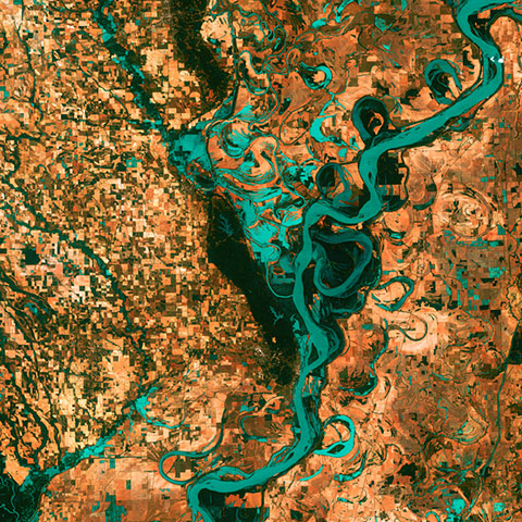
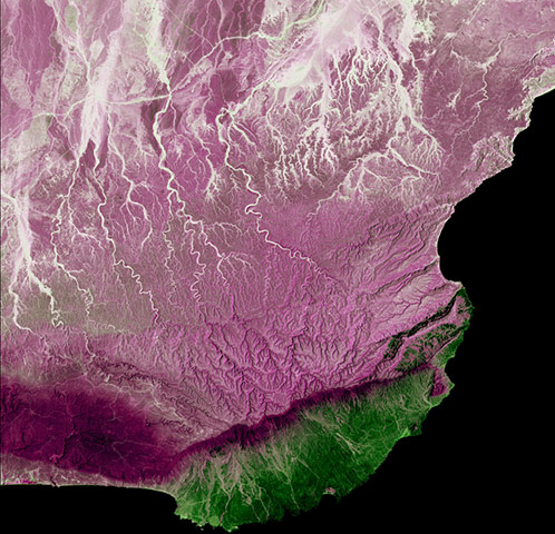
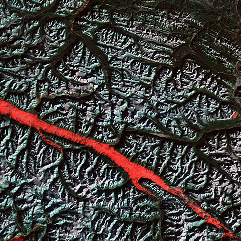
Meandering Mississippi Photograph: USGS/NASA/Landsat/Rex FeaturesMuch of Oman is desert, but the coast of the Arabian Sea in the Dhofar region represents a startling difference in climate. This coastal region catches the monsoon rains, or khareef, during the summer months. Drenching rains fall primarily on the mountainous ridge that separates the lush, fertile areas along the coast from the arid interior Photograph: USGS/NASA/Landsat/Rex FeaturesThe Rocky Mountains. The red stripe is caused by a the interplay of light and cloud in the Canadian Rockies. The light-reflecting nature of the clouds coupled with low sun elevation resulted in this startling effectPhotograph: USGS/NASA/Landsat/Rex Features
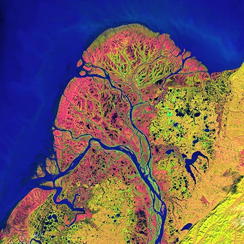
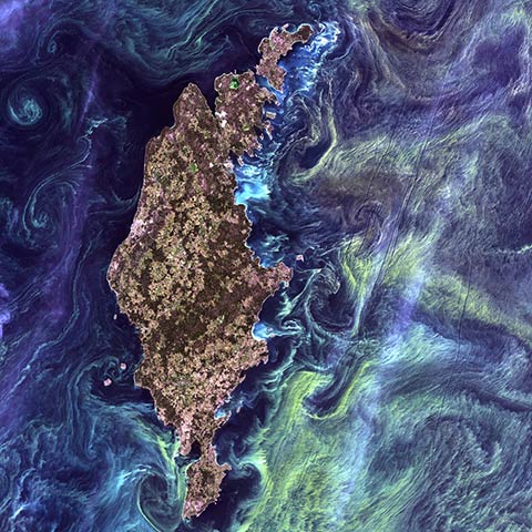
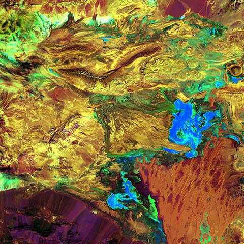
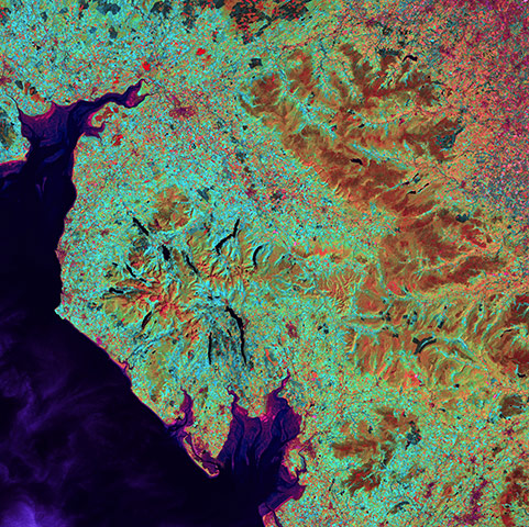
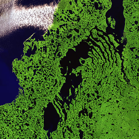
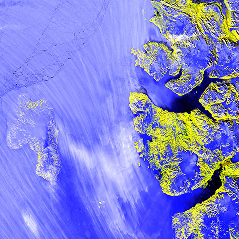
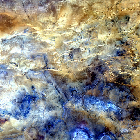
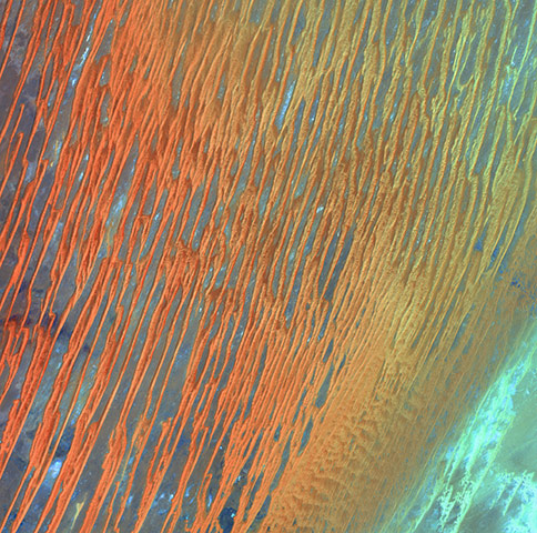
This stretch of Iceland's northern coast resembles a tiger's headPhotograph: USGS/NASA/Landsat/Rex FeaturesLake Eyre in Australia looking like a spooky skullPhotograph: NASA/USGSThe Yukon Delta, with a purple tint, comes to resemble a human heartPhotograph: NASA/USGSThe image USGS calls Van Gough From Space (actually of Gotland, an island in the Baltic Sea)Photograph: NASA/USGSAn image of an Iranian desert the US Geographical Survey has titled Spilled PaintPhotograph: USGS/NASASiberian Ribbons - 15 June 2005. Vivid colors and bizarre shapes come together in an image that could be an imaginative illustration for a fantasy story. This labyrinth of exotic features is present along the edge of Russia's Chaunskaya Bay (vivid blue half circle) in northeastern Siberia. Two major rivers, the Chaun and Palyavaam, flow into the bay, which in turn opens into the Arctic Ocean. Ribbon lakes and bogs are present throughout the area, created by depressions left by receding glaciersPhotograph: Landsat/NASA/USGS/EROSLake District - 19 July 2006. A popular holiday destination, the Lake District in northwestern England is a region of picturesque mountains and long, narrow lakes. Most of the lakes lie in U-shaped valleys that were carved by glaciers during the last ice age. Morecambe Bay, below the Lake District, opens into the Irish Sea. This large expanse of intertidal sand and mudflats is notorious for its quicksand and tides that are said to move 'as fast as a horse can run'Photograph: Landsat/NASA/USGS/EROSRemote Tundra - 26 July 2007. Skeletal extensions of land reach like bony fingers across a section of Liverpool Bay along the northern edge of Canada's Northwest Territories. Only small villages are thinly scattered in this remote and inhospitable region of Arctic tundra bordering the Beaufort Sea. The relatively flat landscape is dotted with shallow lakes during the extremely brief summer seasonPhotograph: Landsat/NASA/USGS/EROSMeighen Island - 14 June 2000. A veil of blowing snow nearly obscures Meighen Island (left) off the northern coast of Canada. Across the Sverdrup Channel lies the much larger Axel Heiberg Island, where glaciers (blue) huddle among mountain peaks (yellow) and flow into deep fjords. No evidence of human occupation has ever been found on Meighen IslandPhotograph: Landsat/NASA/USGS/EROSNo Man's Land - 9 September 2007. A study in shades of blue and brown is actually one of the harshest landscapes on Earth. This glimpse of Africa's Sahara Desert, located near where the borders of Mali, Niger, and Algeria converge, is truly a no man's land, a world of sand and rock without roads or settlements. The horizontal lines across the top half of the image are intrusions of igneous rock, where magma poked up to the surface from deep undergroundPhotograph: Landsat/NASA/USGS/EROSDesert Patterns - 13 April 2003. Seen through the 'eyes' of a satellite sensor, ribbons of Saharan sand dunes seem to glow in sunset colors. These patterned stripes are part of Erg Chech, a desolate sand sea in southwestern Algeria, Africa, where the prevailing winds create an endlessly shifting collage of large, linear sand dunes. The term 'erg' is derived from an Arabic word for a field of sand dunesPhotograph: Landsat/NASA/USGS/EROS
Sign up to read this article
Read news from 100’s of titles, curated specifically for you.