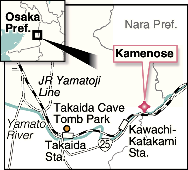
KASHIWARA, Osaka -- The Yamato River runs through the Osaka Plain after water gathers in the Nara Basin. Located along the river and on the edge of the plain is a district called Kamenose, which literally means "on the back of a turtle."
The district, part of Kashiwara, Osaka Prefecture, has been hit by many landslides in the past, which has prompted the central government to implement countermeasures fully utilizing the world's most advanced technology.
Long known as an important point along a route that connects Osaka and Nara, the Kamenose district is located on the southern edge of the Ikoma mountains. Today, National Highway Route 25 and the JR Yamatoji Line run along the bank opposite the district, which is located on the northern edge of the Kongo mountains..
According to records, major landslides hit the district in 1903, 1931-32, and 1967. In the 1931-32 landslide, a mass of soil stretching roughly 32 hectares moved slowly toward the Yamato River, raising its riverbed enough to completely impede the flow and eventually causing the flooding of a wide area in upstream Nara Prefecture.
The railway once ran through the district. However, damage caused by the disaster forced its reconstruction to bypass the area.
A Kamenose museum features photos from those days, showing the landslide's devastation.
Why has Kamenose been so frequently hit by landslides? According to the Land, Infrastructure, Transport and Tourism Ministry's local office for the Yamato River, it has something to do with a volcano that used to be to the north of the district. As a result of this volcano erupting twice millions of years ago, there are layers of solidified lava underground in Kamenose and surrounding areas.
There is also a layer of clay between the lava, and when the clay absorbs a large amount of water from heavy rain, it becomes easier for the ground to slide. The Yamato River itself also runs on this ground.
Pieces of wood have been found at the sites of past landslides, and the dating of these fragments indicates that landslides have occurred over and over since more than 40,000 years ago.
The central government began an initiative against landslides in 1962. An area that could be subject to landslides is estimated to stretch about 1 square kilometer, with about 15 million cubic meters of soil. Through the initiative, 900,000 cubic meters of soil have been removed so far from the upper section of the area to reduce the load the slope has to sustain.
In order to drain the groundwater, 4,000 pipes have been installed underground, with a total length of about 153 kilometers. Seven tunnels have also been excavated to discharge the water to the Yamato River.
Moreover, a total of 730 piles -- including ferroconcrete ones with a maximum length of about 100 meters and a diameter of 6.5 meters each -- were driven deep into hard and stable stratum.
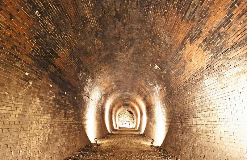
During this process, in 2008, a portion of a railway tunnel believed to have collapsed due to the 1931-32 landslide was coincidentally discovered. Black soot residue from steam locomotives remained on its brick ceiling.
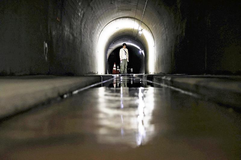
I was given a guided tour of one of the drainage tunnels, which runs about one kilometer and has a diameter of about four meters.
Walking inside the slightly pitched tunnel, I found a vertical pit above my head, dug to collect underground water. From the hole, water poured down like rain and flowed toward the outside through a ditch in the floor.
At present, landslides have almost ceased, and experts from various countries visit the Kamenose district to observe one of the rarest projects of its kind in the world.
The district is surveilled via equipment such as devices used to measure the surface of the ground and underwater gauges.
"Should the Yamato River be dammed up by a landslide, a huge amount of accumulated water would overflow and hit the Osaka Plain downstream all at once -- this is the presumed worst-case scenario," said Hiroyuki Enomoto, deputy head of the construction ministry's local office for the river. "We should absolutely never let it happen."
If you want to extend your trip, the Takaida Cave Tomb Park is recommendable.
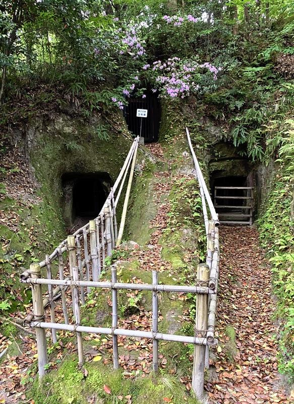
Located about four kilometers downstream from the Kamenose district, this park contains horizontal caverns, of which at least about 160 have been confirmed so far, that were built from the mid-sixth century to the early seventh century.
Of them, 27 tombs feature cave engravings, depicting people riding boats, birds, horses and other items on their ceilings.
The Kashiwara municipal government turned the area into a park in 1922, and it is visited by many history fans.
Read more from The Japan News at https://japannews.yomiuri.co.jp/