PHILADELPHIA — A nor’easter that started grinding the Jersey Shore over the weekend caused widespread moderate flooding as tides peaked Monday. It was expected to continue to throttle the coast overnight.
Local officials already dealing with the high water issues and loss of beach braced for more at least through Tuesday and possibly into Wednesday from the slow-moving storm, which came on the heels of Hurricane Ian’s remnants.
The National Weather Service issued a coastal flood warning through 9 p.m. Eastern time Tuesday, along with a high surf advisory, with “1 to 2 feet of inundation” expected in low-lying areas near the Shore, back bays and tidal waterways.
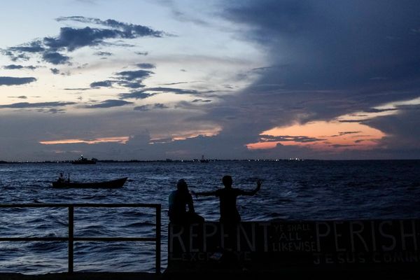
The storm caused dangerous rip currents and presented surfers with risky conditions.
Atlantic City, Ocean City, and Cape May all saw moderate flooding by Monday afternoon, with worse to come with Tuesday’s high tides, when some areas could experience near-major flooding.
Impacts are expected to be felt longest in the back bays.
But the rain also brought a positive: a dent in the drought or dryness that’s affected much of South Jersey and the Philadelphia region.
“We’re in the thick of it right now,” Cameron Wunderlin, a meteorologist for the National Weather Service, said Monday morning. “And it’s going to continue through Wednesday. Most of the coast is what we’re concerned about.”
Wunderlin did not expect major flooding in the immediate Philadelphia area, although flooding of low-lying areas or those with poor drainage is possible. The ground has been dry enough to absorb the rain so far.
The storm began causing headaches along the Shore over the weekend and into Monday.
Brigantine Mayor Vince Sera said a pump station on Quay Boulevard went down after a bulkhead breached early Monday morning around North Point Marina in the Atlantic County community.
The breach overwhelmed the system and caused some flooding around Brigantine’s kindergarten-to-eighth grade school and the surrounding neighborhood. School was canceled just after 7 a.m., and the department of public works was trying to fix the pump.
Flooding was reported in Wildwood, North Wildwood, and Ocean City in Cape May County, as well as Long Beach Island in Ocean County.
North Wildwood Mayor Patrick Rosenello said the storm could be one of the worst in the last several years by the time it’s over.
He said several people got stranded in cars Sunday when the tide “came about halfway across the island from the bay side” and had to be rescued by military surplus vehicles that the community uses because they can go through high water.
Ocean City saw a peak high tide of 6.5 feet at Great Egg Harbor Bay at 3:30 p.m. Monday. Major flood stage is 7.3 feet.
“We’ve already sustained some significant beach and dune erosion,” Rosenello said Monday morning. “So the ocean side is precarious as well.”
In Ocean City, students were dismissed early Monday as officials warned residents in a statement to expect 25 to 30 mph winds with gusts up to 45 mph.
“Residents should be prepared to move vehicles to safe places well in advance of these high tides,” the statement said, noting that all municipal parking lots would be free and that additional parking would be available at the Trinity United Methodist Church in Marmora.
Atlantic City officials sounded sirens throughout the city Monday afternoon warning residents of flooding and urging them to move their cars to higher ground, including to the Wave parking lot, which was offering free parking for residents.
Fire Chief Scott Evans said he expected between 8 and 16 inches of water to inundate major roadways that typically flood, including Routes 40 and 30, Fairmount Avenue between Mississippi and Iowa, as well as streets in the city’s north end, in and around the Ocean and Hard Rock casinos.
Evans said there was significant beach erosion around Vermont, New Hampshire and Rhode Island Avenues.
High tide reached 7.2 feet at the ocean at 2:12 p.m. Monday, with 7.5 feet expected at 4 p.m. Tuesday. Eight feet is major flood stage.
Tree limbs fell throughout the city, and there were some transformer fires. Evans said an earlier high tide had not receded due to onshore winds, and so the afternoon’s high tide would be pushing water from the ocean and the back bay into city streets.
”We will see water from the back bays,” Evans said. “And now the beach is getting pounded.”
Atlantic City Mayor Marty Small Sr. said City Hall closed at 1:30 p.m. Monday and would do so at 2:30 p.m. Tuesday to allow employees to get home before the expected flooding.
”Please take this storm seriously,” Small said. “We’ve been dealing with these conditions since Friday night.”
Meteorologist Tom Lamaine, who is advising the city, said the storm is “in a blocking pattern” that has kept it from moving farther north, “the same type of system as Hurricane Sandy.”
“The winds seemed to be shifting slightly around to north/northeast, which might help to push some of the water back out to sea,” he said.
In Ventnor, police shut off access to the Dorset Avenue Bridge as streets in Ventnor Heights filled with 2 feet of water by 3 p.m. Roads were expected to continue to flood as the back bay reached high tide.
Harvey Cedars police told residents to expect up to two more days of flooding on Long Beach Island, especially near the causeway bridge from Route 72.
Cape May could see some of the worst flooding Tuesday with a high tide expected of 8.1 feet, an inch shy of major flood stage.
As the Shore coped, Philly saw a steady soaking but dodged major issues.
An additional 1 to 1.5 inches of rain was expected to fall in the city before the storm fully makes its way out to sea this week.
Nearly 3 inches of rain fell over the weekend, going a long way toward putting a dent in the dry conditions that had persisted since summer. To put it in perspective: July, August, and September saw a combined deficit of 6.11 inches below normal. Overall, the year has run 2.2 inches below normal.
———