NASA says it’s planning to fly planes into dangerous wildfire-generated storms this summer to help improve forecasting – and potentially save lives.
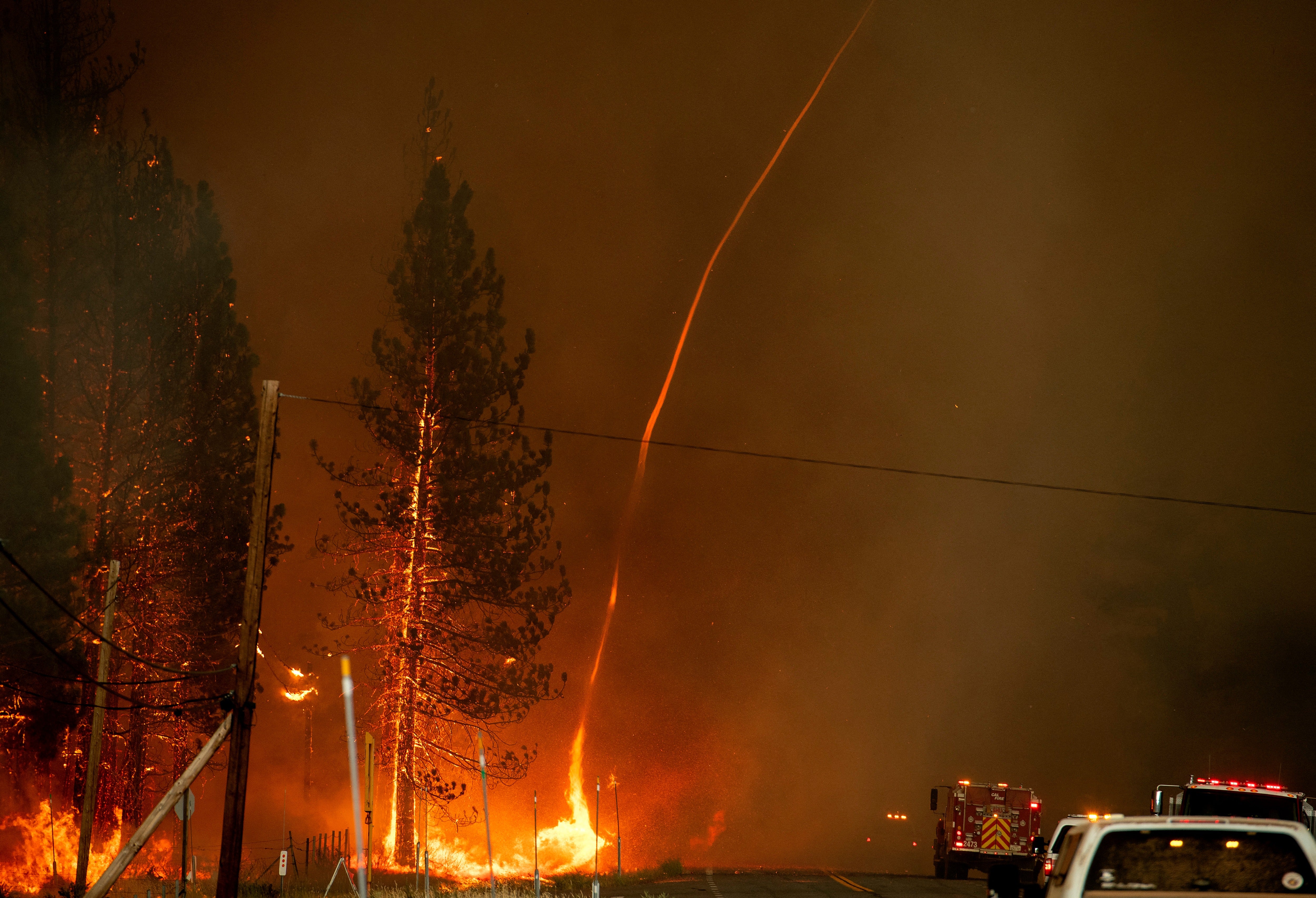
Major wildfires across the U.S. West have produced clouds that can shoot choking smoke high into Earth’s atmosphere, generate thousands of fire-causing lightning strikes in a matter of just hours, and even spawn destructive, whirling firenadoes.
These clouds and their impacts complicate firefighting efforts and threaten Americans living near the fire and those thousands of miles away.
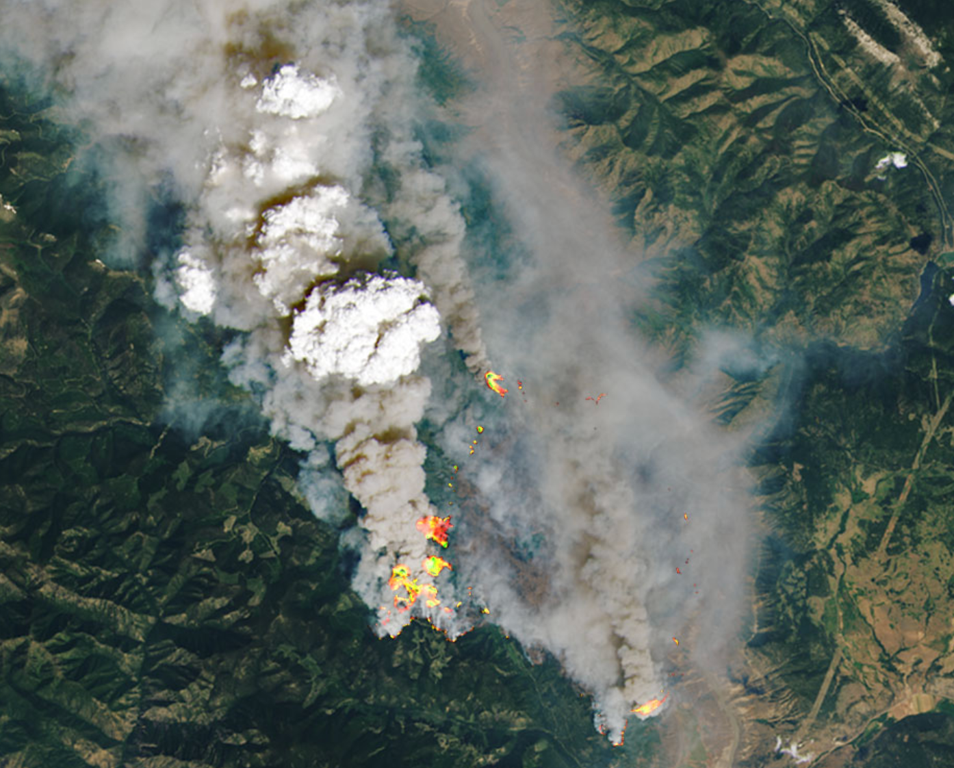
Rising smoke is responsible for the clouds, known as pyrocumulonimbus clouds. But exactly how the clouds form remains poorly understood and current predictions are often inadequate, the space agency’s researchers say.
That’s concerning in a warming world that is expected to produce more severe and frequent fires. Human-caused climate change is fueling tinderbox conditions that make fires more likely.
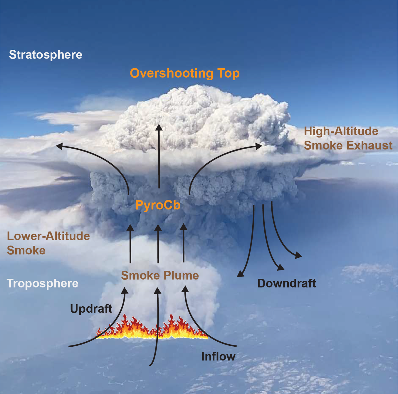
“Measuring and mapping the dangerous storms as they develop in real-time will help scientists forecast them in the future,” NASA’s Jet Propulsion Laboratory said in a statement on Monday.
The experiment is known as the Smoke and PYRocumulonimbus Experiment, or “INSPYRE,” and led by the Naval Research Laboratory.
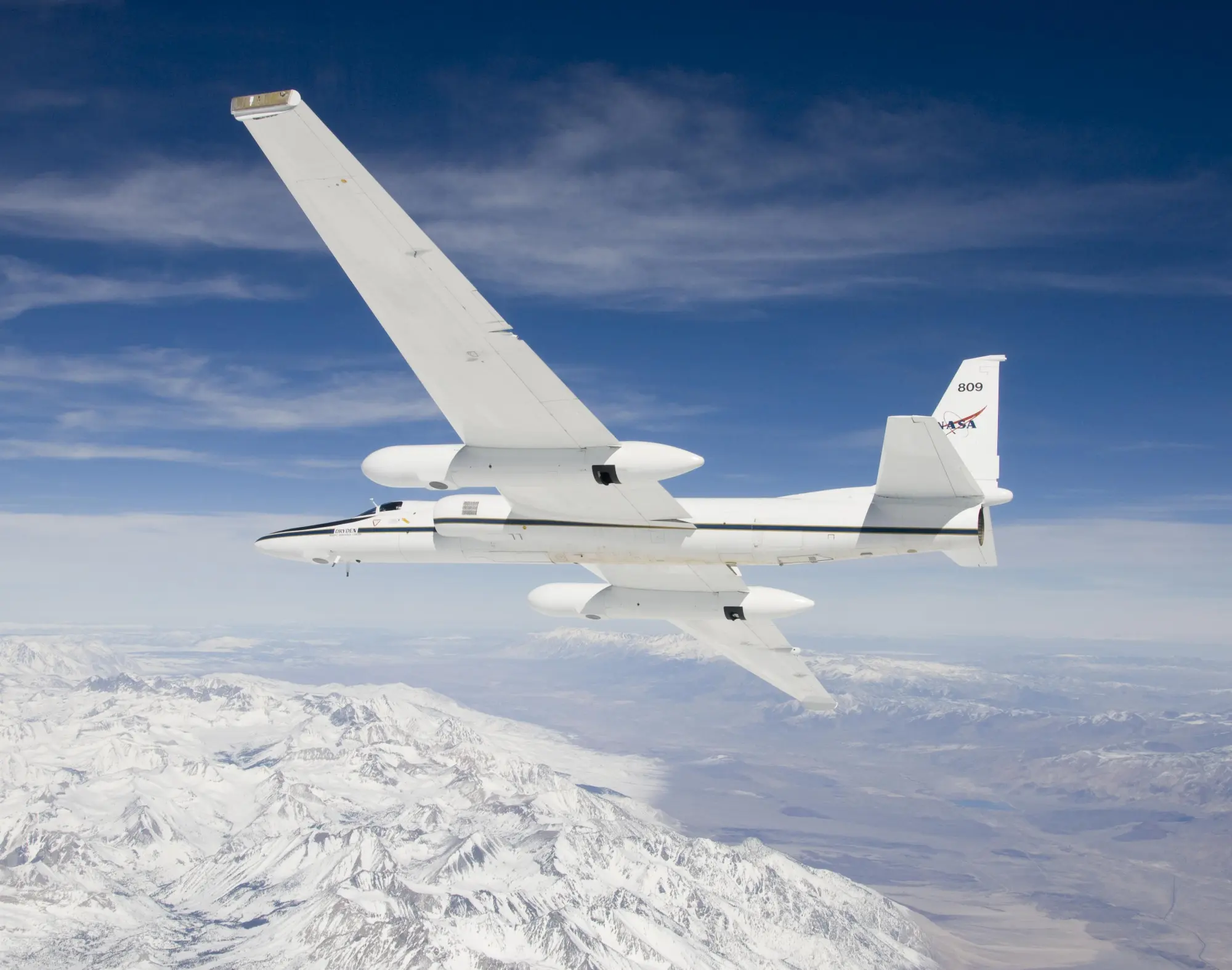
The plan is to fly NASA’s ER-2 and WB-57 planes out of Montana to record data on the clouds’ formation.
There would be at least two 6-8-week flight missions over the western U.S. or Canada.
Each mission will include more than a dozen science flights and the planes will be carrying infrared wildfire trackers developed at NASA’s Jet Propulsion Laboratory in Southern California.
NASA is also planning to deploy radar and remote sensing tech on the ground to observe the clouds in the U.S. West.
Canada has seen an especially active fire season this year, resulting in more than 900 blazes across the nation and sending hazardous smoke into major U.S. cities for days.
There are also fires burning in the Pacific Northwest that have triggered air quality alerts.
Some 1,457,545 acres have burned in large fires this year across America, according to the National Interagency Fire Center.
Still, more fires and smoke are likely on the way. Peak fire season in the U.S. doesn’t begin until August.