The Met Office has issued a yellow weather warning for rain covering parts of the UK on Wednesday.
Heavy rain is expected to cause travel disruption and flooding, with thunderstorms possible in some areas. Forecasters said the UK could see as much as 60mm of rainfall between the early hours of Wednesday morning and the afternoon, with the weather warning in place until 2pm.
The Met Office also warned coastal gales are “likely” along English Channel coasts, saying people should prepare for “heavy rain and strong winds” and potential power cuts in some places.
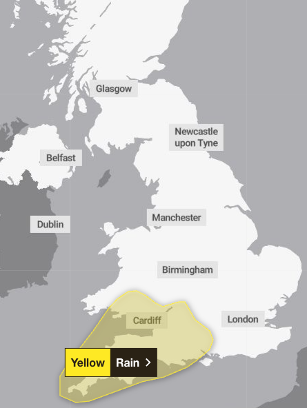
The warning covers the areas of Hampshire, Southampton, West Berkshire, and much of the South West and Wales, with wet and windy weather expected to set in during the early hours of Wednesday morning.
The Met Office said: “Heavy rain and strong winds will move northeast through the first part of Wednesday, followed by heavy showers and some thunderstorms, these becoming more isolated through the afternoon.
“Rainfall totals widely 20 to 30mm, but some places could see 40 to 60mm within a period of six to nine hours. Coastal gales are likely for a time, especially along English Channel coasts.”
People have been urged to plan journeys ahead of time and be aware that spray and flooding on roads could increase journey times, with those in areas at risk of flooding advised to prepare a flood plan and an emergency flood kit.
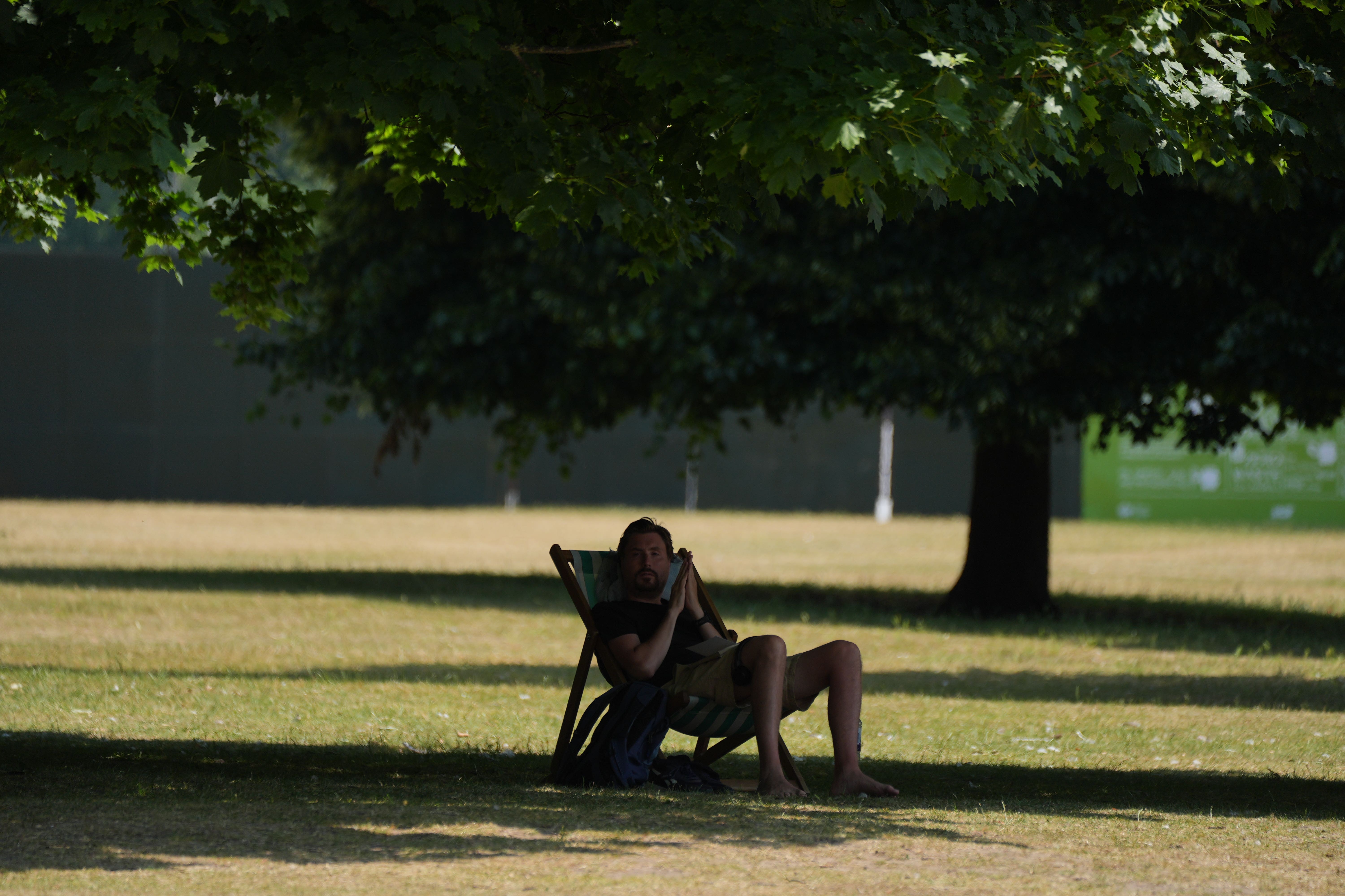
It comes after the Met Office confirmed summer 2025 to be the hottest on record in the UK. The country saw back-to-back heatwaves with the mean temperature from 1 June to 31 August sitting at 16.1C, which is 1.5C above the long-term average. This has smashed the previous record set in 2018 at 15.7C, although no new record high temperatures were recorded.
The highest temperature recorded was 35.8C in Faversham, Kent – well below the 40.3C recorded in Coningsby, Lincolnshire in July 2022.
But it looks set to be a rainy start to September, with the long-term effects of Hurricane Erin and Tropical Storm Fernand expected to last for the first half of the month. Brits could see seasonably warm temperatures alongside showers or long spells of rain.
The Met Office said: “Climate change has the power to turn previously unremarkable years into record-breaking ones, as baseline conditions steadily rise. This summer’s four heatwaves, which might once have passed as pleasant spells of warm weather, are made more prominent by the heightened backdrop that climate change creates.”
The forecaster has warned of “an unsettled first week of meteorological autumn”. On Tuesday, rain is expected to move eastwards across the southern counties of England and Wales. Elsewhere in the country will see a mixture of sunny spells and scattered showers.
But cloud and rain is expected to develop overnight, with strong winds also setting in across the South. These are expected to continue, with “brisk winds and outbreaks of heavy rain” dominating the forecast on Wednesday. The Met Office said temperatures will remain near average at around 17C, but will be “tempered” by the strong winds.