A three-day-long thunderstorm is set to sweep across the UK this weekend as temperatures are forecast to hit 30 degrees.
Rising temperatures this week, brought on by a plume of humid air from Iberia, increases the risk of thunderstorms across the country.
Yellow thunderstorm warnings are set to last from Thursday through to Saturday, with the Met Office warning of potential travel disruptions.
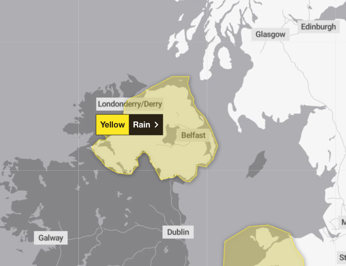
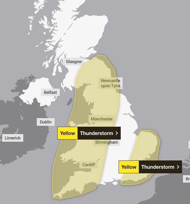
On Thursday Wales and south-west England, including Devon, Somerset and parts of Cornwall, will be affected by a yellow weather warning until 7pm. Northern Ireland is also forecast to experience heavy rain until 9pm.
The forecaster warned there was “a good chance driving conditions will be affected by spray, standing water and/or hail, leading to longer journey times by car and bus”, with delays to train services possible. Short-term power loss and other services are also likely.
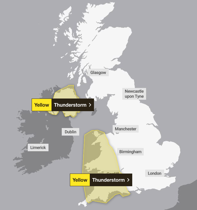
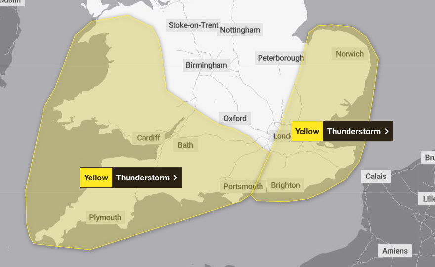
On Friday at 3pm until Saturday at 6am, London and the South East covering parts of Cambridgeshire, Norfolk, as well as Surrey, Kent and East Sussex, have been given a yellow weather warning.
Heavy rain and thunderstorms are also expected in parts of Wales and south-west England with a yellow warning between 6am and midnight on Friday.
On Saturday, in addition to the thunderstorm warning in London and the South East, the forecaster issued a yellow warning until 6pm spreading from sout-west England and Wales all the way across the West Midlands, Yorkshire and south-west Scotland.
Some western areas could see 20 to 40mm of rainfall over just a few hours, with intense downpours moving northeasterly with lightning on Thursday.
Meanwhile, the second band of thunderstorms is set to move in again from the South West on Friday and will cause intense rainfall into the early hours of Saturday. Most of England, Wales and parts of Scotland could see 30 to 50mm of rain in a few hours.
The forecaster revealed there will be a chance of delayed public transport and power cuts, while homes and businesses could flood quickly with damage to buildings from floodwater, lightning strikes, hail and strong winds.
But the spell of warm weather, which could see parts of England reach 30C, has also triggered a heat-health alert by the UK Health Security Agency (UKHSA) between 9pm on Thursday and 8am on Sunday.
Under UKHSA and the Met Office’s weather-health alerting system, a yellow alert means that there could be an increased use of health care services by vulnerable populations, leading to an increase in risk to health for individuals over the age of 65 and those with pre-existing health conditions, including respiratory and cardiovascular diseases.
Dr Agostinho Sousa, head of extreme events and health protection at UKHSA, said that even moderate heat can result in serious health outcomes, especially for older adults, making it important for people to take precautions in the sun.
“The forecasted high temperatures are expected to be short-lived but could primarily impact those over the age of 65 or those with pre-existing health conditions,” he said.
“If you have friends, family or neighbours who are more vulnerable, it is important to check in on them and ensure they are aware of the forecasts and are following the necessary advice.’’
Met Office deputy chief meteorologist Mike Silverstone added: “As temperatures rise this week, it is possible heatwave thresholds could be reached in some parts of the UK, particularly the north-west Midlands, north-west England and north-east Wales, however it is very dependent on cloud cover later this week, so it is not a certainty.
“This warm spell will feel different to the fine weather we experienced in May as the humidity will be much higher, making it feel more uncomfortable. Additionally, while in May the nights were still fairly cool, overnight temperatures this week are forecast to remain fairly warm, which can disrupt people’s sleep.”