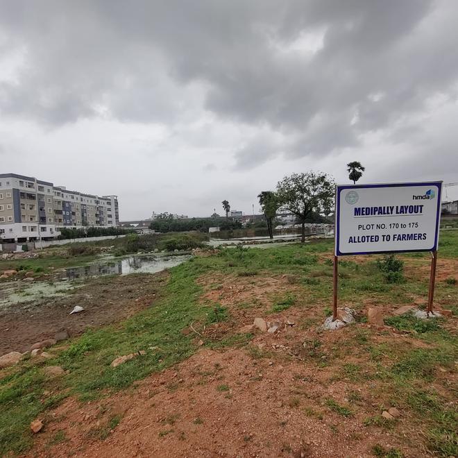
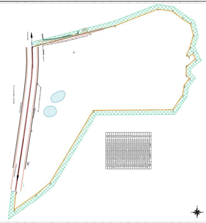
The colourful brochure released by the Hyderabad Metropolitan Development Authority advertising its venture in Medipally village of Peerzadiguda Municipal Corporation in March last year has a picture of the layout with boundaries marked out.
It shows a water body abutting the north-western edge of the layout, right next to the boundary, which any casual onlooker could easily mistake for a lake or pond.
The water pooled on the right side of the National Highway 163 between Hyderabad and Warangal is in fact the surplus water from whatever is remaining of the Medipally Kunta, a lake on the other side of the highway. The lake falls half inside the premises of the Central Power Research Institute (CPRI), and half outside, which gives it another name, CPRI Cheruvu.
“Water used to flow through the fields earlier, before HMDA layout came up here. During heavy rains this year, water got stagnated, and even flowed on roads,” said M. Srinivas, a resident of the village, pointing at the stagnant water in some open plots.
For more than a decade before the floods in October 2020, the lake had little water in it, which made its surplus course invisible. The area was heavily constructed during this period, which blocked the channel, as evident from the historical satellite images.
The surplus water appears to have stagnated at the location since 2020, gradually increasing in extent. Now, one can see the stagnant pool of surplus water sandwiched between the HMDA layout and the heavily constructed area on the other side. Attempts can be seen to fill up the water course using sand and rubble.
The HMDA pooled the assigned lands in the area, and developed a layout of 55 acres. Online auction of 128 plots in two phases garnered the government more than ₹200 crore revenue.
No HMDA explanation
Irrigation authorities who granted clearance for the HMDA layout, deny that it falls on the surplus course of Medipally Kunta, yet failing to give a plausible explanation for the stagnation close to the layout.
The HMDA officials did not respond to queries pertaining to the layout.
Adding to the threat looming on the downstream localities is the rampant encroachment of the water body over the years.
The original spread of the lake extends over 16 acres, which has now shrunk to five to six acres, thanks to the constructions which have come up right inside the FTL area.
Curiously enough, the water body does not appear in the list of lakes mapped by the HMDA, despite the fact that the irrigation authorities had fixed the Full Tank Level and buffer zone boundaries a decade ago. FTL stones are not planted, nor does any fencing exists, which leaves the lake open for encroachment.
According to sources, the neglect could be more an act of commission rather than omission, as lands inside the FTL reportedly belonged to the kin of a powerful politician who had served as a Minister prior to 2014.