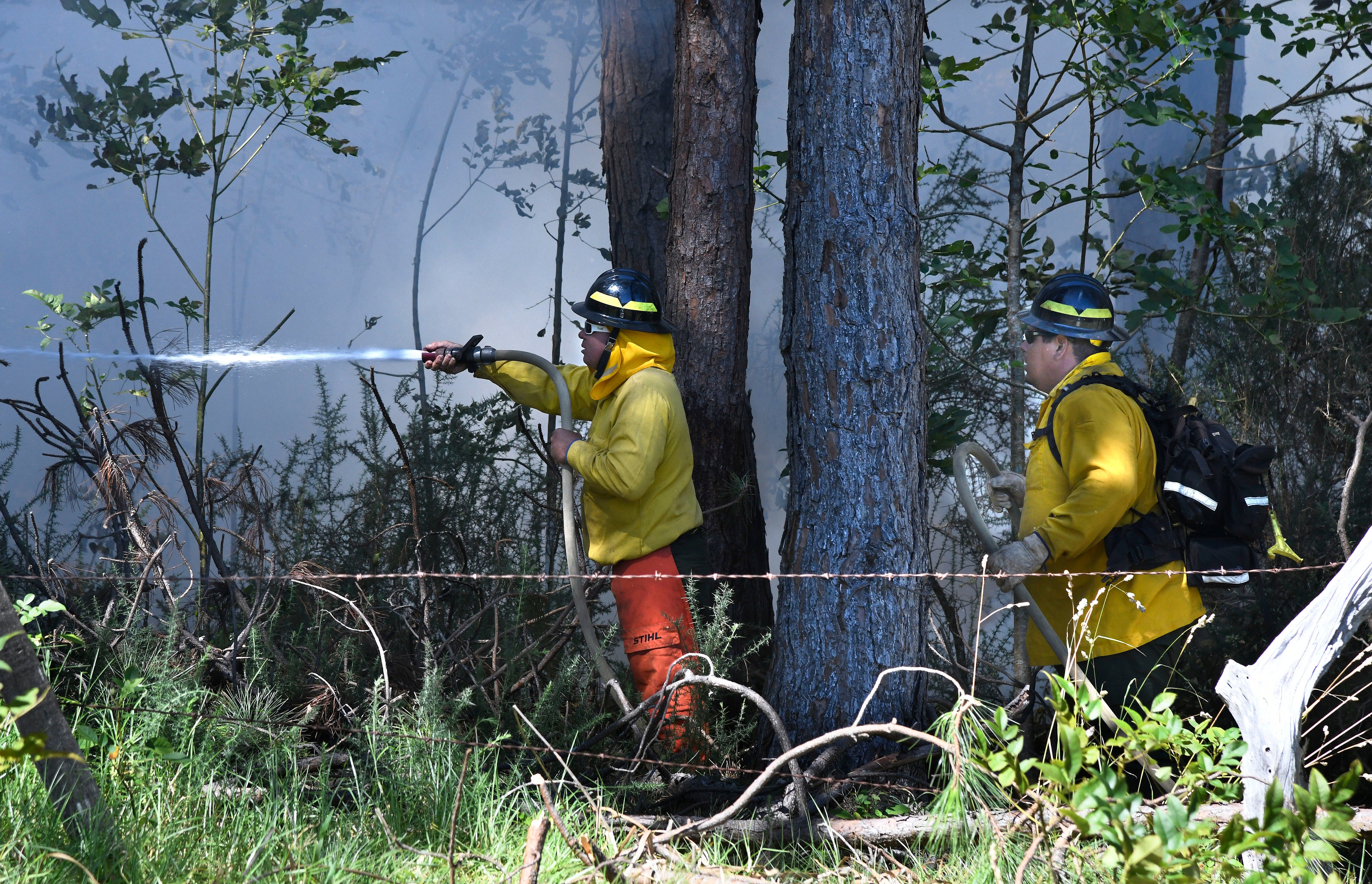
Thousands of residents in Hawaii have been racing to escape their homes as deadly wildfires swept across the island of Maui, killing at least 36 people in one of the worst US wildfires in recent years.
US senator Brian Schatz said the historic town of Lahaina, which dates back to the 1700s, is almost totally burnt to the ground, with the blaze leaving behind smoking piles of rubble where historic buildings stood.
Maui County officials said that at least 36 people have died, with dozens others injured.
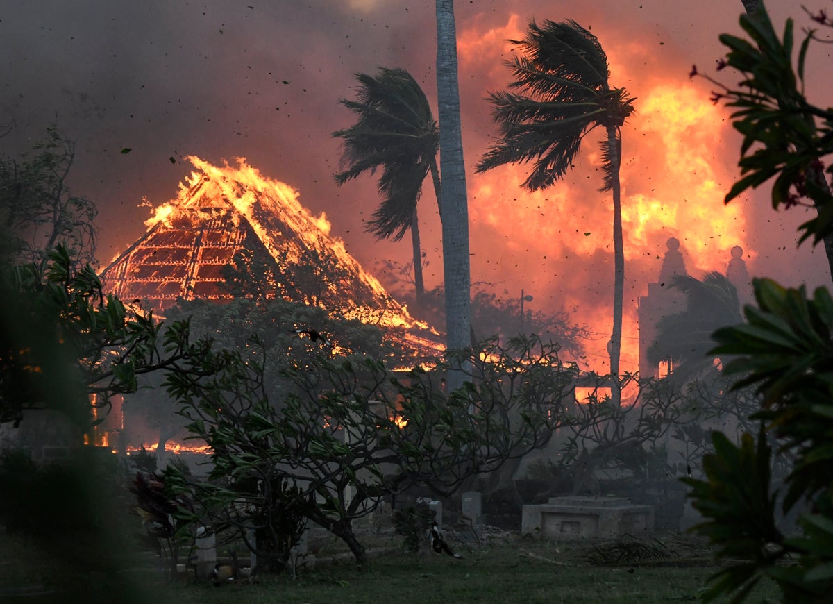
Smoke and flames rise in Lahaina, Maui County— (Reuters)
The fires were whipped by strong winds from Hurricane Dora passing far to the south. It’s the latest in a series of disasters caused by extreme weather around the globe this summer. Experts say climate change is increasing the likelihood of such events.
Lahaina resident Mason Jarvi, who escaped from the town, said the fires were like the “apocalypse”, adding: "We just had the worst disaster I’ve ever seen. All of Lahaina is burnt to a crisp.”
“This is a deeply somber day,” Maui Mayor Richard Bissen said. “The gravity of losing any life is tragic. As we grieve with their families, we offer prayers for comfort in this inconsolable time.”
Follow live updates of the wildfires in Maui here
Where are the current wildfires in Hawaii?
The map below shows the areas currently affected by the wildfires.
As flames continued to rage across the Island, adults and children were forced to dive into the ocean for safety.
Video footage shows locals jumping into the ocean and flames spread to the harbour. “We had to push off to escape the heat and ash. The harbour quickly filled with black smoke. We made it safe to Lanai,” Brantin Stevens, who filmed the video said.
According to reports from CNN, On Wednesday more than 11,000 people were flown out of Maui, Hawaii Department of Transportation Director Ed Sniffen said at a news conference.
This GOES-18 fire temperature composite satellite image taken 6:30 p.m. EDT. on Wednesday, Aug. 9, 2023 and released by NOAA, shows hot land surface temperatures in red on the Hawaii Islands. A dangerous mix of conditions appear to have combined to make the wildfires blazing a path of destruction in Hawaii particularly damaging, including high winds, low humidity and dry vegetation.— (AP)
What is fuelling the wildfires?
The raging fires could be due to heavy winds coming from Hurricane Dora off the islands’ coast. On Wednesday, the storm was moving west across the Pacific Ocean, hundreds of miles sound from Hawaii.
According to the National Weather Service, winds reached up to 45 miles an hour, with gusts of up to 60 mph.
A meteorologist at the Weather Service’s office in Honolulu, Robert Bohlin, told The New York Times, that while the hurricane wasn’t directly responsible for the worsening conditions in the island state, it has made the winds stronger in the area.
As of now, the cause of the fires has not been determined.
Additional reporting from agencies.