Wohlgemut's depiction of his home city is meticulous in its accuracy, with all the major landmarks, including the twin spires of the St Lorenz church, depicted realistically in more or less correct relation to one another Photograph: Royal Geographical Society

Neither Schedel nor his engraver Wolgemut would have had the opportunity to go to Athens, and this woodcut view is entirely fictitious, and makes no attempt to render either the topography or the building style realistically Photograph: Royal Geographical Society

From a collection of English verses begun in the mid-15th century, probably as a gift for Henry VI or Edward IV. The volume remained unfinished until the early 16th century, when the Flemish painter Gerard Horenbout added this miniature depicting Chaucer's pilgrims leaving Canterbury, with a panorama of the cathedral city in the background Photograph: Royal Geographical Society
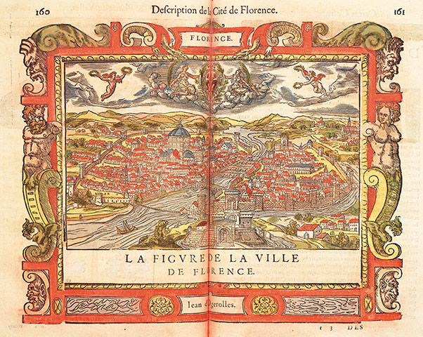
Du Pinet's Florence appears to have been copied from a 1550 map in Munster's Cosmographia, and was in turn recycled into the 1572 edition of that book. It places all the main landmarks accurately, though the dome of the cathedral is too shallow; Schedel is more accurate in this respect. Note the chain across the River Arno Photograph: Royal Geographical Society
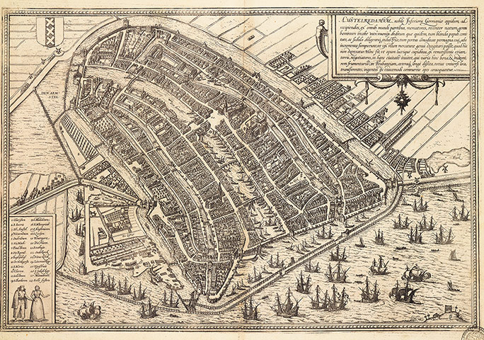
'The port is so conveniently placed and so spacious,' wrote Braun, 'that Amsterdam is reckoned the leading commercial town in the Netherlands ... Ocean-going ships from all corners of the globe sail into the town' Photograph: Royal Geographical Society
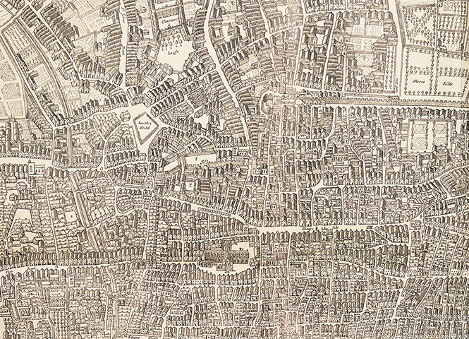
This detail of the last map of London made before the Great Fire of 1666 offers a bird's-eye perspective onto the narrow streets packed with wooden houses around old St Paul's Cathedral – all of which would soon be burnt to the ground Photograph: Royal Geographical Society
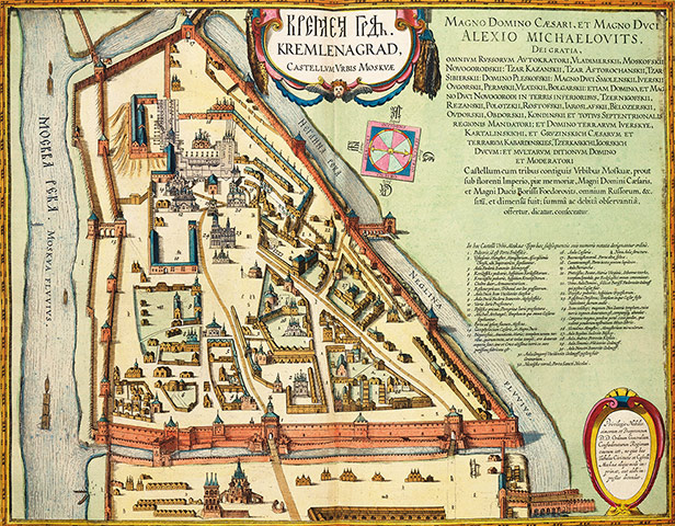
Dedicated to the reigning Tsar Alexei Mikhailovitch, this is possibly the earliest detailed plan of the Kremlin. The Spasskaya tower is in the foreground, and within the walls. the Ivan the Great belltower (24) is clearly recognisable, and beyond it the Cathedral of the Assumption (20) Photograph: Royal Geographical Society
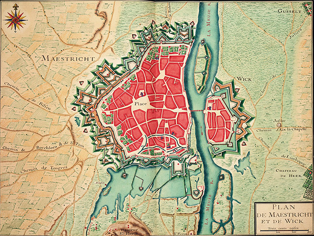
This hand-drawn military map comes from a set bound in red gilt morocco with the French royal arms. The area was at the forefront of conflict between France and the Habsburg rulers of the Netherlands; Maastricht itself was captured by the French in 1673 and again in 1748 Photograph: Royal Geographical Society
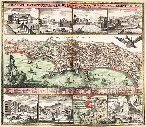
This crisp, precisely engraved bird's-eye view is framed by vignettes of (top row from left) the Viceroy's palace, Castel Nuovo, Castel dell'Ovo, the mole with its ancient lighthouse, and (bottom, from left) the market square, the Sant'Elmo fortress, a plan of the area in Roman times and smouldering Vesuvius Photograph: Royal Geographical Society
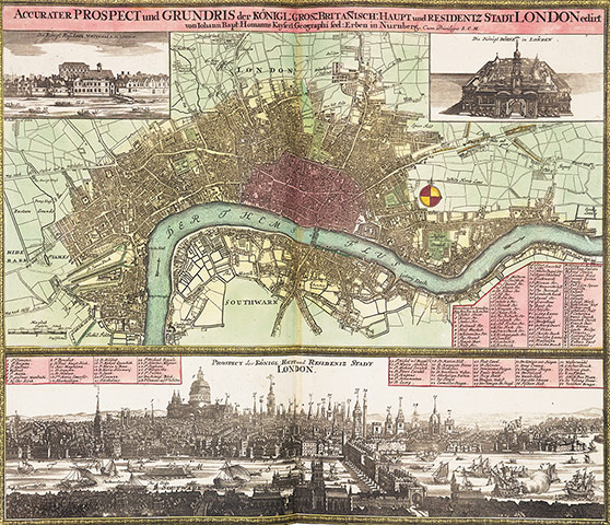
Homann's great map and panorama shows the early Georgian city resurgent after the fire, with the dome of Wren's recently completed St Paul's Cathedral surrounded by the spires of his other churches. The insets show Inigo Jones' Banqueting House in Whitehall and the Royal Exchange, rebuilt in 1669 Photograph: Royal Geographical Society
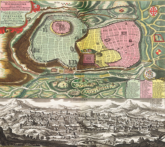
This magnificent engraving combines a map of the city in Biblical times with a contemporary panorama. The Muslim shrine of the Dome of the Rock, built in 691, stands on the site of Solomon's temple Photograph: Royal Geographical Society
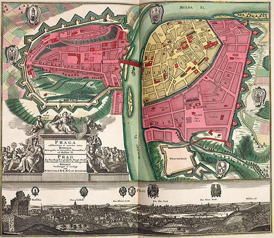
The panorama is taken from the top of Hradcin hill looking out across the castle, Mala Strana and the River Vltava to the Old Town. Since Braun and Hogenberg's view 160 years earlier, many familiar Baroque landmarks have appeared, including the cupolas of the Strahov Monastery, giving the cityscape much of its present appearance Photograph: Royal Geographical Society
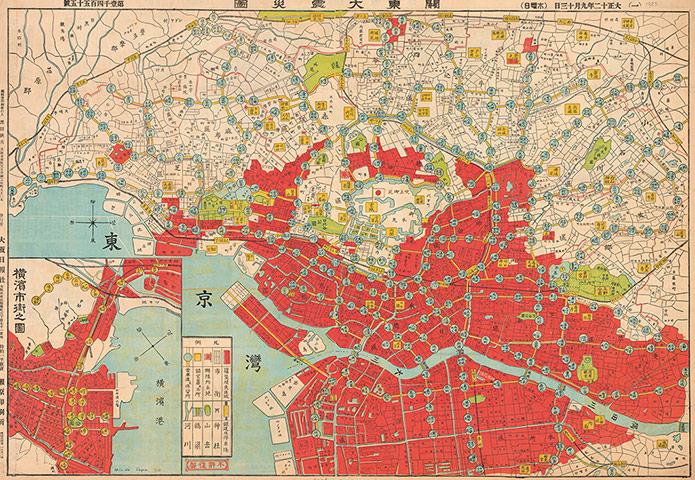
On to a transport map of Tokyo, a newspaper has superimposed the impact of the Great Kanto Earthquake of 1 September 1923. The red area denotes the fire damage in the aftermath of the quake, tram lines are shown in yellow with blue cirles for stops, while the Yamanote rail line is black with yellow squares. The inset shows the Yokohama area Photograph: Royal Geographical Society
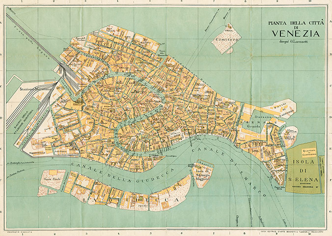
The 3km railway bridge connecting the historic city to the mainland was constructed in 1846, ending centuries of isolation. The line ran from Milan via Verona, Vicenza and Padua. Work on the Santa Lucia terminus in Canareggio began in 1860. The new docks, the stazione marittima, were built on reclaimed land towards the end of the 19th century Photograph: Royal Geographical Society
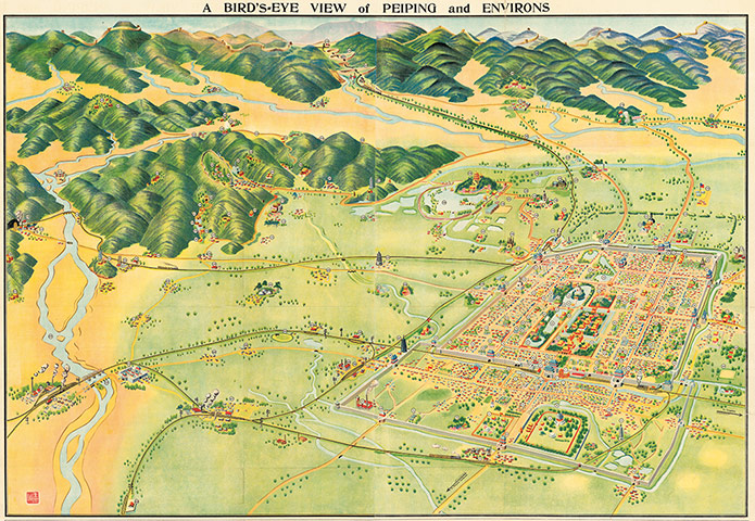
When the republican Kuomintang took control in 1928, Beijing (the name means 'Northern Capital') was renamed Peiping ('Northern Peace') to reflect the fact that the seat of government was now at Nanjing. This attractive bird's-eye view was given away with the Peiping Chronicle Photograph: Royal Geographical Society
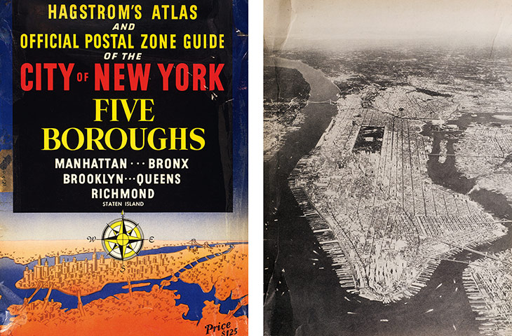
Aerial photography revealed the dreams of the 16th-cenury chorographers in stunning cityscapes such as this. The aviator and inventor Sherman Fairchild refined the technology to the point where his cameras were standard issues on Second World War reconnaissance flights and were carried on the Apollo moon missions Photograph: Royal Geographical Society