
A Caribbean jetstream is set to see temperatures rise across the country, ending the UK’s bank holiday washout.
The South East may even see up to 25C by the end of half-term week, according to a Met Office forecast.
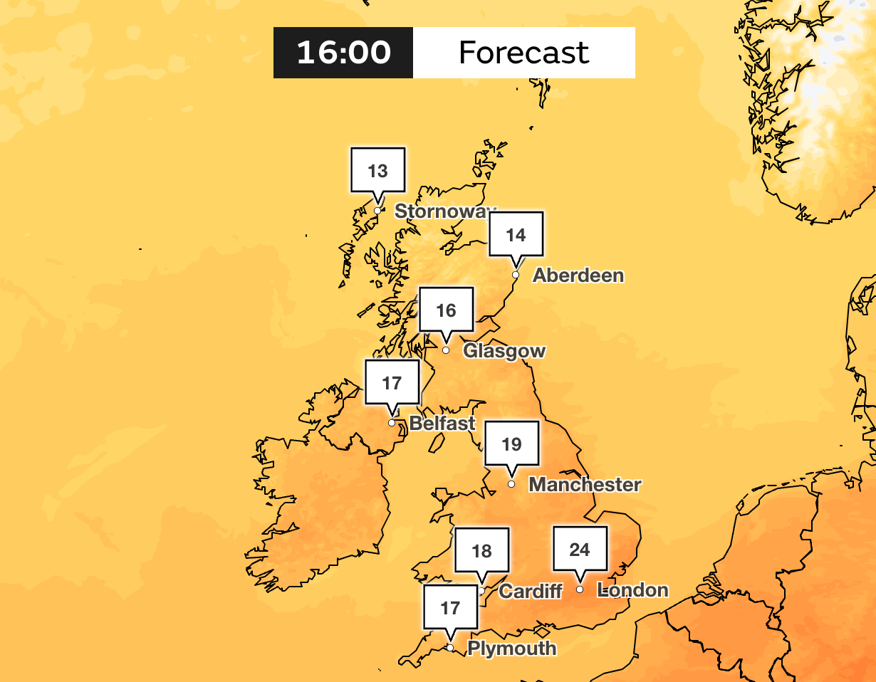
Weather maps show a Caribbean jet stream sweeping across Britain, triggering a 48-hour spell of summer weather warmer than parts of Greece, Morocco and southern Italy.
London will even be hotter than Rabat, the capital city of Morocco, and Palermo in Sicily on Friday.
But Met Office spokesperson Oliver Claydon told The Independent that the burst of warm weather doesn’t quite reach the forecaster’s criteria for a heatwave.
He said: “Temperatures this week will fluctuate as weather systems move across the UK, bringing wet and windy weather at times, interspersed by warmer spells of sunshine.
“Temperatures could reach highs of 25C in the south on Friday and Saturday, while remaining a little cooler further north with temperatures reaching the high teens, possibly low 20Cs.
“There is a possibility as we head into June and through the latter part of next week that we could see higher pressure moving in and with it higher temperatures in the south, but at this stage, there is fairly low confidence in the extended outlook.”
He added: “Temperatures in the mid to high 20s are not unusual for late May and early June. Additionally, any period of higher temperatures is more likely to be fairly short-lived.”
Temperatures are predicted to return to normal by Monday, but could rise again by Tuesday 3 June.
The Met Office’s long-range forecast warns of strong winds and thunderstorms in that period. It reads: “Strong winds may also develop at times, particularly in the North and North West.
“With time, the signs are that systems will increasingly track to the northwest of the country, with the South probably starting to see longer, drier interludes while the North West continues to see more in the way of rain and at times strong winds.
“Temperatures are expected to be around normal overall, but will be cooler in any prolonged periods of rainfall. Meanwhile, there is the possibility of some very warm, perhaps hot conditions developing, especially in the South, and these bring with them the chance of thunderstorms.”

It came as April 2025 was declared the sunniest since records began in 1910. This followed the third-sunniest March, and both months saw temperatures well above average nationwide.
On 1 May, the temperature reached 29.3C in Kew Gardens in London – a new record for the date.
Meteorologists are warning of the potential for a summer drought, as the UK has seen roughly half its usual amount of rainfall for March and April. While farmers are concerned about this year’s harvest, some water companies are urging customers to help reservoir levels recover by limiting water use.
Sao Paulo moves to end area known as Crackland as residents scatter and cry foul against police
Dangerous heat bursts have been spiking temperatures as we sleep. So what are they?
At commemoration of Dayton Peace Accords, NATO leader urges military spending to counter Russia
Summer AC costs expected to skyrocket to 12-year high across the US
Cancer survivor travels 10,000 miles to meet UK man who saved his life
Royal news live: King Charles and Queen Camilla arrive in Canada


.png?w=600)

