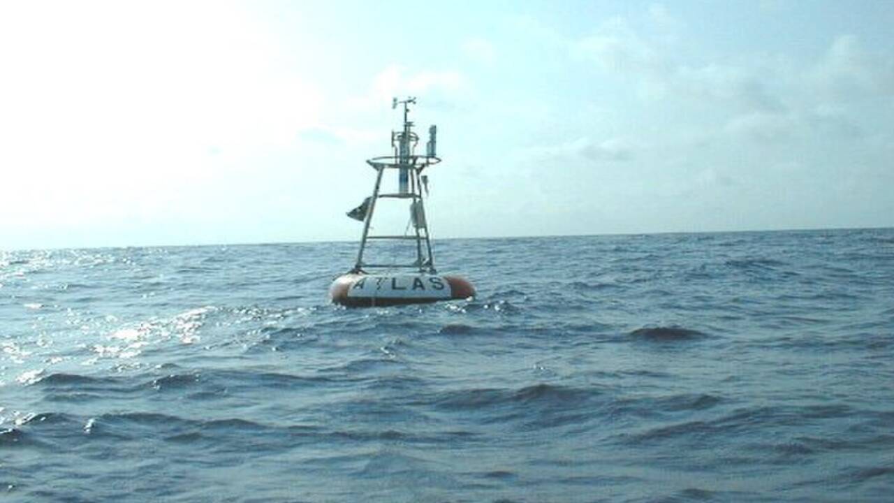
Every single day, many apps, delivery services, and weather portals can lose their way when location data is missing. When digital map databases encounter glitched, incomplete, or missing location coordinates, their internal software often falls back to zeros. This technical fallback can send that broken information to the intersection of the Equator and the Prime Meridian when missing coordinates default to zero. To help systems handle bad data, cartographers created a tiny virtual landmass at that spot, where misplaced location records can accumulate.
Get breaking news anytime, anywhere. Download the TOI app now!
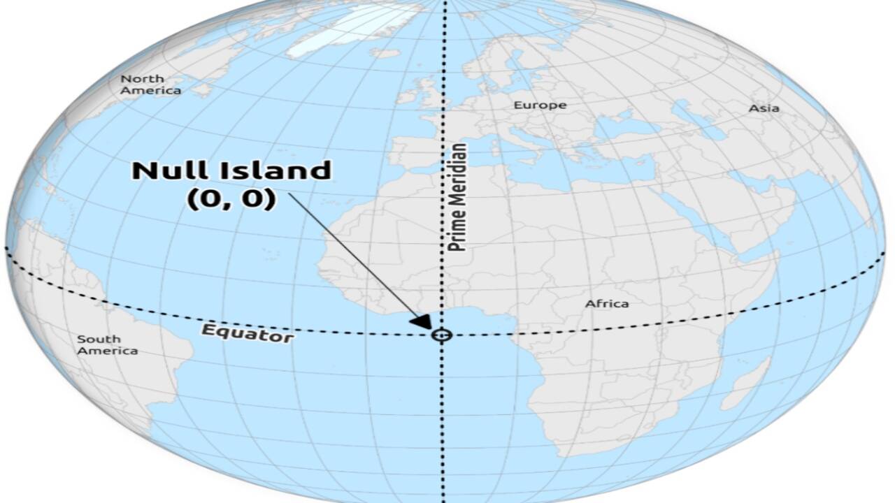
According to the Library of Congress , mapping experts created a one-square-metre virtual feature at zero degrees north and zero degrees east within public datasets. Known informally as Null Island, this artificial landmass was added to handle broken code more smoothly. Located in the international waters of the Gulf of Guinea in the Atlantic Ocean, the site lies over deep open water, roughly 600 kilometres off the coast of West Africa. At this exact spot, oceanographers maintain the Soul buoy, an autonomous weather station managed by the National Oceanic and Atmospheric Administration . The buoy measures surface marine conditions while surrounded by millions of phantom data check-ins.
This strange phenomenon happens because software engineers often configure databases to treat empty location entries as zeros. According to the research published in IEEE Xplore , when mobile apps, shipping trackers, or IP-based tools fail to pinpoint a user’s true location, the system may fill the blank with zero degrees north and zero degrees east. As a result, many broken user check-ins, automated weather pings, and misformatted addresses can be mapped to this point in the ocean.
How software defaults create virtual geography
The mechanism relies on simple computer programming logic in which zero acts as a neutral starting point in coordinate systems, but in mapmaking, zero degrees latitude and zero degrees longitude point to a real physical place on Earth. When an application fails to fetch satellite positioning data, the underlying database fills the missing values with zero rather than throwing an error message. The software treats these numerical zeros as precise geographic directions and plots the activity to the Gulf of Guinea. By placing a one-square-metre virtual island at those exact coordinates, cartographers gave these orphaned data points a safe place to land, helping digital maps stay working even when data gets scrambled.
Data analysts say that traffic sent to Null Island can help monitor digital mapping networks. Monitoring sudden traffic spikes at these coordinates can help engineers spot glitched software updates, malfunctioning satellite receivers, and systematic errors in global address databases.
Why Null Island matters for digital cartography
The creation of Null Island highlights a major challenge in managing big data across global networks. As many connected devices constantly share location data, handling simple technical glitches cleanly has become essential for keeping everyday navigation tools reliable.
As location-based services become increasingly woven into everyday life, from ride-hailing apps and food deliveries to weather forecasting and emergency response, even small errors in geographic coordinates can have wider consequences. A single default value may seem harmless, but when repeated across thousands or even millions of records, it can distort datasets, complicate research, and make technical problems harder to detect. Null Island has therefore become more than an internet curiosity, serving as a useful reminder of how seemingly minor software decisions can shape the way digital maps interpret the real world.
This shows how software design interacts with real-world geography. Rather than letting mapping apps freeze when given invalid data, cartographers created a fallback location for invalid coordinates. Understanding how these computational defaults work can help database managers improve location tracking tools and explain where lost digital information goes when technology stumbles.