EDITORS/NEWS DIRECTORS:
The Biden administration is removing more trees from National Forests as part of its strategy to prevent wildfires on public lands from exploding through nearby cities and towns.
The multi-billion dollar effort includes 21 “priority landscapes” in 10 Western states where climate change, drought and disease have killed many trees and stands are primed to burn.
Key to the government's strategy is addressing forest patches where computer simulations show wildfire could quickly spread to inhabited areas. Experts say the scale of spending is unprecedented and millions of acres have been through environmental review and are ready for work.
Mixed early results underscore the challenge of reversing decades of lax forest management and aggressive fire suppression that allowed many woodlands to become tinderboxes. Federal land managers in the program's first year fell behind on several of their priority forests for thinning even as they exceeded goals elsewhere.
Here's a look at the administration's wildfire strategy and the states where work has been announced to date.
___
READ AP's COVERAGE:
US push to lower wildfire risk across the West stumbles in places
___
STATES TARGETED FOR THINNING IN 2022 AND 2023 AND THEIR PROJECT AREA NAME:
— Arizona: Four Forest Restoration Initiative, Greater Prescott Area, San Carlos Apache Tribal Forest
— California: North Yuba Landscape, Stanislaus, Plumas, Southern California, Trinity, Klamath River Basin(asterisk), Sierra and Elko Fronts(asterisk)
— Colorado: Colorado Front Range
— Idaho: Southwest Idaho, Nez Perce-Clearwater-Lower Salmon, Kootenai Complex(asterisk)
— Montana: Kootenai Complex(asterisk)
— Nevada: Sierra and Elko Fronts(asterisk)
— New Mexico: Enchanted Circle
— Oregon: Central Oregon, Mount Hood Forest, Klamath River Basin(asterisk)
— Utah: Pine Valley, Wasatch
— Washington: Central Washington, Colville Northeast Washington
(asterisk)included under more than one state
___
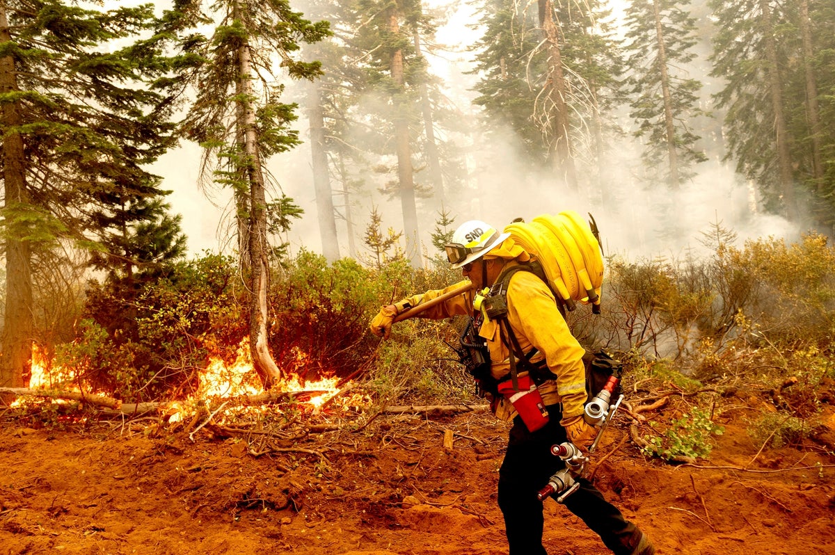
WHAT IS FOREST THINNING?
By logging and using prescribed fires to remove smaller trees and low-lying vegetation, officials hope to lessen the amount of fuel that's available to burn. The idea is to reduce the intensity of fires so they don't rage out of control and destroy inhabited areas.
It's a simple concept, but putting it into practice is complicated by environmental concerns such as preserving older trees and not logging in wilderness areas, a shortage of workers trained to do the thinning and the sheer magnitude of the task. And areas thinned will likely need maintenance work in the future — making it hard to keep up with the rapid changes happening to forests as the world heats up.
___
VIEW DETAILS ON EACH OF THE 21 PRIORITY LANDSCAPES:
— Details on initial 10 landscapes announced in 2022
This report provides maps, acreage and fiscal details for 10 landscapes in eight states: Arizona, California, Colorado, Idaho, Montana, New Mexico, Oregon and Washington. View progress on these landscapes here: US Forest Service 2022 priority landscapes progress report
— Details on second round of 11 landscapes from 2023
This report provides maps, acreage and fiscal details for 11 additional landscapes in the above states, plus Nevada and Utah.
___
LOCALIZING THE STORY:
Reporters can explore the fire risks on U.S.-owned forests in their coverage area and find out if they are in the treatment program.
What areas are getting thinning treatments and controlled burns? Have there been previous wildfires in these areas?
Are the most at-risk parts of the state or region being targeted by the work?
What communities are located within or adjacent to the forests being treated? What steps have those communities taken to prepare for a fire?
What impacts could there be/have there been to local communities from smoke from controlled burns or traffic from logging trucks and burning crews?
Who is doing the work? In many cases the Forest Service is partnering with outside agencies, organizations and private companies.
How much money is being spent? Will logging or milling have local benefits in terms of jobs?
Do areas slated for more logging overlap with stands of mature and old growth trees? If so, do local officials have any size limits on what can be cut? Is the work welcomed by communities? Did environmental groups object during the planning stage?
Is any of the treatment work occurring along scenic rivers or roadways and if so, what kind of impacts will that have on recreation and tourism?
___
VIEW ADDITIONAL RESOURCES:
Data on 21 thinning projects, funding, acreage treated, future plans The projects are listed as individual tabs at the top. You can also see logos for local partners listed that you may want to contact.
Landing page for Forest Service reports and media resources
___
CONTACT INFO FOR THE FOREST SERVICE:
A list of the Forest Service’s regional offices
Reach the National Press Desk at at 202-205-1134 or SM.FS.pressoffice@usda.gov
___
MORE AP STORIES:
Climate change, logging collide — and a forest shrinks
US plans $50B wildfire fight where forests meet civilization
Feds send $930 million to curb ‘crisis’ of US West wildfires
Biden forest plan stirs dispute over what counts as “old”
US inventory: old forests cover area larger than California