Environmental scientists see flora, fauna and phenomena the rest of us rarely do. In this series, we’ve invited them to share their unique photos from the field.
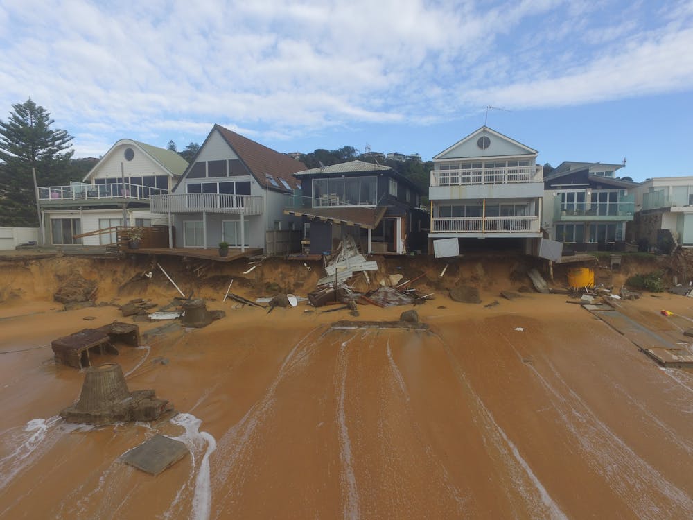
Extreme storms can cause devastating erosion and leave beachfront houses teetering on cliff edges. But our new research, published today, finds storms might also help replenish beaches by bringing in new sand from deeper waters.
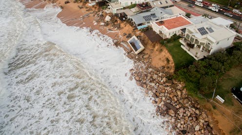
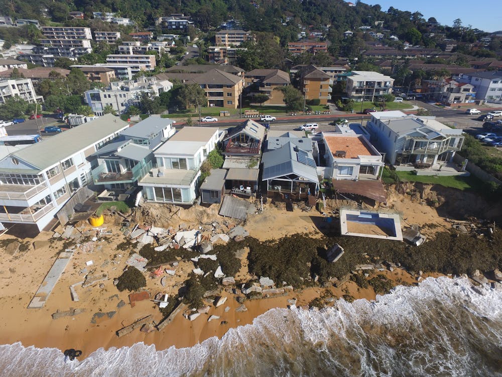
We studied three extreme storms in Australia, the United Kingdom and Mexico. One, in Sydney in 2016, famously ripped a swimming pool away from a property overlooking the coastline.
For the first time, we’re able to show just how much new sand can be added to a beach in a single storm alone – over 400,000 cubic metres in some cases. That’s equivalent to the typical volumes of sand engineers use to nourish beaches artificially.
As sea levels rise, this natural form of beach replenishment might be an important factor in offsetting some of the damaging effects of climate change on beaches. Yet, with little knowledge of exactly how much sand is moving around offshore, predicting the future of beaches in the coming decades is extremely difficult.
Wave after wave
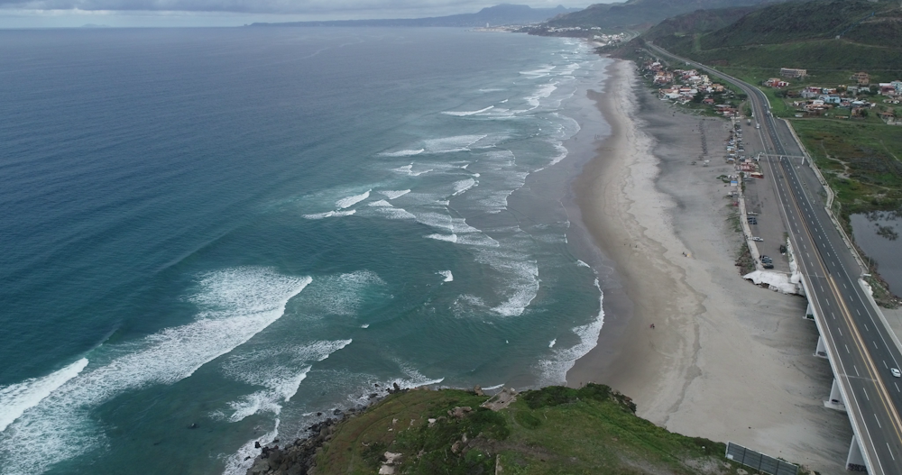
Violent storm waves strip beaches of sand above the waterline, which often erodes sand dunes. In deeper waters, however, these same waves help stir up sediment lying dormant on the seabed. This sand is then pushed towards the shore and settles as the storm passes.
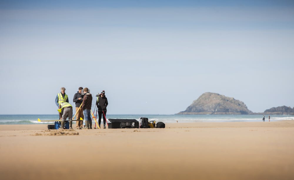
To study the three storms in Australia, the UK and Mexico, we used high-resolution monitoring equipment including twin engine airplanes, drones and jet skis mounted with an echo-sounder for measuring the seabed.

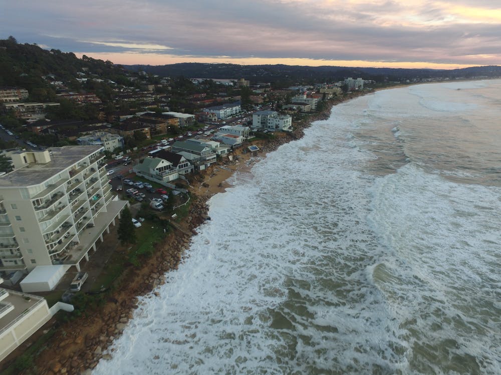
In Australia, we measured Narrabeen Beach in Sydney. In the UK, we monitored the impact of several storms during the winters of 2013-2014 and 2015-2016, at Perranporth beach in Cornwall. And in northwest Mexico, we recorded the impact of the 2018-2019 winter on La Mision Beach.
In the time-lapse video below, you can see just how quickly the water can encroach on beachfront houses during extreme storms. Beneath the water surface, however, huge volumes of sand is also moving about.

Source: Mitchell Harley (author provided)
By capturing the three-dimensional seabed changes for each event, we could quantify for the first time the precise sand volumes mobilised during these extreme storms.
To give an indication of the scale of beach change, the amount of sand added to the beach resulting from the stormy periods was on the order of 100 cubic metres for every metre length of beach – that’s like 20 tip trucks pouring sand on every metre-wide strip.
Read more: The seas are coming for us in Kiribati. Will Australia rehome us?
As the beaches spanned several kilometres, this amounted to 130,000 cubic metres for La Mision beach, 400,000 cubic metres for Narrabeen and 420,000 cubic metres for Perranporth.
The time-lapse video below is of Wamberal Beach during a storm in 2020. While it wasn’t included in our study, it’s another great example of how large storm waves cause abrupt changes to beaches.
Rethinking coastal erosion
Exactly how a coastline might change due to sea-level rise is a key question facing coastal managers, as they plan for the escalating impacts of climate change.
The Intergovernmental Panel for Climate Change projects global sea levels to rise up to 76 centimetres by 2100, under a middle-of-the-road emissions scenario where global temperatures rise 2.1-3.5℃.
The response of the coast to sea-level rise has previously been estimated using an approach known as the Bruun rule. This rule states that for a given metre of sea-level rise, the coastline is expected to retreat between around 20m to over 100m, depending on the steepness of the coast.

Using the Bruun rule, global sea-level rise caused by climate change has been projected to result in losing almost half the world’s sandy beaches by 2100. However, not all coastal scientists share this view.
Let there be no doubt: sea-level rise is a tragic consequence of climate change, and it poses an existential threat to many coastal communities, especially for island nations in the Pacific.
What our new research confirms is that the Bruun rule approach is overly simplistic, as it doesn’t take into account the many complex local factors about how individual beaches respond to sea-level rise.
This includes the amount of sand stored in deeper water immediately off the coast, and its potential to replenish beaches during extreme weather events.
Improving predictions in an uncertain future
While this research has focused only on three extreme storm sequences, it shows that understanding how sediment moves along the coast is fundamental to planning for climate change impacts.
There are two ways we can significantly improve long-term predictions of coastal change in this uncertain future:
upscaling efforts in mapping the seabed to learn how much sediment is presently stored in the deeper coastal waters
increasing routine coastal monitoring of the entire nearshore system, from the sand dunes down to deeper waters. This is currently carried out by UK coastal observatories.
A greater understanding of sand movements off the coast, combined with computer modelling, can better forecast future shorelines. This will give coastal managers the information needed to make critical long-term planning decisions for communities.
Read more: Why some beaches, including in Queensland, are getting bigger despite rising sea levels
Mitchell Harley receives funding from the Australian Research Council
Gerd Masselink receives funding from NERC.
This article was originally published on The Conversation. Read the original article.


.png?w=600)

