After Japan ended its seclusion from the rest of the world, the government of the Meiji era (1868-1912) aimed to build up its sea power. As part of those efforts, a unit tasked with hydrographic and oceanographic research was established within the naval section of the military ministry in 1871.
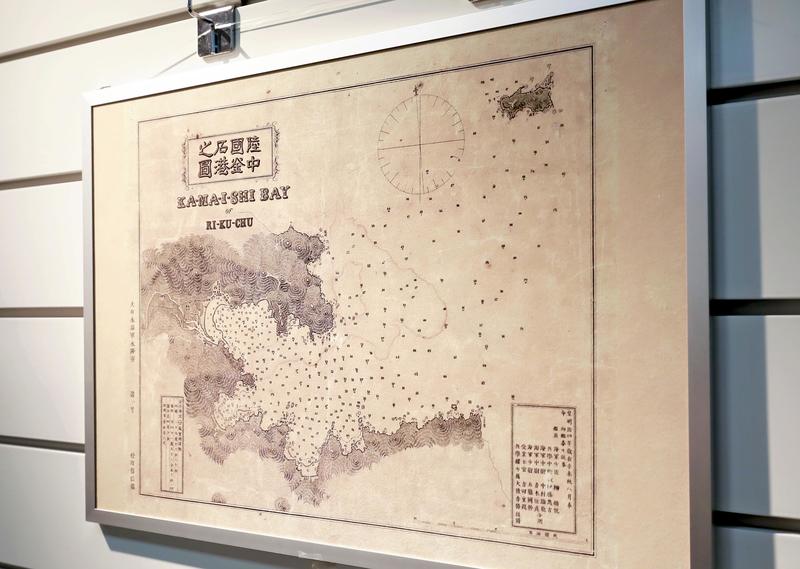
The following year, a nautical chart of Kamaishi Port in Iwate Prefecture was published, said to be the first full-scale nautical chart created in Japan. It was put together by unit leader Narayoshi Yanagi, who had studied at the Nagasaki naval training center owned by the Edo shogunate.
Yanagi is called the "father of hydrography in Japan." At that time, Kamaishi was an important refueling point for ships traveling between Tokyo and Hakodate, Hokkaido, and the nautical chart was created just before the construction of state-owned ironworks started there, which is said to be why the port was selected for the first nautical chart.
After World War II, the creation of nautical charts was transferred to the former Transport Ministry. Currently, the Japan Coast Guard's Hydrographic and Oceanographic Department is in charge of the task.
A copy of the Kamaishi Port nautical chart can be viewed at the JCG's Hydrographic and Oceanographic Museum in Koto Ward, Tokyo, along with secret nautical charts of military ports created in the Meiji era and other materials.
Four copies of the Dainihon Enkai Yochi Zenzu (maps of the Japanese coastal areas) created by geographical surveyor Ino Tadataka (1745-1818) of the Edo period (1603-1867) are also on display.
They were believed to have been burned in a fire caused by the 1923 Great Kanto Earthquake, but were found at the JCG building in 2004.
Kenzo Imai, 75, a museum official who was involved in the designing of nautical charts as a JCG official, said, "Thanks to the electronic information retrieval system, old nautical charts in various parts of the country clearly show us the coastal lines before development. "
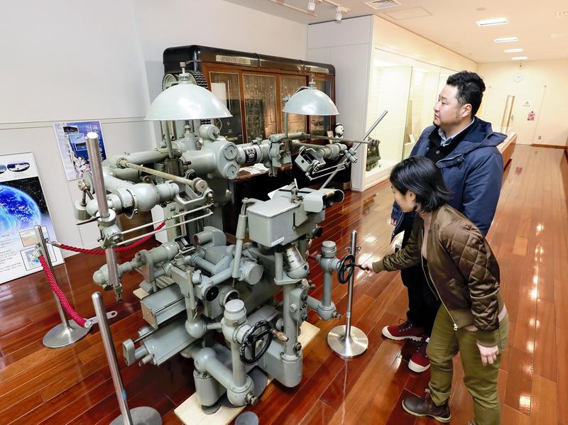
There is also notable research equipment at the museum. A top-quality stereoplotter manufactured by Carl Zeiss AG of Germany and imported to Japan by submarine in 1940 was capable of plotting coastal lines and ocean waves based on aerial photos and other data.
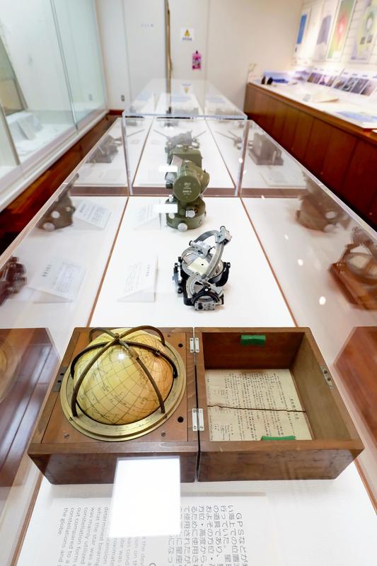
There is only one other surviving product of this type, which is currently in Germany, according to the museum.
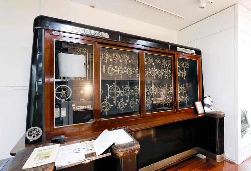
A tide-predicting machine made in Britain has 42 pulleys lined up on the side of the main body, which looks like a wooden shelf, and wire rotates the pulleys. The machine was introduced in 1957 and was used to predict the ebb and flow of tides until electronic calculators appeared.
Visitors can touch rocks taken during a survey on Nishinoshima island in Ogasawara, Tokyo, whose land area has grown due to a volcanic eruption in 2013.
The shapes of Japanese coastlines have been changed by people and the power of nature. I have enjoyed marine leisure activities, but seeing our ancestors' achievements to protect maritime rights and safe of travels gave me a broader perspective on the ocean.
-- Hydrographic and Oceanographic Museum
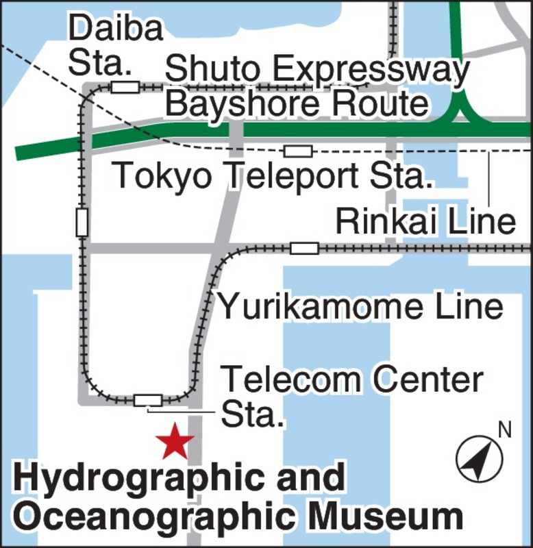
The museum opened on the first floor of the new building of the JCG's Hydrographic and Oceanographic Department in 2012. In a facility called "Umi no Sodanshitsu" (Consultation room on the ocean) within the museum, visitors can check seawater temperatures and depths while viewing nautical charts and magazines on water channels. The museum is a five-minute walk from Telecom Center Station on the Yurikamome Line.
Address: 2-5-18, Aomi, Koto Ward, Tokyo
Open: 10 a.m. to 5 p.m. (Closed on Tuesdays, Thursdays and Saturdays and during the year-end and New Year holiday period)
Admission: Free
Information: (03) 5500-7155
Read more from The Japan News at https://japannews.yomiuri.co.jp/