Six months ago, when curator Shailka Mishra and art conservators Anuja Mukherjee and Bhasha Shah began browsing the maps at the Maharana of Mewar Charitable Foundation’s research centre in Udaipur, they found them in a sorry state — stored with the limited knowledge and materials available at the time (MMCF was founded in 1969). “Some were so brittle they couldn’t be opened properly as there was termite damage,” says Mukherjee, while Shah adds, “Other maps were so fragile that they would dissolve into fragments if touched.”
Months of restoration followed: using Japanese archival paper, special adhesives, fumigation to remove dust, and humidifying to ensure the ink did not fade. There were paper maps, and those drawn on paper with textile backing, done directly on cloth or even varnished. “So, we had to plan and change treatment according to individual needs,” says Mishra.
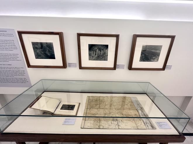
The long hours of work have culminated in an exhibition at the City Palace Museum in Udaipur, Picturing Place: Painted and Printed Maps at the Udaipur Court. It brings together 53 rarely seen artefacts: a mix of hand-painted maps, photographs of 18th century landscape paintings, topographical maps, world maps, and cartographic devices and documents from the Mewar Royal collection.
Keeping pace with Google
The exhibition harks back to when the city of Udaipur, the capital of the Mewar kingdom, was founded in 1559; construction of the City Palace started at the same time. The fact that the palace and the kingdom have not been destroyed from the 1700s to 1945 has given this exhibition life.
“Dipti Khera in her book, The Place of Many Moods: Udaipur’s Painted Lands and India’s Eighteenth Century, and later in the exhibition catalogue with Debra Diamond of A Splendid Land: Paintings from Royal Udaipur [held at the Smithsonian from November 2022 to May 2023], emphasised the role of court artists. They painted the architecture of the palaces, emphasised the mood of the monsoons, and documented the region’s natural resources, like mining or stone quarries,” explains Mishra. “We often look at these paintings as aesthetic objects, but they are also cartographically and geographically correct. As part of Dipti and Debra’s project, they overlaid the most recent Google map images on these paintings and found them to be geographically accurate. So, when we know that these paintings have so much potential, why do we always start the narrative of Indian cartography from cosmology or British mapping?”
Over 300 years of history
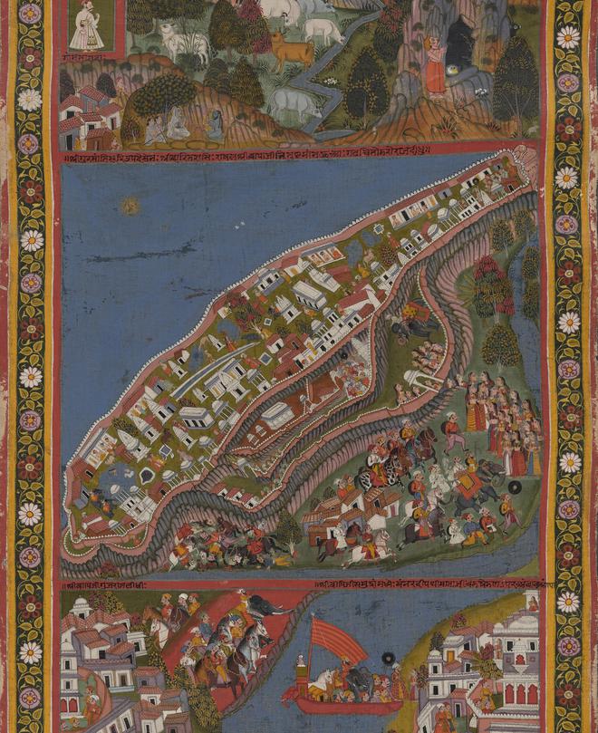
Picturing Place is divided into four parts: paintings, maps of Udaipur, maps of the world and revenue maps. In the first section, a large-scale painting, Maharana Sarup Singh at Thikliya Marga (1851), catches our eye. It shows the topography of the Mewar kingdom through multiple episodes of the maharana hunting tigers and playing polo. The miniaturists skilfully depicted the city’s landscape, including hunting towers that are still standing today, and local flora and fauna such as the mango and mahua trees, and the cactus-like thuhar shrubs.
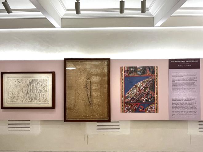
From there, Mishra guides us to a comparison of a painting of the Chittorgarh Fort made in 1740, a Survey of India map of the fort and city from 1877, and a map of the surrounding areas from the same year. The resemblance between the painting and the maps is striking; it also throws into focus how impersonal the maps of the 19th century are as compared to the earlier ones.
In the ‘Maps of Udaipur’ section, we come across locally-made maps from the early 20th century, in Hindi. Others have been relabelled in Hindi with red ink so that they could be read by local people at court. British era world maps are revealing, too. The focus on border areas, water bodies and crops underline how their main interest was taxation and annexation.
The final section, with books of architectural drawings made during the late 19th and early 20th century, is insightful. This includes bahidas or daily court records, which give a peek into the cosmopolitanism of the regional kings. There are also photographs and map books that were used as field books by surveyors. “The exhibition is significant as it provides insights into how the earlier generation of painters, draughtsmen and historians perceived the world,” says Mishra. “These maps complement and complete our understanding of the past.”
The exhibition is on at the City Palace till December.
The writer is the author of a fantasy series, and an expert on South Asian art and culture.