Lake View residents raised traffic congestion and air pollution concerns during a community meeting Thursday on an ongoing study being done to revamp the northern leg of DuSable Lake Shore Drive.
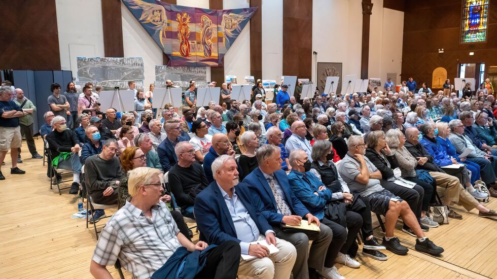
The “Redefine the Drive” study meeting was held at Temple Sholom, 3480 N. Lake Shore Dr., and focused primarily on proposed changes to busy roadway through the Lake View area, The study, which began in 2013, covers a seven-mile stretch of the drive from Grand Avenue to Hollywood Avenue. Hundreds of residents attended the meeting.
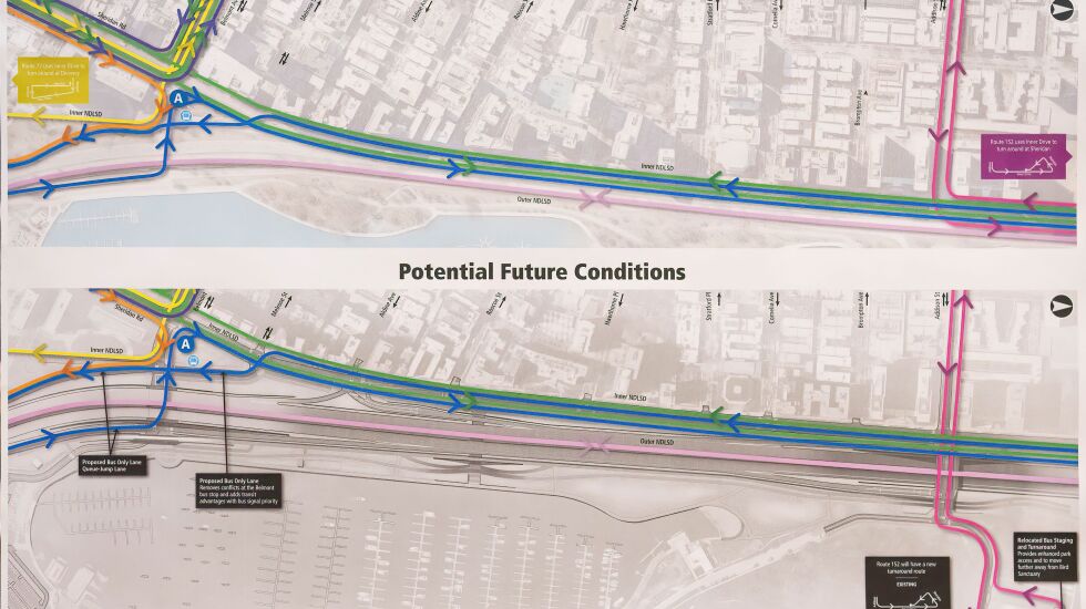
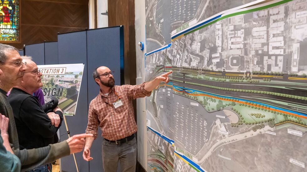
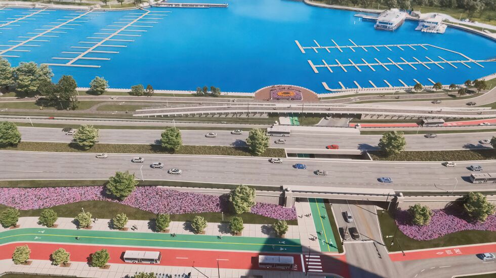
City and state transportation officials presented new renderings showing proposed changes to lakefront parks and pedestrian and bike pathways around Belmont Harbor, where traffic builds up as cars attempt to get on DuSable Lake Shore Drive.
One such proposed change was creating a CTA bus staging area in the Waveland Parking Lot near the Bill Jarvis Migratory Bird Sanctuary.
But the parking lot sits right across from tennis courts, and a resident said he didn’t want to breathe in fumes from buses in the parking lot when he is playing.
“The whole point of the park is to get away from traffic,” the resident said.
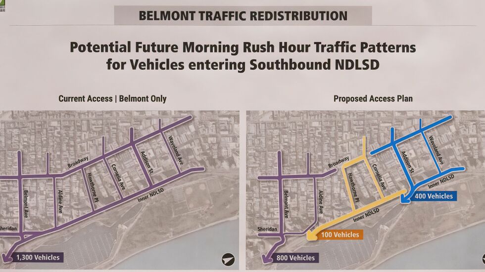
Another proposed change is adding a traffic signal at Aldine Avenue and North Lake Shore Drive. There is currently a stop sign there, and residents said traffic congestion builds up on that residential street as cars try to get on southbound DuSable Lake Shore Drive.
The current conditions make it dangerous for pedestrians and bicyclists, residents said, adding that they were worried the changes would just transfer congestion to different parts of the area instead of eliminating it completely.
Officials also proposed expanding the pedestrian underpass at Roscoe Street similar to the pedestrian underpass under DuSable Lake Shore Drive near the Museum campus. “That would be good,” said one audience member when the rendering was displayed.
Alderpersons-elect Bennett Lawson and Angela Clay were at the meeting. Lawson will replace 44th Ward Ald. Tom Tunney, and Clay is taking over for Ald. James Cappleman. Their wards include areas where the proposed changes would occur.
“Redefine the Drive was one of the biggest concerns for all of us because it does have long-term implications and short-term implications,” Clay told the audience.
Residents were reminded that the study was still in its design phase, which won’t be completed until the end of 2024 and that no proposals were final. There is no funding in place yet to begin drawing up contracts or construction.
The Illinois Department of Transportation and the Chicago Department of Transportation have been leading the project since 2013.
The agencies said that though DuSable Lake Shore Drive has been repaired and resurfaced many times since much of its infrastructure was constructed in the 1930s, “the bridges and appurtenances have reached the ends of their useful lives and may warrant complete reconstruction or major rehabilitation.”
“We hear you and we hear your concerns with this project,” Lawson said during the meeting. “We have an opportunity here to get it right for the next hundred years.”