Information on river flood risks from the land ministry and the Japan Meteorological Agency will be available on a single website.
Previously, the Land, Infrastructure, Transport and Tourism Ministry and the JMA posted information separately on their own websites.
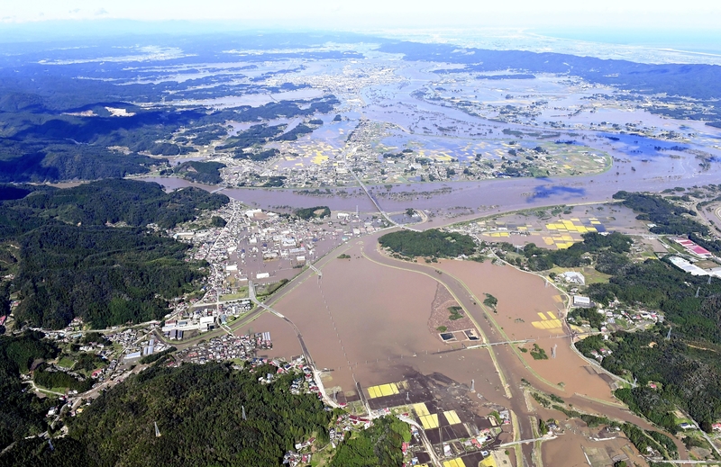
The new policy is part of the government's efforts to dissolve the vertical divisions of ministries and agencies, especially in the wake of extensive flood damage caused by Typhoon No. 19 about a year ago.
The single information portal will help to encourage early evacuation by disseminating all information on river situations at once.
The integration will be between the land ministry's information on large rivers, which shows their water levels among other data, and the JMA's information on small and midsize rivers, which predicts the distribution of flood risk.
There are differences in the information. The land ministry mainly uses data from water level gauges and the JMA uses precipitation forecasts, but they both divide the flood risk into five levels based on their own standards. Both show rivers on a map in different colors according to the level.
Under consideration is putting the land ministry's information on the JMA's map, implementing it gradually, starting with river systems that can be easily transferred.
The separate ways of providing disaster information among ministries and agencies have been questioned since Typhoon No. 19 hit last October. It was revealed that, after the JMA lifted its emergency warning for heavy rain, many people returned to their homes from evacuation sites, despite the land ministry's call to be cautious of rivers overflowing.
The land ministry and the JMA have since reviewed these separate ways of providing information. They held six joint press conferences in the wake of the torrential rains in Kyushu in July and Typhoon No. 10, which prompted a warning as one of the strongest on record. They are also considering sharing their data.
Read more from The Japan News at https://japannews.yomiuri.co.jp/