The Adani Carmichael coal mine has been an election issue across state and federal politics since 2016.
Despite bipartisan support, it defined the November 2017 Queensland election, has shaped federal by-elections since and prompted protests in almost every Australian state and territory – including a convoy that has made its way up to the neighbouring town of Clermont all the way from Tasmania.
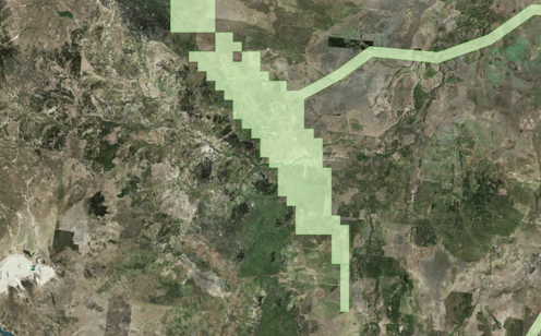
So given it’s gone through several revisions thanks to issues with funding and environmental approvals, what does the proposed mine look like now?
This is a heavily revised version of the graphic originally created for the 2017 Queensland state election.
It will be updated as new information becomes available.
Note: a previous version of this graphic noted the two instances of stormwater released at Abbot Point as containing specifically carbon particles. It has been updated to “suspended solids” which may contain silt, sediment, dirt, gravel, organic matter or coal dust/particles.
This article was originally published on The Conversation. Read the original article.