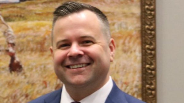
Avantika Gori is an assistant professor of civil and environmental engineering at Houston’s Rice University who is currently examining how to improve flood hazard detection and resilience in rural counties in Texas. Her three-year project began in 2025—so far it’s been funded with $1 million from the National Science Foundation. That’s only enough, she says, to conduct thorough research for two counties in South and West Texas. Several other counties were hit last week by devastating flooding in the Hill Country that has killed more than 100 people. Gori spoke with the Texas Observer this week about deadly floods, what can be done to prevent the next one, and what she’s learned from her flood research.
TO: This has been a really sad week. The Fourth of July weekend flood in the Hill Country will likely be the one of the deadliest in modern Texas history with more than 100 confirmed deaths and even more still missing. What makes the Hill Country a more dangerous place for flooding?
There’s a combination of factors. The main reason why the Hill Country is known as “flash flood alley” is because of the terrain here. Because of all the hills, you have a steep ground surface. So when you get intense rainfall, the rain falls on the ground and it runs off quickly because of those steep slopes and it really just accumulates in rivers and becomes this deadly wave of water that travels downstream very fast. So that is what makes that area particularly dangerous in terms of floods.
Other parts of the state, the coastal areas, have floods but the terrain is more flat so people usually have time to find safety during heavy rainfall events.
More than 5 million Texans, or one in six people in the state, live or work in areas susceptible to flooding, per a draft of the first-ever statewide flood plan, which was mandated under a 2019 law passed after Hurricane Harvey. Do you know how many homes are vulnerable in the Hill Country?
I don’t know. [The Texas Water Development Board] is currently remapping the floodplain, so presumably they’ve created updated flood models for all of the river basins. Some of them have already been released. I think that can be a really valuable resource because those are going to be updated with the latest data and conditions that we know of.
There have been conflicting reports about whether Kerr County and other counties in the Texas Hill Country already have warning systems and whether they were deployed. Does your work include examining local warning systems?
The National Weather Service has its own nationwide warning system, so they have their forecast models and then they issue either a flood watch, a flood warning, or, in this case, it ended up being a flood emergency. … So that system is in place.
I think one of the issues in the Hill Country is that cell reception can be pretty spotty. So I know there’s a lot of reports of people not necessarily getting those alerts. The question is whether a localized warning systems could be effective in some rural counties that would rely on local water level sensors, rain gauges, or some kind of modeling efforts that would trigger some kind of alert that is sent out to residents of the county.
In general, those systems can be effective. But it’s not clear that even if that type of system had been in place, that the outcomes would have been materially different for this flood just because it was so extreme, the water levels rose so fast, and all of this occurred in the middle of the night when most people were sleeping.
There have been reports, notably by the Houston Chronicle, that some of the hardest hit areas, including buildings at children’s camps, were in the 100-year-flood plain or even in the floodway of the river. Many people probably didn’t know that. Experts also say the nation’s floodplain maps are outdated.
In general, in most rural counties across the U.S., the flood maps are probably outdated. To remap the floodplain is a significant effort and rural counties don’t have the resources that urban counties do. … I know from work in other parts of Texas that in a lot of rural counties the flood maps can be decades old. The general public probably doesn’t interact with these flood maps ever … so I think it’s quite feasible that many people probably would not have known they were in a flood-prone area.
Tell me more about your current study of floods in rural Texas.
We’re working with one county in West Texas and one that’s on the coast, but they’re rural counties similar to the rural counties of the Hill Country in terms of resources. We’re working with Hudspeth County, which is close to El Paso, and Jim Wells County, which is on the southern Texas coast. Hudspeth is basically flooding from the Upper Rio Grande area; Jim Wells is mostly heavy rainfall from the Gulf storms that come in.
This was initially work that done through colleagues at Texas A&M–the Digital Risk Infrastructure Program (DRIP)—where they were reaching out to many different rural counties across the state and trying to help them organize and consolidate and understand their data related to flooding to help them better understand their flood risk.
From that initial work, these two counties requested the most assistance. We’re working on how can we improve the models and methods, and how could we evaluate potential solutions that could then alleviate some of that flood risk.
Extreme weather and very intense rainfall events are being reported more frequently in Texas, according to the National Oceanic and Atmospheric Administration. The Hill Country gets an average rainfall of 15–34 inches per year. In this event, as much as 15 inches of rain fell in a matter of hours in some areas. How common is that kind of rainfall across Texas?
In any part of the state, that’s going to be an extreme amount of rainfall. Even in the east part of the state that’s more wet, to get 15 inches of rain in a day is a very, very extreme event and I think that is part of the challenge. It’s hard to find a very compelling trend if we zoom into one location.
If we look generally across the state, the total amount of rainfall is not really changing but it is being condensed into more of these short, high-intensity events and then longer periods of drought. So we’re basically getting more drought and more floods because the rainfall is being condensed into these high-intensity events.
Are there enough rain gauges to accurately measure increasing rainfall events in the Hill Country and elsewhere in rural counties to help measure local risks?
In general there is a lot less flood data available in rural counties, whether that’s rainfall gauges, water level gauges, [and] in some parts of the state the weather radar rainfall coverage is pretty spotty, so all of those things make it really challenging to understand the current flood risk at a specific location.
What other factors are you looking at in your current studies in rural Texas? What’s the goal?
We are trying to first understand, by collecting reports from residents, about where it has flooded in their community in the past and compare that with what the Federal Emergency Management Agency (FEMA) floodplain shows. So basically, trying to quantify how different is the current flooding compared to what the FEMA floodplain map shows.
The second [goal] is to figure out how we can improve the flood map to better reflect the reality of flooding. So we’re going to collect new data specific to each community on the ground … and see if having a richer data set can improve our flood modeling … and then, given that these are resource-constrained communities, to find some realistic solutions that would be low-cost, easy to implement, and could potentially help alleviate some of the floods these communities have experienced in the past few years.
What could those solutions be?
A low cost-flood warning system. Maybe deploying additional water-level or rain gauge sensors and then if rainfall or water exceeds an amount, triggering a warning or alert for residents.
Other options are temporary or deployable flood barriers [since it’s often] not feasible to implement levees or hard structures because they’re very costly. There are increasingly new kinds of deployable temporary flood barriers that could be helpful.
If you were advising the rural counties in the Hill Country on next steps, what would you suggest?
I think as much as possible, gathering and implementing systems that collect more data will really pay off in many ways, like first alerting people when there is flooding. But also helping us build better models. If we can enrich our dataset of flood observations then I think we can improve our ability to predict floods in the future and our ability to potentially mitigate them.
There certainly were a lot of camps and RV parks in the flood zone or in the 100-year floodplain, and there’s going to be debate about whether they should be moved.
It’s a challenging issue because people want to be by the river. It’s a beautiful natural resource we should use in a recreational sense. But maybe thinking about risk-averse decision making, there may be a lesson going forward about what actions to take given a future flood watch or future flood warning. Those spaces in the floodway can and should be used when it’s not flooding, but we need to know more about what are the situations [when] we need to evacuate from there. And we need to make those decisions in a timely way.
This interview has been edited for clarity and length.