Imagine building a house and then discovering that half of it sits on your neighbour’s property, and that neighbour is another country. That is roughly what happened on Märket, a tiny 3.3-hectare island in the Baltic Sea divided between Sweden and Finland. The peer-reviewed study, ‘ The Peace Treaty of Fredrikshamn and its Aftermath in Sweden and Finland ,’ by the historian Petri Karonen, who co-authored the study, describes how the 1809 Treaty of Fredrikshamn forced Sweden to cede all of Finland, including the Åland Islands, to Russia after a war between the two countries. According to Finland's National Land Survey and multiple historical accounts of the border, this treaty created a straight line dividing the island itself, with the precise coordinates of that split formalized in a topographic survey in 1811.
Get breaking news anytime, anywhere. Download the TOI app now!
Why the island needed a lighthouse
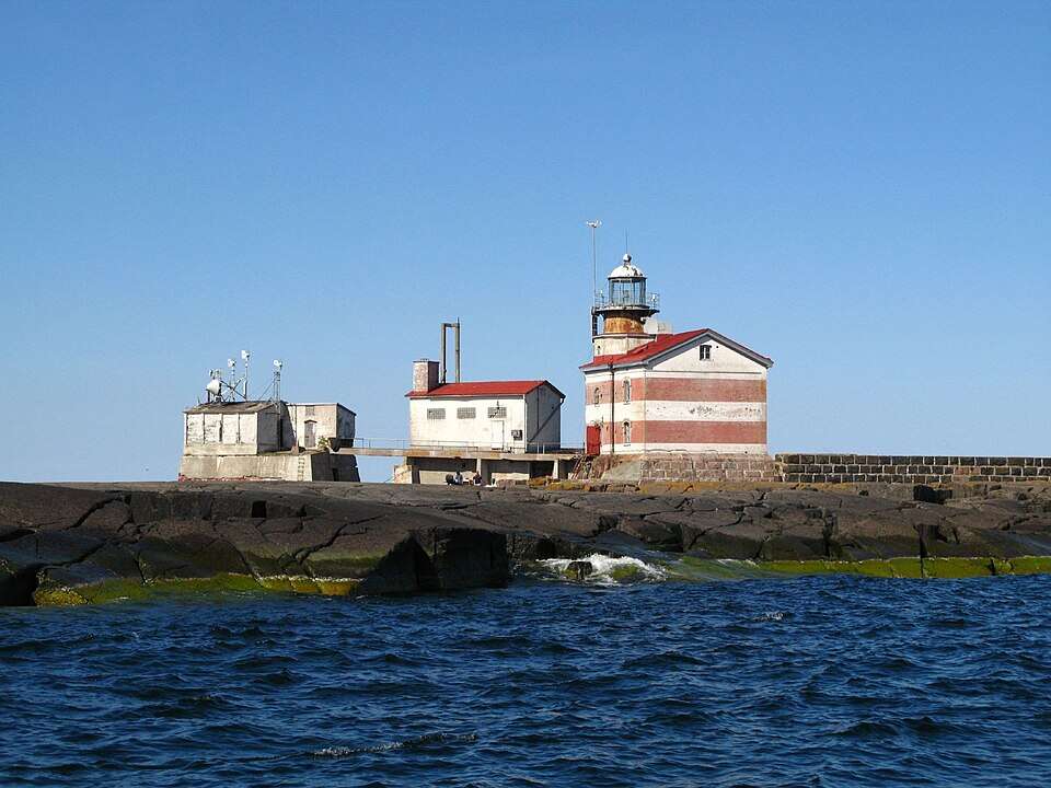
Märket is located in a narrow, exposed shipping lane between Sweden and the Åland Islands. It was dangerous for ships to sail through the strait because a rocky reef lay close to the surface of the water. This is one of the reasons why the local authorities decided that a lighthouse should be constructed on the island. In 1885, a lighthouse was built on Märket to guide passing ships, as public broadcaster Yle reports in its profile of the site. At the time, Finland was not an independent country but the autonomous Grand Duchy of Finland under Russian rule. it would not gain independence until 1917, decades after the lighthouse was completed.
One small building choice, one big diplomatic problem
The builders placed the lighthouse on the highest point of the island, the spot least likely to be damaged by waves and drifting ice. The highest point happened to fall on the Swedish side of the line, so the new lighthouse ended up standing on land that technically belonged to Sweden, even though the Grand Duchy of Finland, then part of the Russian Empire, had built it and kept its light burning.
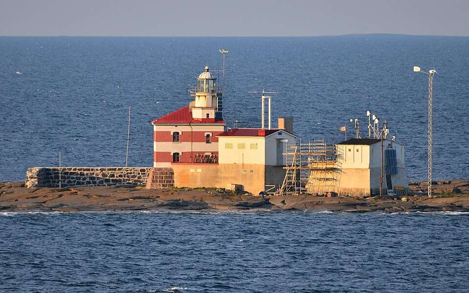
For years, neither side rushed to resolve the issue. The island was unpopulated, isolated, and forgotten by all but the sailors and keepers of the light itself. Finland just continued operating its lighthouse on Swedish territory, and both sides have let the strange arrangement lie peacefully in the water.
Bending the border instead of moving the lighthouse
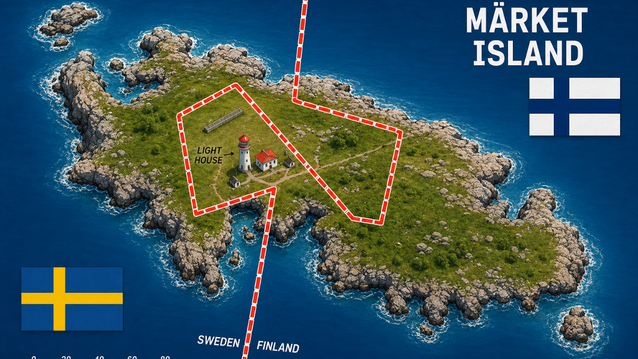
Since relocation of a functioning lighthouse would prove to be costly and difficult, especially one anchored to the most stable point of a small, storm-battered island, it was considered more convenient for the countries to move their borders rather than the building itself. The UN's Division for Ocean Affairs and Law of the Sea hosts the official record, an exchange of notes between Finland and Sweden dated 14 June 1985, showing that Swedish and Finnish frontier commissions surveyed their shared border in 1981, with Sweden's parliament formally approving the results, effective August 1, 1985. The survey redrew the border so the lighthouse fell on the Finnish side, while Sweden received an equal area elsewhere on the island.
The result was not a neat, straight line. It became a jagged border that winds around the lighthouse before continuing. As described by Yle, the border is marked not by any fence or poles, but by markings painted on the rock, because any marking above the rock will most likely be torn apart by the storms in the area. Finland's National Land Survey , the government body responsible for official mapping, notes that such boundary reviews with neighbouring countries are typically repeated roughly every 25 years, to check that markers and terrain still match the agreed line.
A coastline that keeps quietly rising
One of the reasons that this particular segment of the border has to be re-marked now and then is a geological one. The coast of the Baltic Sea region in Finland and Sweden is steadily coming up out of the water as a result of post-glacial rebound. NASA's Earth Observatory explains that this region was once pushed under by over 500 meters of ice during the last Ice Age, and is slowly but steadily bouncing back into its position. Some parts of the coastline are still gaining new land from the sea. On a low and flat skerry such as Märket, even minor changes are significant enough to warrant re-marking the border roughly every 25 years..
Why this border story still matters
The lighthouse was automated in the mid-1970s, and then fully unmanned by 1977, after which it fell into disrepair for years. Since 2007, volunteers from the Finnish Lighthouse Society have restored it and now welcome visitors during the summer months. Yle also points out a nice detail: thanks to this same boundary, Märket has long marked Finland's westernmost land point, a status the Finnish side of the island has held since the border was first surveyed in the early 19th century.
Märket is a reminder that borders are not always fixed or permanent as we tend to think. Two states spotted a construction error and chose to work together rather than create a dispute. They did not demolish anything; they just agreed to bend a border accordingly. In a time when territorial controversies usually last for decades, it seems a surprisingly easy and quite reassuring approach to the matter.