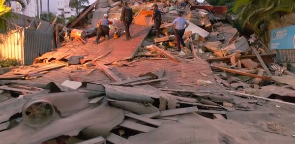
The next major Pacific Northwest earthquake could cause coastal land to sink by up to 6.5 feet in a matter of minutes, a new study has warned.
A magnitude 8.0 tremor on the Cascadia subduction zone fault would not only risk a tsunami but also have a devastating impact on coastal communities by massively expanding the flood risk, researchers at Virginia Tech University say.
“We could have a disaster on the scale of Japan 2011 or Sumatra 2004,” the study's lead author Tina Dura told The Washington Post. “It's the same kind of fault. It has the same capability of making a huge earthquake, tsunami and coastal subsidence.”
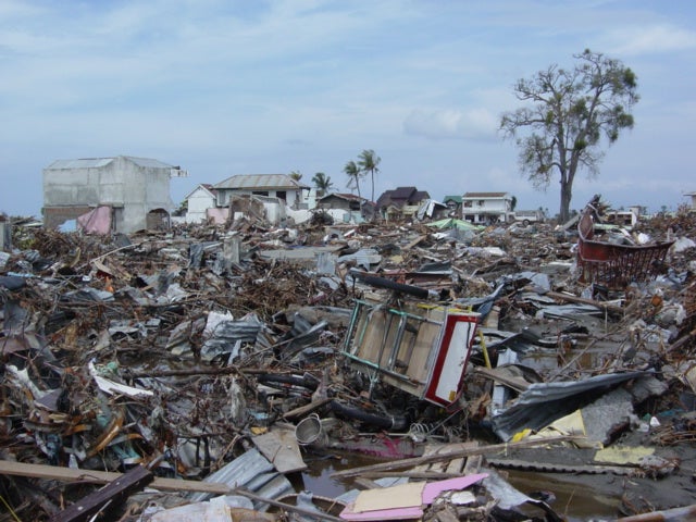
The 9.2 Sumatra earthquake and subsequent tsunami killed more than 227,000 when it struck the day after Christmas Day, while the 9.1 Tohoku earthquake in Japan killed more than 18,000 people.
A powerful quake on the Pacific Northwest would also mean floodplains - areas of land next to rivers or streams that flood when water levels rise - would be expanded by 116 square miles, the study says. That means that if the “Big One” were to strike today, an extra 14,350 residents, 22,500 structures, and 777 miles of roadway would fall within the post-earthquake floodplain.
Hospitals, public schools, an electric substation, waste facilities, police and fire stations, and five airports would all potentially be affected. Farmland would experience heavy economic loss, as flooding would render soils unusable, the researchers go on to say. And coastal estuaries and wetlands — which help fight climate change — would erode, impacting the ecosystems they support. Those ecosystems may never recover, the study warns.
It would also affect hospitals, public schools, an electric substation, waste facilities, police and fire stations, and five airports. Farm land would experience heavy economic loss, as flooding would render soils unusable.
In addition, coastal estuaries and wetlands — which help fight climate change — would erode, impacting the ecosystems they support. Those ecosystems may never recover, the study warns.
“The expansion of the coastal floodplain following a Cascadia subduction zone earthquake has not been previously quantified, and the impacts to land use could significantly increase the timeline to recovery,” Tina Dura, an assistant professor of geosciences, said in a statement.
Dura is the lead author of the quake study which was published Thursday in the journal Proceedings of the National Academy of Sciences.
The most severe effects would occur in southern Washington, northern Oregon, and northern California.
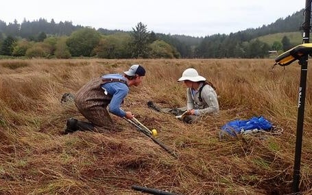
To reach their conclusions, Dura and her team generated tens of thousands of earthquake models to help estimate the potential range of the sinking. They then quantified the expansion of the floodplain at 24 different communities and estuaries in the area of the fault.
They tested the models against the impacts of an earthquake as it could happen today, but also as it may occur in 2100. By then, climate change is expected to already bring sea levels up by up to four feet.
Notably, a quake of that seismic magnitude has not occurred along the Cascadia subduction zone since Jan. 26, 1700.
Looking at records from the last 7,000 years, there have been 11 great earthquakes every 200 to 800 years in the Pacific Northwest. The last earthquake in the region resulted in between 1.5 to 6.5 feet of land along the coastline immediately sinking.
“Cascadia is a unique place. It’s not super heavily populated, but most estuaries have a community in them, and they’re all right in the zone of subsidence,” said Dura. “This is honestly where I think the subsidence could have bigger impacts than it has during other recent large earthquakes around the world.”
A great Pacific Northwest earthquake could generate tsunami waves up to 40 feet high, and residents should prepare themselves, Dura told The Washington Post.
“You have the tsunami evacuation signs, but they seem more like a novelty than any serious thing,” Dura said. “People need to worry about it.”