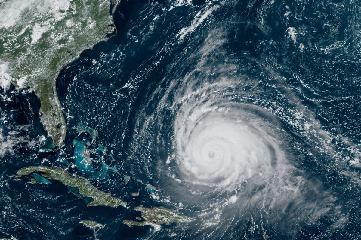
Hurricane Lee began to spin away from the northern Caribbean on Wednesday as the Category 3 storm aimed for Atlantic Canada and left big waves in its wake.
The storm was located about 475 miles (765 kilometers) south-southwest of Bermuda in the morning. It had winds of up to 115 miles per hour (185 kilometers per hour) and was moving northwest at 6 mph (9 kph).
Lee was expected to eventually pass just west of Bermuda, prompting forecasters to issue a tropical storm watch for the island. Wind and heavy rainfall were expected to lash Bermuda starting late Wednesday or early Thursday, forecasters said.
Lee is then expected to keep traveling north and lose strength in cooler waters before potentially making landfall over the weekend in Nova Scotia, Canada, as a possible tropical storm.
“Slow weakening is forecast during the next few days, however Lee is likely to remain a large and dangerous hurricane into the weekend,” the National Hurricane Center said. “Lee’s expected post-tropical transition will not diminish potential wind, rain and coastal flooding impacts in New England and Atlantic Canada due to the system’s broad wind field.”
Hurricane-force winds extend up to 115 miles (185 kilometers) from Lee’s center, and tropical-storm-force winds extend up to 240 miles (390 kilometers), the center reported.
Forecasters warned of dangerous surf and rip currents in Lesser Antilles, the British and U.S. Virgin Islands, Puerto Rico, Hispaniola, the Turks and Caicos Islands, the Bahamas, Bermuda and parts of the U.S. southeast coast. The conditions were expected to spread to the U.S. East Coast and Atlantic Canada in upcoming days.
Meanwhile, Hurricane Margot was spinning through open Atlantic waters on Wednesday. It was located 790 miles (1,270 kilometers) west-southwest of the Azores and had maximum sustained winds of 85 miles (140 kilometers). It was moving north at 12 mph (19 kph) and is expected to remain over open waters.
It is the 13th named storm of the Atlantic hurricane seasons and the fifth hurricane to form. The season runs from June 1 to Nov. 30 and peaked on Sunday.
The National Oceanic and Atmospheric Administration has forecast 14 to 21 named storms this season. Six to 11 of those are expected to strengthen into hurricane, and of those, two to five could develop into Category 3 storms or higher.