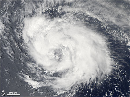
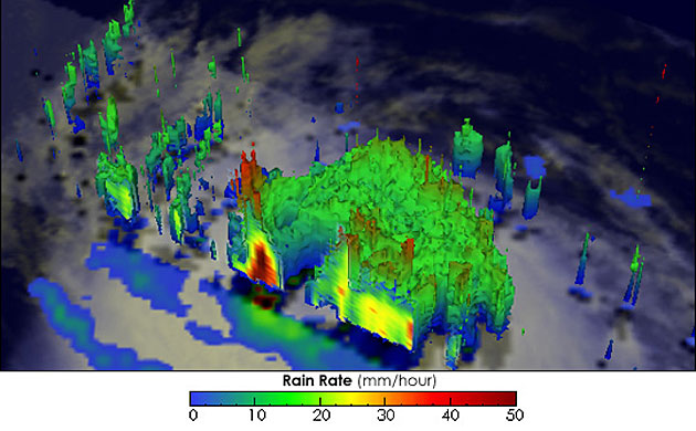
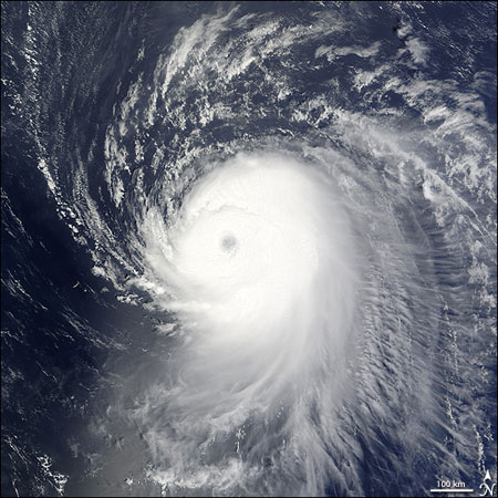
September 2: As hurricane Gustav rained itself out over the southern USA, hurricane Ike started to develop. In this image the storm is taking shape over the central AtlanticPhotograph: Jesse Allen/NASASeptember 3, 1900 GMT: This 3D view of hurricane Ike, created by a rainfall measuring satellite, shows the heaviest rain in red. The calm eye of the storm is in the centre of the image. Ike had just become a hurricane with winds of 80mph (130kmh) when this image, part of an animated fly-by, was createdPhotograph: Noaa/NoaaSeptember 4, 1445 GMT: Within 24 hours Ike was a category four hurricane travelling north west across the Atlantic at 12mph with sustained winds of 140mphPhotograph: Noaa/Noaa
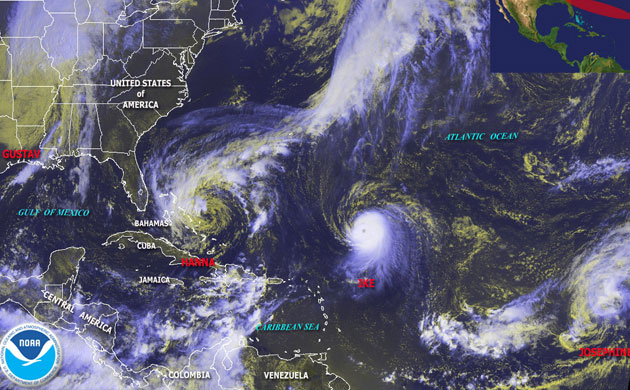
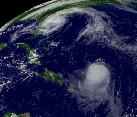
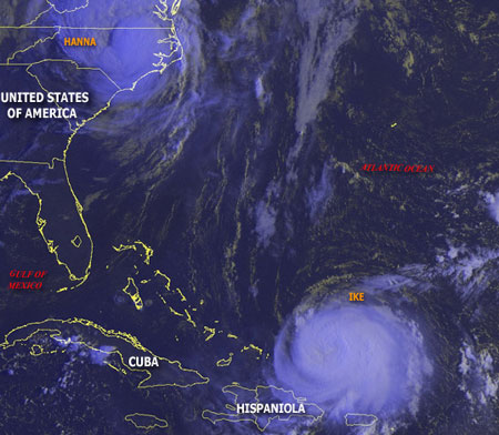
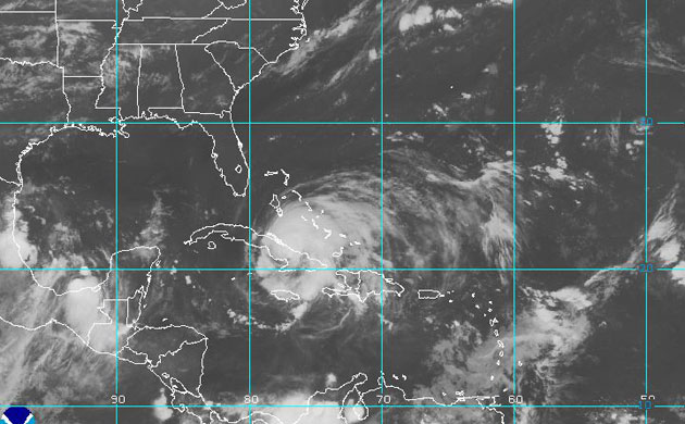
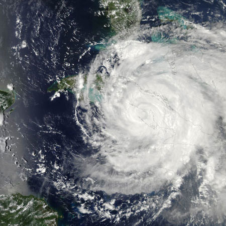
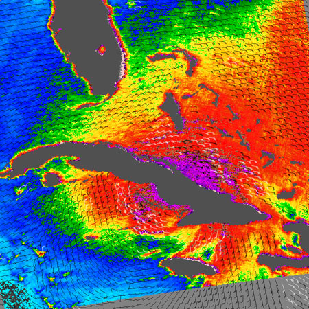
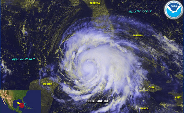
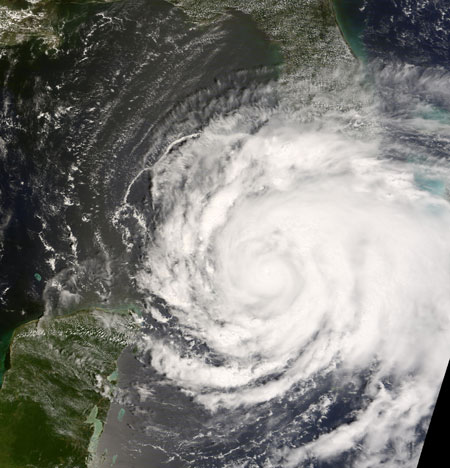
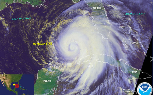
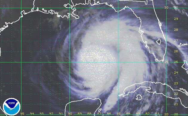
September 4, 1540 GMT: The distinct eye of hurricane Ike is clear in this image taken by Nasa's Terra satellitePhotograph: Nasa/NasaSeptember 5, 1945 GMT: This enhanced image shows Ike over the Bahamas, heading towards Haiti and Cuba. To the north is tropical storm HannaPhotograph: Noaa/NoaaSeptember 6, 1215 GMT: As tropical storm Hanna made landfall over the USA, with winds blowing at 60mph, Ike continued to move west as a category 2 hurricane, with winds of 115mphPhotograph: Noaa/NoaaSeptember 8, 0745GMT: As Ike passed over Haiti the devastation caused killed 48 people and destroyed buildings and roads. The casualties brought Haiti's death toll from four tropical storms in a less than a month to 306. In this image the storm is over Cuba, approaching Havana and the USPhotograph: Noaa/NoaaSeptember 8: In the early hours of September 7 Ike slammed into eastern Cuba as a Category 3 storm. The storm re-emerged over the island's south-west coast on the afternoon of September 8 as a Category 2 storm. This image was taken that afternoon. The closed eye of the storm was over water just offshore in the centre of the western coast. Clouds span almost the entire island, cover the Bahamas (upper right), and graze the southern tip of FloridaPhotograph: Nasa/NasaSeptember 8, 1112 GMT: This data visualisation of the hurricane shows observations from Nasa’s QuikScat satellite. The most intense winds appear off the coast of Cuba, at more than 50 knots (purple). Radiating out from this region are wind speeds of more than 25 knots (red). Small barbs indicate wind direction, and white barbs point to areas of heavy rainPhotograph: Nasa/NasaSeptember 9: Ike hit the eastern part of Cuba as a Category 3 storm and weakened to a Category 1 storm as it spent its energy through wind and rainfall over the island. In the image, the eye of the storm was over the western part of the island, and the outer bands of rain clouds reached Florida in the north and the Yucatan Peninsula of Mexico in the westPhotograph: Noaa/NoaaSeptember 9, 1500 GMT: Ike was a category 1 hurricane as it made landfall again in western Cuba, with sustained winds of 80mphPhotograph: Nasa/NasaSeptember 10, 1500 GMT: Hurricane Ike grew in size and strength in the south east Gulf of Mexico, moving west-northwest at 8mph with sustained winds of 90mphPhotograph: Noaa/NoaaSeptember 11, 0915 GMT: Hurricane Ike is in the Gulf of Mexico, heading north west towards Texas. It is increasing in strength and is expected to make landfall on Saturday September 13 as a category four hurricane, with sustained windspeeds of 130mphPhotograph: Noaa/Noaa
Sign up to read this article
Read news from 100’s of titles, curated specifically for you.