The aftermath of Hurricane Humberto could bring strong rains and winds to Britain this week, as it crosses over the Atlantic and heads closer to the UK.
The storm, which strengthened into a category 4 hurricane over the weekend, has mostly bypassed the US and is currently over the southwest Atlantic. The Met Office said it was monitoring it closely.
The weather agency has also issued a yellow weather warning for Scotland from Wednesday evening to Friday morning, as it forecasts persistent, heavy rain.
A separate weather warning was in place this morning as heavy fog covered parts of the East and South East of England. The yellow warning was issued on Monday morning after fog fell on Sunday night.
“This week’s weather is shaped by a classic northwest-southeast split. While high pressure keeps the South East settled with light winds and chilly nights, the North West is seeing a series of frontal systems bringing heavy rain and strong winds,” the Met Office said.
Hurricane Humberto developed into a category 5 hurricane on Saturday before easing back down to category 4 on Sunday. Tropical Storm Imelda also formed in the Atlantic Ocean on Sunday, heading northward over the Bahamas, causing tropical storm conditions. It is expected to bring dangerous surf on the southeast coast of the US in the coming days.
Local weather reports say both weather events could eventually be a threat to Bermuda as they continue to track towards the islands.

The Met Office added: “The situation becomes more complex later in the week as tropical cyclones Humberto and Imelda currently over the southwest Atlantic influence our weather, increasing the risk of a deep low developing near the UK.
“If this materialises, we could see some very strong winds as well as further heavy rainfall Friday into Saturday, but at this time the development and track of this system remains uncertain. We’re monitoring this closely.”
In Scotland, rainfall is expected to be persistent across areas of Central, Tayside & Fife, Highlands & Eilean Siar, and Strathclyde, with strong spells of wind from Thursday night.
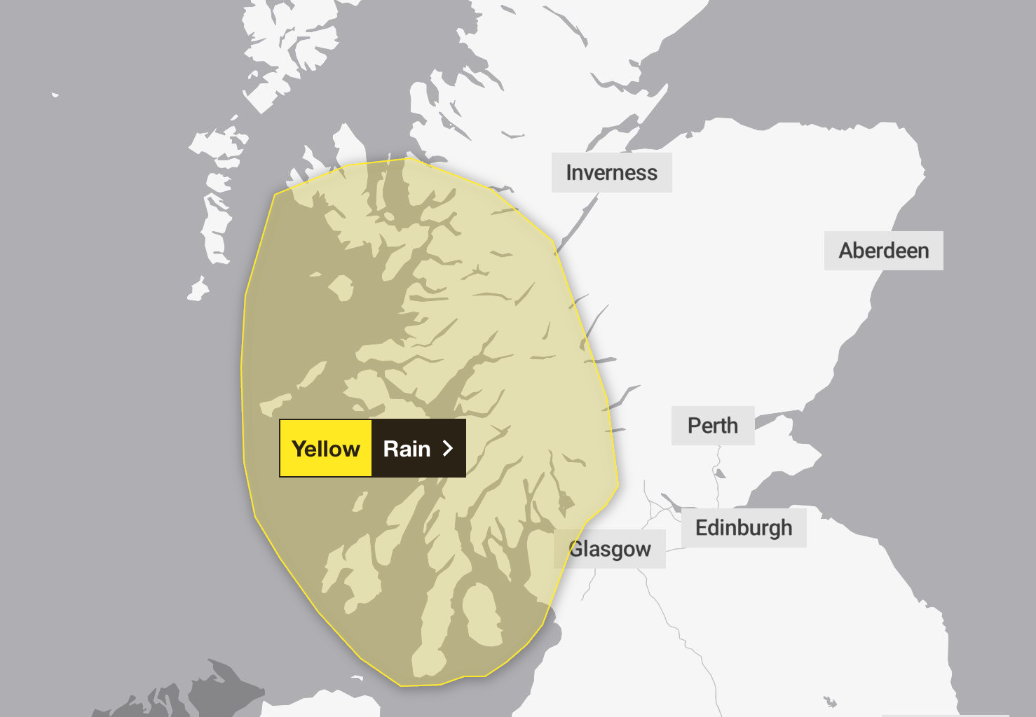
The Met Office said the heaviest rain will be over the hills and mountains, with as much as 200-250mm of rain likely to build up over a few mountains by early Friday. The warning is in place from 5pm Wednesday to 6am Friday.
Some communities may be cut off by flooded roads, and possible power cuts, and flooding and damage to homes and businesses could occur. The Met Office warned that there may be fast-flowing and deep floodwater, which poses a danger to life.
“Check if your property could be at risk of flooding. If so, consider preparing a flood plan and an emergency flood kit,” the service said.
“Be prepared for weather warnings to change quickly: when a weather warning is issued, the Met Office recommends staying up to date with the weather forecast in your area.”

This morning’s dense fog brought the visibility down to 50 metres in some areas across East Anglia.
The Met Office warned of traffic delays and slower travel times in the areas affected by the fog, which included Cambridgeshire, Essex, Hertfordshire, Norfolk, Suffolk, Thurrock, East Sussex, Greater London, Kent, Medway, Surrey, and West Sussex.
Here is the weather forecast in the UK for the coming week, according to the Met Office.
Today
Fog in the South East will gradually clear this morning. A fine day follows with plenty of sunshine, although hazy at times. Cloudier in the North West with outbreaks of rain in western Scotland and brisk winds.
Tonight
Staying cloudy and windy in Northern Ireland and western Scotland with further patchy rain and drizzle. Dry in the South with clear spells. Turning chilly with a few fog patches.
Tuesday
Dry for many with sunny spells. However, cloudier skies will persist across the North West with drizzly outbreaks and brisk winds. Cloud also thickening in the far west of England and Wales.
Outlook for Wednesday to Friday
Rain will turn heavy across the North West through midweek with strong winds, especially on Friday. Staying drier in the South but increasingly cloudy. Temperatures around average.