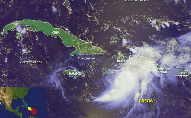
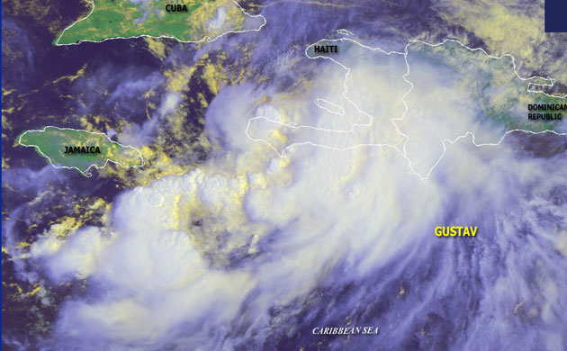
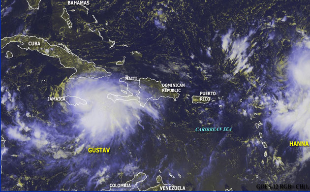
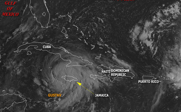
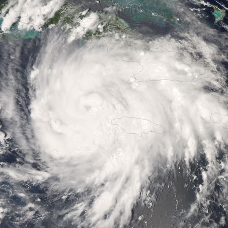
August 26, 1500 GMT: Hurricane Gustav south east of Cuba, about 380km from Guantanamo. At this time it was moving at 15kmh (8mph) with sustained winds of 160kmh (90mph)Photograph: NOAA/NOAAAugust 27, 1500 GMT: Downgraded to a tropical storm Gustav weakened about 170km west of Haiti and moved north west at 8kmh with maximum winds of 100kmh (60mph)Photograph: NOAA/NOAAAugust 28, 1500 GMT: In this image tropical storm Gustav was 70km east of Kingston, Jamaica, moving at 8km with sustained winds of 120kmhPhotograph: NOAA/NOAA
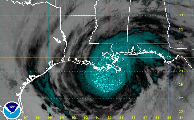
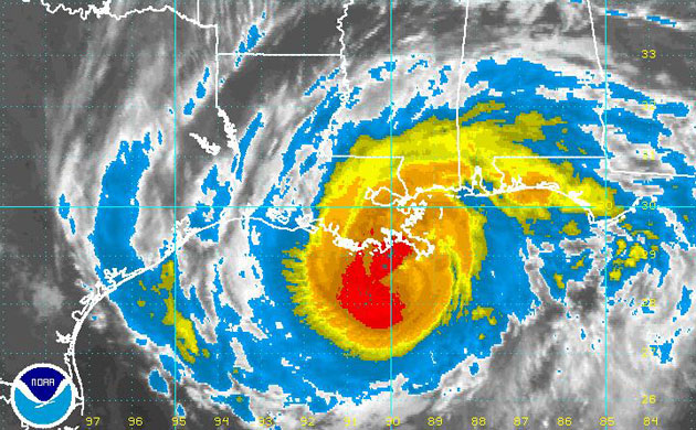
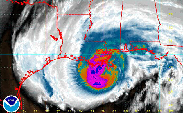
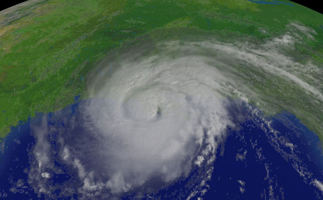
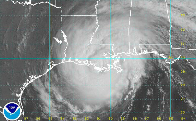
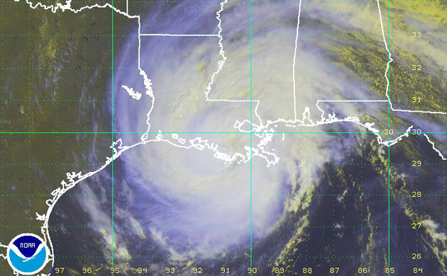
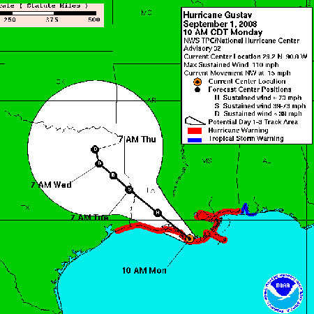
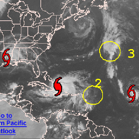
August 29, 1215 GMT: However, Gustav was forecast to strengthen as it tracked through the Gulf of Mexico towards the US coastPhotograph: NOAA/NOAAAugust 29: By the afternoon Gustav was a category 1 hurricane. When NASA’s Aqua satellite captured this image the storm had developed, taking on a distinct circular shape that it had not displayed in previous days. A small dark depression hints at the location of the eye. Winds were hitting 120kmhPhotograph: NASA/NASASeptember 1, 0945 GMT: A shortwave image of hurricane Gustav as it approaches New Orleans. It is now a category 3 hurricane, with winds of 185kmph (120mph)Photograph: National Hurricane Centre/NOAA/National Hurricane Centre/NOAASeptember 1, 0945 GMT: An infra red image of hurricane Gustav as it approaches the US coastPhotograph: National Hurricane Centre/NOAA/National Hurricane Centre/NOAASeptember 1, 1015 GMT: A water vapour image of hurricane Gustav. Gustav is expected to cause severe damage, but is forecast to weaken as it tracks over land and loses energy Photograph: National Hurricane Centre/NOAA/NOAASeptember 1, 1200 GMT: Gustav made landfall in Louisiana, just west of New OrleansPhotograph: NOAA/NOAASeptember 1, 1445 GMT: Gustav was downgraded to a category two hurricane as it continued to progress inland. It was expected to create a storm surge of 2m to 3mPhotograph: NOAA/NOAASeptember 1, 1545 GMT: An enhanced-colour image of hurricane GustavPhotograph: NOAA/NOAASeptember 1: This is the National Weather Service's projection of the hurricane's track conePhotograph: NOAA/NOAASeptember 2: As the threat of catastrophic damage from hurricane Gustav recedes, the National Hurricane Centre is warning people to be prepared as hurricane season continues. Other tropical storms and hurricanes, including hurricane Hannah, are on the radarPhotograph: NOAA/NOAA
Sign up to read this article
Read news from 100’s of titles, curated specifically for you.