Hurricane Erin became the first Atlantic hurricane of the 2025 season on Friday, 15 August.
It exploded in strength from a Category 1 to a Category 5 storm in just over 24 hours. After weakening and then restrengthening, it is still ranked among the fastest bursts of rapid intensification on record in the Atlantic and has been fluctuating in strength.
Scientists have linked the rapid intensification of Atlantic hurricanes to climate change. Global warming causes the atmosphere to hold moisture and ocean temperatures to spike, key ingredients for a storm to gather strength. Warm waters provide more fuel for hurricanes to unleash more rain and strengthen more quickly.
A preliminary analysis by non-profit research organisation Climate Central claims that Erin’s rapid intensification on Saturday occurred as the hurricane moved over “unusually warm ocean waters” made up to 100 times more likely by climate change.
Meteorologists say Erin is “unusually large” and is expected to grow in size, fluctuating between Category 2 and 3 wind speeds, as it moves northwards towards the western Atlantic Ocean.
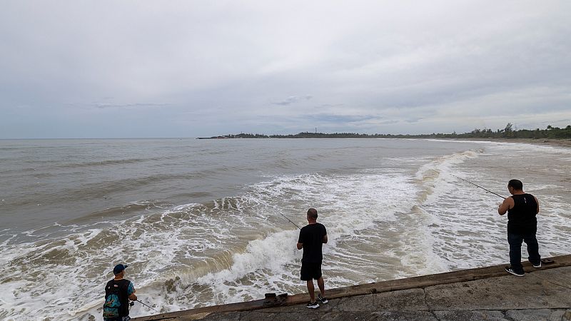
Forecasters are confident Erin won't make direct landfall, but it has brought potentially deadly beach conditions all along the US East Coast. Part of a main highway in North Carolina has been flooded as rain from the hurricane's outer bands poured on the coast.

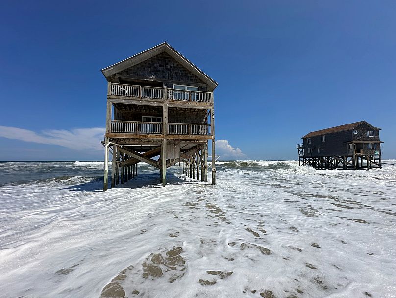
Officials in North Carolina have also warned of waves as high as 6.1 metres, putting dozens of beachfront homes already worn down by chronic erosion at risk.
Will Europe feel the effects of Hurricane Erin?
As Erin moves into cooler Atlantic waters, it will no longer have the energy needed to sustain itself as a hurricane. It will transform into an extratropical or post-tropical low-pressure system.
This still means it will be a storm, just not a hurricane. One that gets its energy from clashing cold and warm air masses instead of warm ocean water.
Forecasts show that the remnants of Erin are most likely to impact parts of western Europe, including the UK and Ireland.
Met Éireann has said that Erin will be heading somewhere between Ireland and Iceland. But as it moves across the Atlantic, it will weaken and become the kind of low-pressure system that brings Ireland its usual unsettled weather.
The UK’s Met Office says there is the potential for the weather to turn more unsettled towards the latter part of this weekend as they keep a keen eye on the track of the hurricane. It may be picked up by the jet stream and moved towards northwest Scotland by next Tuesday or Wednesday.
The Met Office says there is a low-probability risk of Erin moving closer to or across the UK as a deep extratropical depression. Though not technically a hurricane, it adds, this would bring damaging winds.
“We are closely watching Erin’s track, with the possibility of the UK feeling the effects of what would then be ex-hurricane Erin at some point next week, bringing an area of low pressure to the UK and more unsettled conditions,” Deputy Chief Meteorologist Stephen Kocher explains.
“This is still a week away, however, so there is lots of uncertainty in the forecast, but it is possible we could see some wet and windy weather for the last week of August.
“We’ll be keeping a close eye on the movements of Hurricane Erin over the coming days and updating our forecasts accordingly.”


