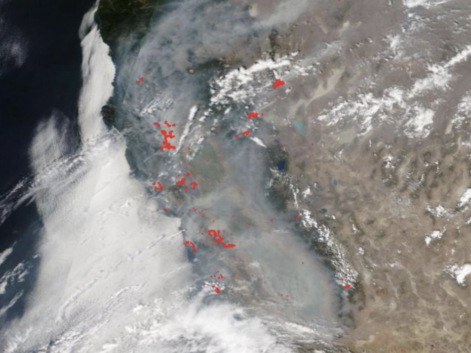
A vast smoke cloud is blanketing California and drifting across the country as the state continues to battle hundreds of raging wildfires.
Images from NASA's Terra satellite on Monday captured the huge cloud, so dense that it blocks views of northern parts of the state from space. NASA reported that the smoke cloud that is choking California is being carried by air currents across the US, all the way to Minnesota and Nebraska.
The red dots designate areas believed to be on fire, according to NASA. The volume of dots are so great that it is no longer possible to pick out individual blazes.
California has had more than 13,000 lightning strikes since 15 August, sparking more than 650 wildfires that have burned more than 1,875 square miles (4,856 sq km), an area greater than the state of Rhode Island.
The two biggest fires, both located in northern California, are now second and third largest in state history.
The LNU Lightning Complex and the SCU Lightning Complex are named after the firefighting units that tackled them - Lake Napa Unit and Santa Clara Unit - and due to the fact they were sparked by lightning strikes.
The LNU complex has burned 347,630 acres and is around one-fifth contained while the SCU Complex has destroyed 343,965 acres and is just 10 per cent contained.
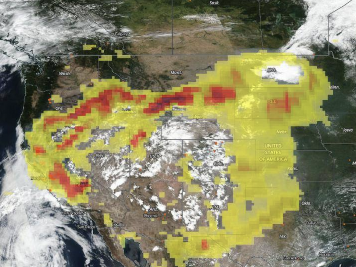
NOAA-NASA's Suomi NPP satellite tracks aerosols over the US from this month's California wildfires (NASA Worldview, Earth Observing System Data and Information System)
Two satellite systems operated by NASA allow wildfires to tracked from space: polar orbiters like NASA's Terra and Aqua satellites, and NASA-NOAA's Suomi NPP satellite. The combination allows for detailed views of fires and smoke around the world each day.
The aerosol image above, captured by Suomi NPP, provides data about the presence of particles in the air. It shows that heavy smoke is not only affecting California but being carried across the US.
The deep red areas, seen over California, are also present as far east as Minnesota, indicating that heavy aerosols remain at similar levels as they are carried by air currents.
Associated Press contributed to this report