Google Street View maps Galápagos Islands – in pictures
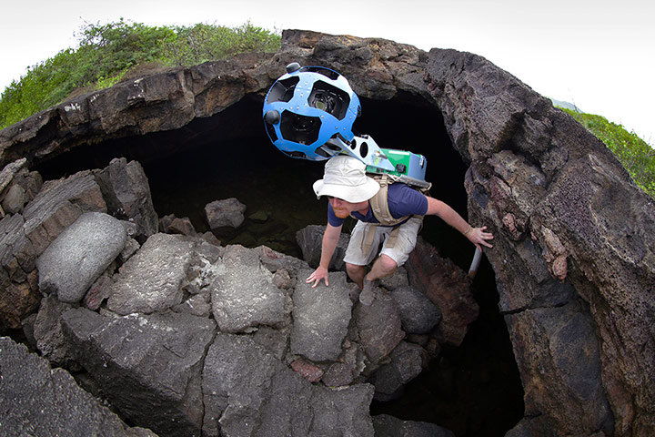
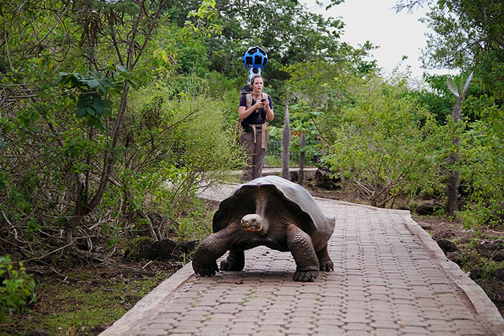
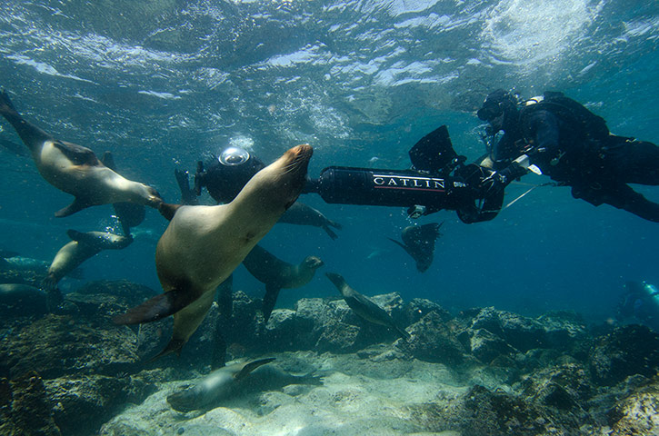
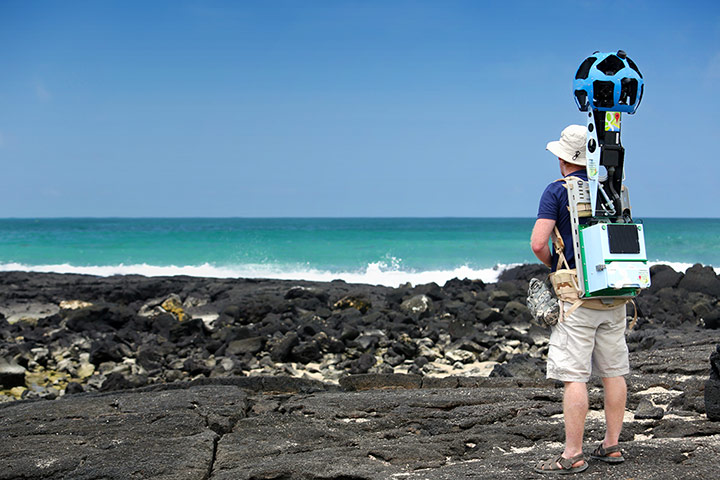
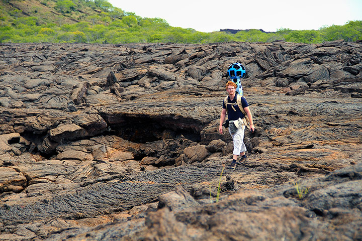
Daniel Orellana of the Charles Darwin Foundation climbs out of a lava tunnel where he was collecting imagery. The dramatic lava landscapes found on Isabela island tell the story of the formation of the Galápagos IslandsPhotograph: Courtesy GoogeA Galápagos giant tortoise crawls along the path near Googler Karin Tuxen-Bettman while she collects imagery with the Street View trekker in Galapaguera, a tortoise breeding centre, which is managed by the Galápagos national park servicePhotograph: Courtesy GoogleChristophe Bailhache navigates 360-degree panoramic SVII camera through a large group of sea lions at Champion Island in Galápagos. The camera was specially designed for Catlin Seaview Survey’s extensive work on coral reefs, but has wider uses for scientists in the GalápagosPhotograph: Courtesy of the Catlin Seaview Survey
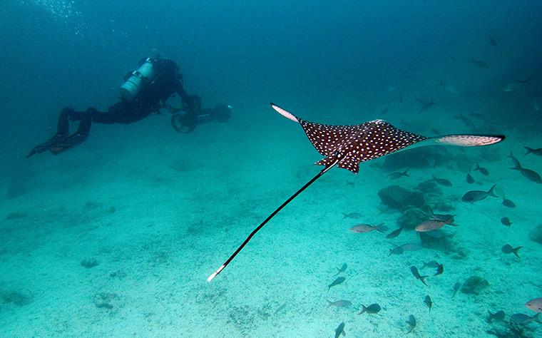
Christophe Bailhache with the SVII camera being escorted by a spotted eagle ray. Taken at the start of a shark and ray survey dive in the Galápagos Islands. The camera takes 360-degree images through three cameras mounted on the underwater scooter every three seconds. These can be ‘stitched together’ to create a virtual dive experience. These dives in the Galápagos islands will be available on Google Maps later this summerPhotograph: Courtesy of the Catlin Seaview SurveyDaniel Orellana of the Charles Darwin Foundation collecting seashore imagery with the Street View Trekker at the Los Humedales wetland area on Isabela island Photograph: Courtesy GoogleDaniel Orellana of Charles Darwin Foundation crossing a field of ferns to reach Minas de Azufre (naturally occurring sulfur mines) on the top of Sierra Negra, an active volcano on Isabela Island. The Google Maps team traveled for over three hours, hiking and on horseback, to reach this remote locationPhotograph: Courtesy GoogleDaniel Orellana of the Charles Darwin Foundation crosses a rocky lava field to reach an land iguana restoration area in Bahia Cartago, Isabela island. Bahia Cartago is a protected area – not accessible to tourists – but the Street View Trekker was invited to collect imagery there at the invitation of CDF and the GNPDPhotograph: Courtesy Google
Sign up to read this article
Read news from 100’s of titles, curated specifically for you.