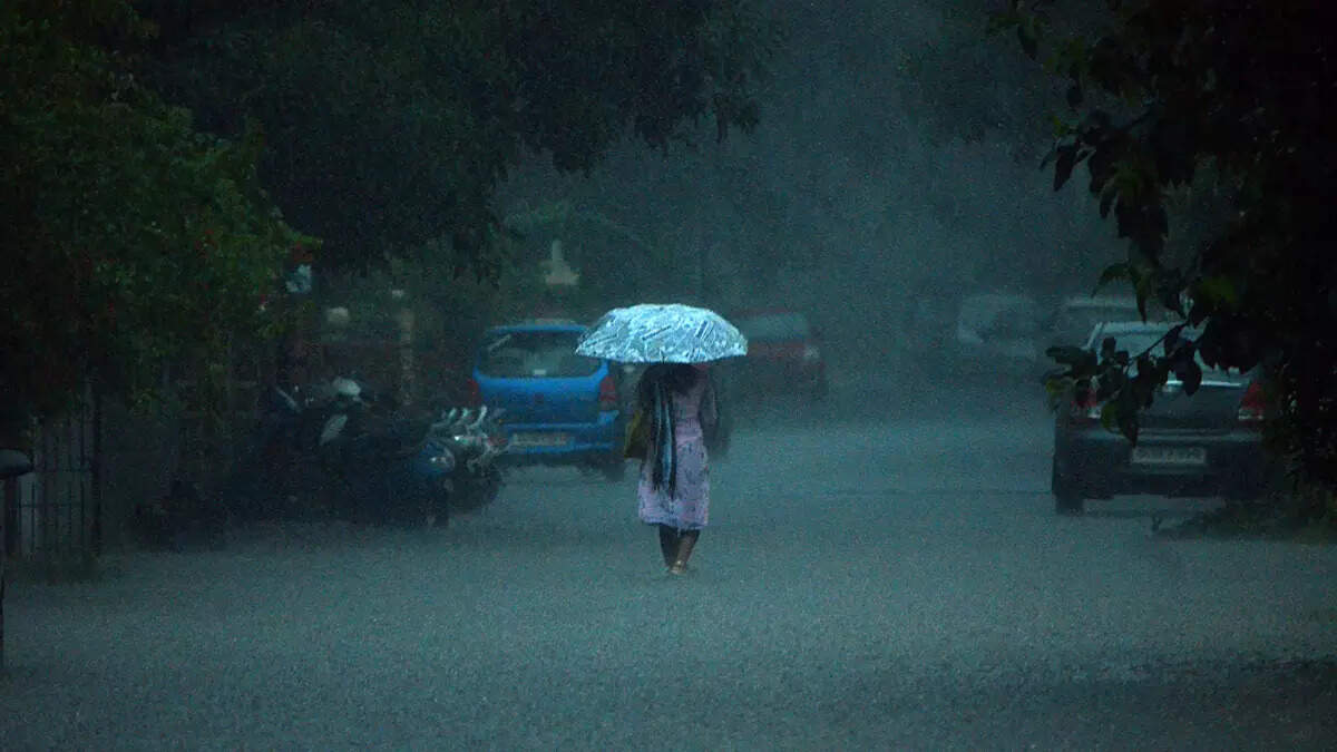
PANAJI: The Southwest monsoon over Goa has been weak for most parts of the season so far except for a short period from June 8 to June 19, and another spell between July 10 and July 23, when it was active. The four homogenous meteorological regions — northwest, east and northeast, and central India, and south peninsula — have also experienced truant rainfall, according to experts.
“This year so far has been an ENSO Neutral year in the Pacific Ocean. The monsoon has been weak for most of the time except for a short period from June 8 to 19, when it was active. Also, there have been two break spells, one three-day break spell in July and another five-day one in August,” meteorologist and retired chief scientist, National Institute of Oceanography (NIO), Ramesh Kumar said.
Monsoon over Goa is so far in 2% deficit. Rainfall was normal to excess on most days during the first two months of this season, but activity was weak to very weak, even break type, in the month of August over the state.
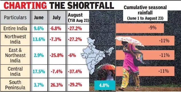
According to Kumar, June saw all the four homogeneous regions receiving excess rainfall with the core monsoon zone region (central zone) receiving the maximum rainfall, with an excess of 17.5%, and the south peninsula region receiving the minimum of 3.7%.
In the peak monsoon month of July, the south peninsula region received the maximum rainfall of about 26.3% excess and the east and northeast regions received the minimum rainfall.
In the peak monsoon month of August (up to August 23), the core monsoon zone of central India is facing the maximum deficit of 37.4% and the east and northeast the minimum deficit of 6%.
“If we consider the season as a whole, out of the 36 meteorological subdivisions, there are 11 deficits, 21 normal and four excess subdivisions,” Kumar said. He said that there has been no convective systems such as a depression or monsoon depression over the Arabian Sea or Bay of Bengal so far this year. “The last time this has happened was way back in 2002, which was incidentally a drought year.”