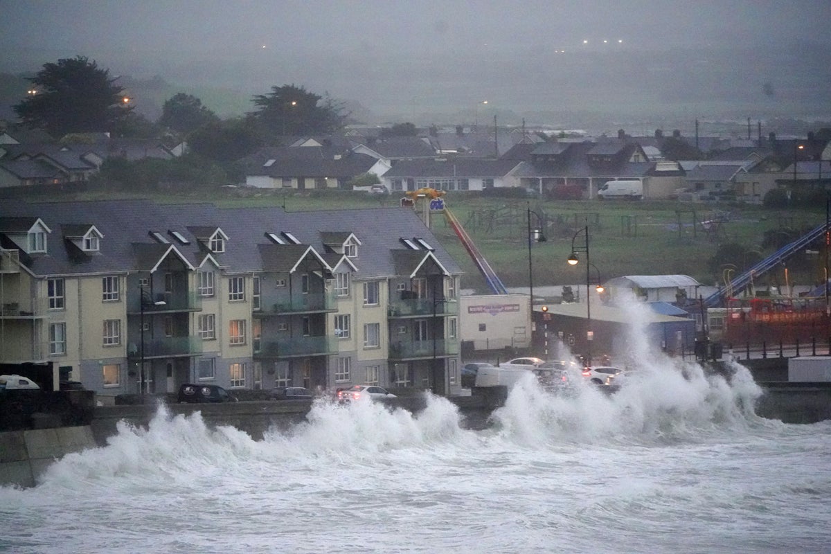
Storm Betty has caused flooding on some roads in the south of Ireland as the Government’s national weather emergency team warned of the potential for further floods amid strong winds and rain across the country.
There was traffic disruption on some roads across Co Cork and frantic scenes in Co Waterford as a boat broke free from its berth and crashed into a harbour in Dungarvan.
A number of matches and outdoor events were cancelled, and emergency crews in the south of the country cleared debris including fallen trees.
Government departments and agencies and every local authority attended a briefing from Irish weather agency Met Eireann, which forecast that Storm Betty will move southwest to northeast across the country from Friday to Saturday morning.
The National Directorate for Fire and Emergency Management (NDFEM) said this could bring “strong winds, rain and the threat of coastal, pluvial and fluvial flooding”.
The NDFEM said in a statement: “Storm Betty is forecast to bring high winds, particularly across the southern areas. Rainfall levels of 40mm could be experienced across the country with the potential for over 60mm in some areas.
“This is a dynamic storm system, intensified by the jet stream leading to some uncertainty as to the potential track and intensity of Storm Betty.”
The national forecasting office Met Eireann issued two status orange warnings for wind and rain which came into effect for seven counties.
The warnings of structural damage, falling trees, localised flooding and power outages, came into effect from 8.35pm and 9pm and expire at 1am and 3am on Saturday.
The warnings applied to Carlow, Kilkenny, Wexford, Wicklow, Cork, Tipperary, and Waterford – with the rain warning also applying to Kerry.
The forecaster also said that the weather conditions could lead to difficult travelling conditions and wave overtopping along coasts.
Three status yellow warnings for wind and rain are in place for the rest of the country from Friday and will remain in place until 3am to 6am on Saturday.
There is a risk of thundery downpours on Friday, as well as strong winds along eastern-facing coasts.
There is also a status red storm warning for the southern coast.
The weather agency said south to southeast winds, veering southwesterly, will reach storm force 10 and occasionally violent storm force 11 for a time on Irish coastal waters from Carnsore Point to Dungarvan to Mizen Head.
Met Eireann forecaster Matthew Martin said the deeply low weather system would bring “heavy and persistent rain” spreading from the south of the island on Friday and there would be a continuing threat of flooding in the evening.
In Northern Ireland, a status yellow rain warning is in place across the region from 9pm on Friday until 6am on Saturday, risking further disruption.
The Met Office has also issued a wind warning for counties Antrim and Down, in place from 6pm on Friday until noon on Saturday, which brings a risk of strong winds that could disrupt transport and temporary infrastructure.
The weather is expected to stay mixed for the rest of the weekend.