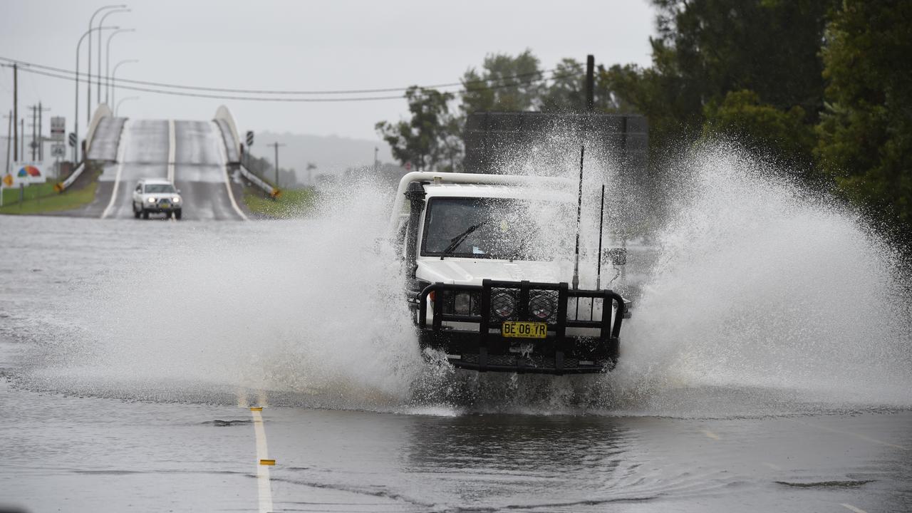
Australia's east coast is again under a flooding risk as an "unpredictable, widespread" weather system prepares to dump heavy rain on already saturated ground.
Emergency services admit communities and volunteers are weary after a brutal year of multiple flooding events, before potentially another 125mm of rain falls across a large swathe of regional NSW.
The significant weather system is set to primarily hit on Thursday and Friday, before easing into the weekend, but flash-flooding and renewed river rises are expected.
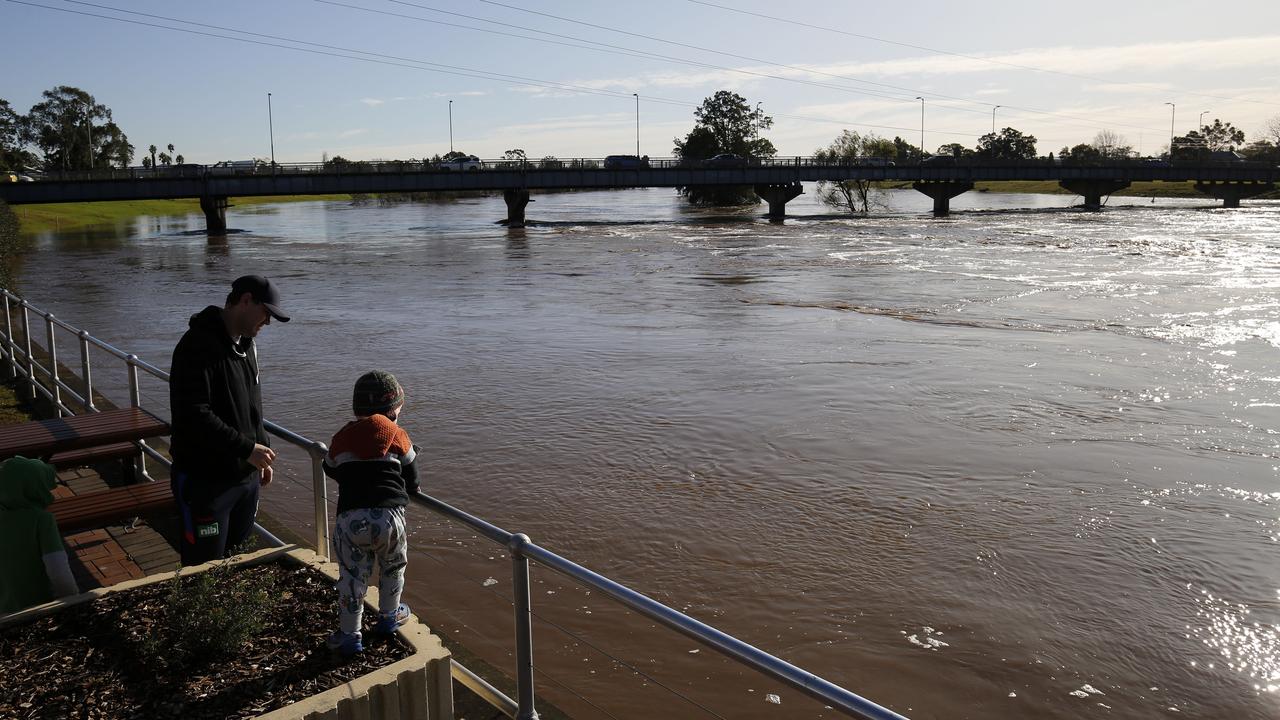
It follows extensive flooding in May in Taree that left homes destroyed and residents isolated for days, claiming five lives.
More flooding hit the mid-north coast and northern Hunter earlier in August, leaving tens of thousands of people without power and claiming one life.
Rivers affected in that event were still at elevated levels, NSW SES deputy commissioner Deb Platz said.
"We know that this year we've seen significant weather events, significant flooding and a lot of damage," she said.
"We know that the community is tired - our volunteers are tired - but it's important that you do a few simple steps to stay safe."
More than 125mm of rain could fall from NSW's northwest to the Hunter region on Wednesday, fuelling fears of flooding.
Cities and towns including Tamworth, Gunnedah, Narrabri and Moree are forecast to receive up to 45mm of rain across the day, with isolated falls of up to 70mm.
The mid-north coast to the Hunter region is forecast to receive up to 80mm throughout the day, with isolated falls of up to 110mm.
"What we have here is a significant rain event affecting most of the northeastern part of the state and the coastal areas," the Bureau of Meteorology's Steve Bernasconi said.
"It will bring widespread, moderate-to-heavy rainfall, essentially from (Wednesday), but moving into Thursday and Friday before easing over the weekend."
NSW SES is preparing for an increased number of calls for help across the multiple regions by deploying aircraft, high clearance vehicles and crews.
By 1.30pm on Wednesday, the SES had received more than 330 calls and responded to more than 120 incidents.
Ms Platz said complacency could be a risk, particularly among communities that had suffered through multiple events already this year.
"Complacency is always a risk, and that's why we continually give our messages to the community to keep abreast of all the warnings in their local area," she said.
"We do know that people are tired, and that can lead to some complacency ... please, for your own safety, think of your family, friends and colleagues."
The potential for flash flooding led authorities to repeat warnings to not drive through swamped roads.